

-
Welcome to Tacoma World!
You are currently viewing as a guest! To get full-access, you need to register for a FREE account.
As a registered member, you’ll be able to:- Participate in all Tacoma discussion topics
- Communicate privately with other Tacoma owners from around the world
- Post your own photos in our Members Gallery
- Access all special features of the site
Quick Links: Expo Trailer Maiden Voyage, but truck now sags?? HELP!!
  3rd Gen/ 2nd Gen Engine bay Splash Guard/ Rock guards Template.
  Switching from CB to GMRS/FRS
 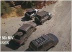 How do you document your trips?
 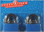 Padlocks that won't corrode or jam up in dusty conditions Marlin Crawler's 15th Annual Round-Up (Rubicon, Sept 17, 2016)
OBX Closures
Discussion in 'Off-Roading & Trails' started by 2kool4school, Nov 16, 2010.


