1. Welcome to Tacoma World!

    You are currently viewing as a guest! To get full-access, you need to register for a FREE account.

    As a registered member, you’ll be able to:
    • Participate in all Tacoma discussion topics
    • Communicate privately with other Tacoma owners from around the world
    • Post your own photos in our Members Gallery
    • Access all special features of the site

Tablet/GPS/Set-Up/Apps/Rigging Questions

Discussion in '1st Gen. Tacomas (1995-2004)' started by Ryan_3TacosIn, Sep 27, 2017.

  1. Sep 27, 2017 at 9:04 AM
    #1
    Ryan_3TacosIn

    Ryan_3TacosIn [OP] Well-Known Member

    Joined:
    Aug 8, 2016
    Member:
    #194084
    Messages:
    424
    Gender:
    Male
    First Name:
    Ryan
    Houston, TX
    Vehicle:
    '02 XTRA Cab, 4x4, TRD- Working on Restore
    OME Shocks, 883 Coilovers, Synthetic Brake Lines, Dakar Leafs with AAL, Baja Rear Bumper; ES Body mount Bushings, Light Racing UCAs, American Racing Wheels w/ 33" Hercules Tires, and more to come...
    Guys-

    Looking for some help and advice here... I posted in the 1st Gen. Tacoma section because that's what I have.

    I'm looking for an "inexpensive" (less than a few hundred bucks) options on how to rig a small tablet so I can download/save maps and possibly use a GPS function for off-road trails and maps. I'm in Texas so we don't have many of the off-road trails and parks like guys in NorCal/Colorado/UT have.

    I know @Blackdawg had a write-up about this very thing in his "Frankenstein" build, but just wanted to see if anything has changed. I'd like to get something with a bigger screen than a phone, and be able to have some maps and possibly a GPS function.

    Through my course of researching options for this on TW, I saw there were a few that recommended the "map and compass" option, so for the record- I do know how to use a map and compass. I spent 6 years in the Army (2 of 3 deployments to Afghanistan) so I'm very, VERY familiar with the map and compass option...

    I'm just looking for a good electronic option for tablet/gps option that will stay with the truck.

    Thanks for your help.

    -Ryan
     
  2. Sep 27, 2017 at 10:03 AM
    #2
    jbrandt

    jbrandt Made you look

    Joined:
    Feb 12, 2011
    Member:
    #51038
    Messages:
    17,612
    Gender:
    Male
    First Name:
    Justin
    El Dorado, CA (NOT El Dorado Hills)
    Vehicle:
    '04 TRD Tacoma 4x4 DC
    Kings, J59's Total Chaos UCAs Custom skids Sticker mod
    I've been looking at the Galaxy Tab E lite 7", running Backcountry Navigator (BCN). You can get the Tab E for like $100 on Amazon, and the BCN app is, well, free (with adds though they aren't very intrusive), the paid version is like $10 or $20 iirc.

    I've seen a lot of people use the Galaxy Tab4 or other Galaxy tabs, but I'm sure the E lite will do the same thing since they both have integrated GPS, the E is just cheaper because it's less fancy I guess. It doesn't need to be fast or anything, and has a port for an external mem chip if you run out of space.

    I think the main requirement is that it (obviously) has integrated GPS and runs an OS that's compatible with the app you want to run. Everything else is really just about the "extras" like large internal memory or a bigger screen. Some tabs use GLONASS (Russian version of GPS) satellites along with GPS for better accuracy, but as someone who does GPS surveys for a living, the added level of positional accuracy from using GLONASS is not only necessary for off-road navigation - you don't need sub-meter accuracy to know what road you are on...

    Over the years I've tried a few different off-grid gps apps on my phone:

    Backcountry Navigator: Currently my favorite app. You can easily upload (and download) gpx and kmz files, has USFS overlay maps, various other USGS topo maps, etc... and the interface for downloading off-grid maps is super easy.


    Avenza: Really cool and this is my #2 (2nd to BCN), as you can download (for free) a myriad of geo-pdf maps from their website (some paid maps too), including USFS MVUMs and other topo maps. The down side is that you can't easily upload gpx of kmz files, and if you have multiple map types (a topo and a MVUM, for example), it will switch to the other map (sometimes) when you zoom way in and you can't really switch back - I ended up having my MVUMs and Topos in 2 different folders. The catch is that you can't then print out the maps you download, they are only available through the app so you can't import them to ArcGIS or similar and print them out...

    Trimble Navigator: Until recently, this was my favorite, but Trimble is no longer supporting it, and I hadn't extensively tested it for wheelin', though it did work well from what I saw. Great for hiking/biking, though.

    My Trails: Good because it has a lot of different map options (with local MTB/hiking trail maps), but it's a bit clunky and hard to read while driving (great for hiking though) and I never really got a chance to test it on Forest Service roads.

    There's also ViewRanger, which I downloaded recently, but haven't actually used it because I found BCN

    I plan to (likely) use both Avenza and BCN together. The MVUMs on Avenza are easy to read and navigate since they don't have anything BUT the roads (topo lines etc... can be distracting), and (generally) represent the latest versions published by USFS, they also give some indication of the type of road. The topo maps on BCN are great at doing what topo maps are meant to do, show you the terrain...

    I have my phone mount screwed to the blank switch plate right next to the air vents on my '04. It's a good location, as it has good visability (don't have to look down much) and the a/c vent keeps it cool, lol... For a tablet, though, I really like some the RAM mounts that hold the phone/tablet, but I'll likely fab something up myself for where it mounts since I haven't seen anything that quite fits for what I need and where I want it to go.
     
    Last edited: Sep 27, 2017
  3. Sep 27, 2017 at 10:11 AM
    #3
    Kleenax

    Kleenax Well-Known Member

    Joined:
    Mar 24, 2017
    Member:
    #214267
    Messages:
    532
    Gender:
    Male
    First Name:
    Ray
    Michigan
    Vehicle:
    2001 SR5 4WD V6 Auto - Mica Green
    New frame & stuff CBI bolt-on Sliders
    Can’t go wrong with an iPad. I use mine along with google maps and it has worked great as long as u get your route before you leave cell service to download your route area. GPS works just fine and has gotten me out of being lost a lot of times. You can get a great price for an refurbished iPad too on the apple store. The “little Blue dot” always shows your position in google maps; love it!
     
    wbrigance likes this.
  4. Sep 27, 2017 at 11:08 AM
    #4
    wbrigance

    wbrigance Member

    Joined:
    Nov 26, 2013
    Member:
    #117371
    Messages:
    22
    Gender:
    Male
    First Name:
    Will
    Jackson, TN
    Vehicle:
    1998 Tacoma 4x4, Reg cab, Manual, 2.7L
    I agree with Kleenax, regarding google maps. Also, if you have a handheld gps or gps app that will record/log your tracks, you can convert and save them into google maps. Love that app.
     
  5. Sep 27, 2017 at 3:37 PM
    #5
    Kleenax

    Kleenax Well-Known Member

    Joined:
    Mar 24, 2017
    Member:
    #214267
    Messages:
    532
    Gender:
    Male
    First Name:
    Ray
    Michigan
    Vehicle:
    2001 SR5 4WD V6 Auto - Mica Green
    New frame & stuff CBI bolt-on Sliders
    I also have an app called "MotionX GPS" that I bought a few years ago for iphone & ipad that works well and also allows you to retain "tracks" and then overlay them on Google Maps. Also has altitude and longitude/latitude coordinates. Only bad thing about it is that it really SUCKS battery power, but it if was hooked into your truck's power, that wouldn't be a problem. There's another app with additional maps to download called GAIA GPS. I use that one in Michigan's upper peninsula where cell service is sparse.
     
  6. Sep 28, 2017 at 6:43 AM
    #6
    Ryan_3TacosIn

    Ryan_3TacosIn [OP] Well-Known Member

    Joined:
    Aug 8, 2016
    Member:
    #194084
    Messages:
    424
    Gender:
    Male
    First Name:
    Ryan
    Houston, TX
    Vehicle:
    '02 XTRA Cab, 4x4, TRD- Working on Restore
    OME Shocks, 883 Coilovers, Synthetic Brake Lines, Dakar Leafs with AAL, Baja Rear Bumper; ES Body mount Bushings, Light Racing UCAs, American Racing Wheels w/ 33" Hercules Tires, and more to come...
    Guys- I really appreciate all the input. It was WAY more than I expected.

    I have another question- Is there any way I can connect a hand-help GPS and a tablet and/or app? I have 2 hand held GPS, but they don't have the robust map system I could get on a tablet.
     
  7. Sep 28, 2017 at 12:03 PM
    #7
    Kleenax

    Kleenax Well-Known Member

    Joined:
    Mar 24, 2017
    Member:
    #214267
    Messages:
    532
    Gender:
    Male
    First Name:
    Ray
    Michigan
    Vehicle:
    2001 SR5 4WD V6 Auto - Mica Green
    New frame & stuff CBI bolt-on Sliders
    All ipads/iphones also have a GPS chip in them.
    All you have to do (instead of hooking them together) is to find a stand-alone app for them that shows you the GUI that you want; there are a few out there. I would still keep your "real" handheld GPS with you, but Google maps and a couple of others do it for me just fine. Course, I also keep paper maps with me if I'm going to a REALLY off-the-grid location just-in-case.
     
  8. Sep 29, 2017 at 12:00 PM
    #8
    RLD831

    RLD831 Active Member

    Joined:
    Apr 3, 2016
    Member:
    #183238
    Messages:
    32
    Gender:
    Male
    First Name:
    Rob
    Vehicle:
    2001 Tacoma Doublecab PreRunner Limited
  9. Sep 29, 2017 at 12:22 PM
    #9
    Kleenax

    Kleenax Well-Known Member

    Joined:
    Mar 24, 2017
    Member:
    #214267
    Messages:
    532
    Gender:
    Male
    First Name:
    Ray
    Michigan
    Vehicle:
    2001 SR5 4WD V6 Auto - Mica Green
    New frame & stuff CBI bolt-on Sliders
    Just looked that device over, and I’d have to say you would really be disappointed with it in short order. A newer iPhone or iPad has about 10 times the computing power as that device, and is much more robustly built. Just the graphics disappoint me, and do you notice how they mention absolutely nothing about it’s GPS capabilities?
     
  10. Sep 29, 2017 at 2:24 PM
    #10
    Kleenax

    Kleenax Well-Known Member

    Joined:
    Mar 24, 2017
    Member:
    #214267
    Messages:
    532
    Gender:
    Male
    First Name:
    Ray
    Michigan
    Vehicle:
    2001 SR5 4WD V6 Auto - Mica Green
    New frame & stuff CBI bolt-on Sliders
    Ryan (and all);

    Here's a good article on using Google maps on Android and/or iphone/ipad devices. As I stated earlier, I have used this function on many occasions, and it works fine....

    the only caveat is that your device (ipad, iphone, etc) has to have enough free storage to be able to download the maps beforehand. That is exactly why my ipad & iphone are 256GB; just for this purpose. It's cheaper than another standalone GPS!

    https://www.outsideonline.com/2038406/how-well-do-google-maps-work-offline-absolutely-flawlessly
     
  11. Sep 29, 2017 at 2:26 PM
    #11
    Ryan_3TacosIn

    Ryan_3TacosIn [OP] Well-Known Member

    Joined:
    Aug 8, 2016
    Member:
    #194084
    Messages:
    424
    Gender:
    Male
    First Name:
    Ryan
    Houston, TX
    Vehicle:
    '02 XTRA Cab, 4x4, TRD- Working on Restore
    OME Shocks, 883 Coilovers, Synthetic Brake Lines, Dakar Leafs with AAL, Baja Rear Bumper; ES Body mount Bushings, Light Racing UCAs, American Racing Wheels w/ 33" Hercules Tires, and more to come...
  12. Sep 30, 2017 at 5:40 AM
    #12
    RLD831

    RLD831 Active Member

    Joined:
    Apr 3, 2016
    Member:
    #183238
    Messages:
    32
    Gender:
    Male
    First Name:
    Rob
    Vehicle:
    2001 Tacoma Doublecab PreRunner Limited
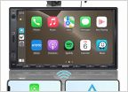
    I've been running that unit in my truck for about 6 months now. It's obviously not going to be as fast as one of the newer flagship phones, but it's definitely not slow. I've used it with google maps and waze, streamed videos and watched local media, and even update my truck maintenance and fuel economy spreadsheets with it. You can even use a keyboard and mouse with a usb or bluetooth connection, though a rarely do unless I'm just messing around. The units do have GPS. It comes with an external antenna and about 15 feet of wire to remote mount it.

    It's not the type of device that you'd want to have constant interaction with, but for putting a map on the screen it works great. Most of the time I leave the Torque app open with a ton of gauges connected to my OBD port.
     
  13. Sep 30, 2017 at 5:56 AM
    #13
    gainman

    gainman Semper Fi

    Joined:
    Oct 23, 2008
    Member:
    #10185
    Messages:
    3,541
    Gender:
    Male
    SW Florida
    Vehicle:
    2012 TRD Sport Supercharged Manual
    Stuff
    Why hasn't anyone mentioned Gaia yet? It is the gps/map/offroadimg/hiking app of the gods.

    Steep learning curve but it absolutely has everything
     

Products Discussed in

To Top