

-
Welcome to Tacoma World!
You are currently viewing as a guest! To get full-access, you need to register for a FREE account.
As a registered member, you’ll be able to:- Participate in all Tacoma discussion topics
- Communicate privately with other Tacoma owners from around the world
- Post your own photos in our Members Gallery
- Access all special features of the site
 CO TW Homebrewers
 Needle Bearing Removal
 What radios are people using
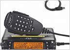 Official Colorado HAM and cheese thread
 Multi Thread Idea - Trail Options
 Suggestions of members or vendors who can Rhino Line some fender flares?
Colorado Trail Status, Closures, repairs, discussion.
Discussion in 'Colorado' started by Deathbysnusnu, Mar 22, 2017.
Page 9 of 31
Page 9 of 31


