

-
Welcome to Tacoma World!
You are currently viewing as a guest! To get full-access, you need to register for a FREE account.
As a registered member, you’ll be able to:- Participate in all Tacoma discussion topics
- Communicate privately with other Tacoma owners from around the world
- Post your own photos in our Members Gallery
- Access all special features of the site
 Diesel Heater Inside Truck Camper?
 New to trail.driving
 Brass tire deflators - leaving them on
 How do you pack your blankets when overlanding?
 Project DIY: Portable Pressurized 12-Volt Water
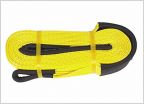 Need A Good Recovery Strap
What Trail maps are you using?
Discussion in 'Off-Roading & Trails' started by Tacoma-toy, Nov 30, 2020.
Page 2 of 5
Page 2 of 5


