1. Welcome to Tacoma World!

    You are currently viewing as a guest! To get full-access, you need to register for a FREE account.

    As a registered member, you’ll be able to:
    • Participate in all Tacoma discussion topics
    • Communicate privately with other Tacoma owners from around the world
    • Post your own photos in our Members Gallery
    • Access all special features of the site

Death Valley Off-Road Adventures

Discussion in 'Off-Roading & Trails' started by Crom, Nov 14, 2009.

  1. Feb 4, 2024 at 2:37 PM
    #7401
    essjay

    essjay Part-Time Lurker

    Joined:
    Nov 29, 2018
    Member:
    #274276
    Messages:
    3,271
    Gender:
    Male
    First Name:
    Chris
    Concord, CA
    Vehicle:
    2011 Tacoma SR5 (V6/AC/4WD)
    I feel like there's just a ton of open-endedness to your question, and it really begs questions about what direction you're coming into the park from, if there's any must-see points of interest, how willing you are to drive at night to find a campsite, etc, etc.
     
    Drainbung likes this.
  2. Feb 4, 2024 at 4:06 PM
    #7402
    essjay

    essjay Part-Time Lurker

    Joined:
    Nov 29, 2018
    Member:
    #274276
    Messages:
    3,271
    Gender:
    Male
    First Name:
    Chris
    Concord, CA
    Vehicle:
    2011 Tacoma SR5 (V6/AC/4WD)
    Personally, I wouldn't bother buying a route. First off, this is a National Park with limited, known roads and plenty of information is available for free. Second, a route of that length almost certainly is going to involve backtracking and/or take you on roads that are currently closed (eg: Titus).

    Just looking at your screenshot, you have a ton of routes already shown. I'd just figure out your ingress and egress points (specifically, the gas stations), and work from there. The trickiest part for DV, IMO, is figuring out the camping situation, given that (A) there's the 4-vehicle limit and (B) some areas require permits.

    edit: And, of course, the road closures. I'd really recommend to split-screen your routing app and the DV/NPS road closure website, and, more importantly, check the closures against the route again before you leave.
     
    Last edited: Feb 4, 2024
  3. Feb 4, 2024 at 4:50 PM
    #7403
    License2Ill

    License2Ill Woke like a Coma Toyota Tacoma

    Joined:
    May 20, 2012
    Member:
    #79174
    Messages:
    2,253
    Gender:
    Male
    First Name:
    Ian
    It's a dry heat thou, AZ
    Vehicle:
    2004 SC'd 5VZ DC 5spd 4x4 TRD.GOV
    Bailing wire & Duct tape
    Lord Helmet, Drainbung and essjay like this.
  4. Feb 4, 2024 at 5:06 PM
    #7404
    essjay

    essjay Part-Time Lurker

    Joined:
    Nov 29, 2018
    Member:
    #274276
    Messages:
    3,271
    Gender:
    Male
    First Name:
    Chris
    Concord, CA
    Vehicle:
    2011 Tacoma SR5 (V6/AC/4WD)
    Whoever did that is a piece of shit. Fuck 'em.
     
    SUMOTNK, jubei, lit_taco4x4 and 8 others like this.
  5. Feb 4, 2024 at 5:23 PM
    #7405
    essjay

    essjay Part-Time Lurker

    Joined:
    Nov 29, 2018
    Member:
    #274276
    Messages:
    3,271
    Gender:
    Male
    First Name:
    Chris
    Concord, CA
    Vehicle:
    2011 Tacoma SR5 (V6/AC/4WD)
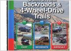
    Those books are great. Reminds me that I need to buy my own copies and return the ones I have to @Blue Canary.
     
  6. Feb 5, 2024 at 8:56 AM
    #7406
    Y2kbaja

    Y2kbaja Well-Known Member

    Joined:
    Jun 11, 2013
    Member:
    #106028
    Messages:
    1,393
    Gender:
    Male
    Sacramento
    Vehicle:
    05 Total Chaos Tacoma
    Total Chaos
    5 Years ago!? Those Tacoma's will look nothing like that now and are probably on their 2nd or 3rd owner since then. lol.
     
  7. Feb 5, 2024 at 9:46 AM
    #7407
    DVexile

    DVexile Exiled to the East

    Joined:
    Dec 17, 2014
    Member:
    #144469
    Messages:
    2,783
    Gender:
    Male
    First Name:
    Ken
    Vehicle:
    2015 DCSB V6 TRD OR 4X4
    Sure, but their friends, family, and co-workers will likely remember they owned those trucks five years ago. That's also why they mentioned some of more identifying aspects of the suspected weapon and ammunition. Not so people would be suddenly on the look out for refilled cartridges with red/orange paint on them, rather so people who know someone who used such ammunition 5 years ago might remember and report it.
     
  8. Feb 5, 2024 at 11:16 AM
    #7408
    AMMO461

    AMMO461 TACO/FJ/FJ

    Joined:
    Nov 14, 2019
    Member:
    #310727
    Messages:
    240
    Gender:
    Male
    SoCal Hi-Desert
    Vehicle:
    2021 TRD Off Road DCSB OD
    Death Valley Camping at Panamint Springs last week before the storm.
    IMG_20240205_111105.jpg IMG_20240205_111054.jpg
    IMG_20240205_111759.jpg
     
    Last edited: Feb 5, 2024
  9. Feb 5, 2024 at 1:17 PM
    #7409
    kylehorvath

    kylehorvath Well-Known Member

    Joined:
    Feb 23, 2010
    Member:
    #32009
    Messages:
    395
    Gender:
    Male
    First Name:
    Kyle
    Humboldt/Tuolumne/Stanislaus
    Vehicle:
    2007 Access Cab, 4x4
    Over GVWR and I keep adding more metal
    Looks more like first gen tacomas to me
     
    Drainbung likes this.
  10. Feb 5, 2024 at 6:56 PM
    #7410
    dman100

    dman100 Well-Known Member

    Joined:
    Mar 2, 2016
    Member:
    #180009
    Messages:
    2,338
    Central Coast, California
    Vehicle:
    2016 TRD OR DCSB
    We seem to be past the storm in the Monterey Bay Area but DVNP is till posting a flood watch for the park. And I saw on the Saline Valley Facebook page that the DV road off Hwy 168 is gated shut, though it’s shown as open as of today on the Inyo County website. Maybe the gate is just because there’s no nighttime snow removal. CalTrans shows chain controls on 168 just 5 miles from 395 so it seems like snow levels are dropping. I hope folks in SoCal are doing OK; it seems to have hit there pretty badly.
     
    Crom[OP] likes this.
  11. Feb 5, 2024 at 6:59 PM
    #7411
    ian408

    ian408 Well-Known Member

    Joined:
    Nov 8, 2009
    Member:
    #25619
    Messages:
    19,673
    Gender:
    Male
    First Name:
    Ian
    Santa Clara, CA
    Vehicle:
    09 Tacoma
    We had some unexpected heavy rain today--you might get a little more :)
     
  12. Feb 5, 2024 at 7:00 PM
    #7412
    License2Ill

    License2Ill Woke like a Coma Toyota Tacoma

    Joined:
    May 20, 2012
    Member:
    #79174
    Messages:
    2,253
    Gender:
    Male
    First Name:
    Ian
    It's a dry heat thou, AZ
    Vehicle:
    2004 SC'd 5VZ DC 5spd 4x4 TRD.GOV
    Bailing wire & Duct tape
    $20 that says Melvin here is the one that did it.:D
     
  13. Feb 5, 2024 at 7:48 PM
    #7413
    ian408

    ian408 Well-Known Member

    Joined:
    Nov 8, 2009
    Member:
    #25619
    Messages:
    19,673
    Gender:
    Male
    First Name:
    Ian
    Santa Clara, CA
    Vehicle:
    09 Tacoma
    I wonder if they have a reasonable idea who but maybe lack sufficient evidence and that's why they're talking about the evidence.
     
  14. Feb 6, 2024 at 9:58 AM
    #7414
    DVexile

    DVexile Exiled to the East

    Joined:
    Dec 17, 2014
    Member:
    #144469
    Messages:
    2,783
    Gender:
    Male
    First Name:
    Ken
    Vehicle:
    2015 DCSB V6 TRD OR 4X4
    New Major Road Closures

    UPDATE: As of 2/7 all of the below have reopened except for Redrock Randsburg Road which definitely lost pavement.

    This is all in flux with the storm still dropping rain and with no real information if these are temporary closures likely to clear quickly after the storm or new multi-week closures. Right now there is also different information from different sources with no clarity as to which is the most up to date!

    At the time of this posting the DVNP road status page has not been updated since 2/1/24 and so it is at this point unknown what if any impacts there are inside the park. But some surrounding roads are already reported to have significant impacts.

    There have also been some conflicting reports about closure signs around 168 and Big Pine Death Valley road in the past few days so ground truth might differ.


    CA-127

    From the Caltrans road conditions site (also reflected on their QuickMap):

    [IN THE SOUTHERN CALIFORNIA AREA]
    1-way controlled traffic from Baker Blvd /in Baker/ (San Bernardino Co) to 7.6 mi south of the San Bernardino/Inyo Co Line - Due to a washout

    [IN THE CENTRAL CALIFORNIA AREA & THE SIERRA NEVADA]
    Is closed from the Jct of I 15 (San Bernardino Co) to 7.7 mi south of the South Jct of SR 178 (Inyo) - Due to flooding - Motorists are advised to use an alternate route


    The first entry above is the long term controlled traffic for construction repairing the damage from this past summer (actually a mixture of Hillary plus thunderstorms a few weeks later). The second entry is new full closure and is related to the rain received in the past two days.


    Panamint Valley Road

    From the Inyo County Road Status as of 2/5/24:

    Panamint Valley Rd is CLOSED due to flooding, from Trona Wildrose Rd north towards Hwy 190.

    Note below the road south of this point is also closed (but has a different name).


    Trona Wildrose Road

    From the Inyo County Road Status as of 2/5/24:

    Trona Wildrose Rd. is CLOSED due to flooding, from the Inyo County Line north towards Panamint Valley Rd.

    So basically no getting into Panamint Valley from Trona/Ridgecrest. 190 is the only way in and you can't go south from the 190.


    Death Valley Road???

    I think this is an error, and Inyo County's two different report formats contradict each other. From the "detailed" road condition report:

    Death Valley Road is open but Closed from North and South Eureka Rd to Scotty’s Castle.

    This reads like an old closure that opened in the past few weeks. The summary road report also from 2/5 lists it as open with no qualifications and DVNP also lists it as open.

    EDIT TO ADD:

    Redrock Randsburg Road

    Closed due to flooding according to CalTrans District 9 FB page. Also video showing pavement washed away and roadbed eroded down a few feet with water still flowing.

    This road connects the 14 and the 395 and is a sometime shortcut from LA if coming up the 14 to get into Panamint Valley (bypasses Ridgecrest) but there are plenty of alternate routes around it. Looks like it will be closed for a bit given the pavement damage.
     
    Last edited: Feb 7, 2024
    d.shaw, Crom[OP], Cwopinger and 8 others like this.
  15. Feb 6, 2024 at 11:34 AM
    #7415
    kylehorvath

    kylehorvath Well-Known Member

    Joined:
    Feb 23, 2010
    Member:
    #32009
    Messages:
    395
    Gender:
    Male
    First Name:
    Kyle
    Humboldt/Tuolumne/Stanislaus
    Vehicle:
    2007 Access Cab, 4x4
    Over GVWR and I keep adding more metal
    The desert has been taking some healthy drinks over the last year, it might be a great wildflower season. Here are the gauges for the Mojave and Amargosa systems...I expect Lake Manly to be around a bit longer.

    mojave.jpg
    amargosa.jpg
     
  16. Feb 6, 2024 at 3:39 PM
    #7416
    dman100

    dman100 Well-Known Member

    Joined:
    Mar 2, 2016
    Member:
    #180009
    Messages:
    2,338
    Central Coast, California
    Vehicle:
    2016 TRD OR DCSB
    I’ve heard that if the rains come late, like these, they can wash away germinated seeds and seedlings, and the bloom is worse. It’s supposedly the late summer rains (monsoon) that contribute the most to the following spring’s flowers. But I suspect nature works in mysterious ways and since we had summer storms to kick things off, and now winter storms to maybe keep things going, I’m hoping it’s another great year like 2016.
     
    MSN88longbed and ian408 like this.
  17. Feb 6, 2024 at 4:20 PM
    #7417
    Shwaa

    Shwaa Well-Known Member

    Joined:
    Jan 7, 2014
    Member:
    #120129
    Messages:
    3,031
    Gender:
    Male
    Bay Area, CA
    Vehicle:
    '13 DC Prerunner TRD Off-Road
    Thanks for posting this. I am heading to the park the first week of March and this was going to be my route in, with a night stopover at the Trona Pinnacles. I'll have to adjust if they are still closed.
     
    AY_ARONTRD likes this.
  18. Feb 6, 2024 at 5:52 PM
    #7418
    RichochetRabbit

    RichochetRabbit Bing Bing Bing

    Joined:
    Mar 6, 2023
    Member:
    #419488
    Messages:
    6,183
    Either these constant rain-outs will make people stop waiting for the opportunity to visit DV or the people will be even more enthusiastic to visit when weather allows.

    When I was there for a weekend to see Lake Manly, most of the roads my truck could take better than cars were closed and I was annoyed by that, after a 7 hour drive.
     
  19. Feb 6, 2024 at 6:10 PM
    #7419
    ian408

    ian408 Well-Known Member

    Joined:
    Nov 8, 2009
    Member:
    #25619
    Messages:
    19,673
    Gender:
    Male
    First Name:
    Ian
    Santa Clara, CA
    Vehicle:
    09 Tacoma
    It's a long haul for sure which is why it's so great to find road information online today. Other places like Joshua Tree or Mojave are cool too. But I'm betting people will want to see Lake Manly. And I bet there'll be some hope for wildflower season.
     
  20. Feb 6, 2024 at 6:17 PM
    #7420
    RichochetRabbit

    RichochetRabbit Bing Bing Bing

    Joined:
    Mar 6, 2023
    Member:
    #419488
    Messages:
    6,183
    I figure Lake Manly will be around a bit longer ... Badwater Road may be easier to keep open for those 12 miles. But I was hoping to do a little more on that trip ... maybe it is just me. I think next "lease is up" I need to move to western neighborhoods of Las Vegas to be only 2 hours away from DV so I can spend a couple of years and explore more year round.
     
    MSN88longbed and ian408[QUOTED] like this.

Products Discussed in

To Top