

-
Welcome to Tacoma World!
You are currently viewing as a guest! To get full-access, you need to register for a FREE account.
As a registered member, you’ll be able to:- Participate in all Tacoma discussion topics
- Communicate privately with other Tacoma owners from around the world
- Post your own photos in our Members Gallery
- Access all special features of the site
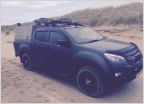 Beach Driving Equipment
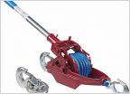 Hand winch instead of power winch?
 West Coast Road-trip Recommendations
 Snow Chains?
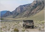 Overlanding and camping in montana etc
 Wheeling with camper shell
Death Valley Off-Road Adventures
Discussion in 'Off-Roading & Trails' started by Crom, Nov 14, 2009.
Page 373 of 405
Page 373 of 405
Products Discussed in


