

-
Welcome to Tacoma World!
You are currently viewing as a guest! To get full-access, you need to register for a FREE account.
As a registered member, you’ll be able to:- Participate in all Tacoma discussion topics
- Communicate privately with other Tacoma owners from around the world
- Post your own photos in our Members Gallery
- Access all special features of the site
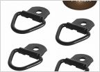 D rings
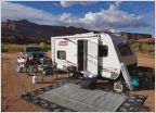 Moab Sep 2019
 Multi Thread Idea - Trail Options
 East Coaster visiting Colorado Mid-August (9th-21st), is this a good time? (long drive)
 Help with 6112 install in Denver area (seized sway bar bolt)
 Rodents snack on my truck while I sleep
How to find trails in Colorado
Discussion in 'Colorado' started by gottaToy, Aug 23, 2015.
