

-
Welcome to Tacoma World!
You are currently viewing as a guest! To get full-access, you need to register for a FREE account.
As a registered member, you’ll be able to:- Participate in all Tacoma discussion topics
- Communicate privately with other Tacoma owners from around the world
- Post your own photos in our Members Gallery
- Access all special features of the site
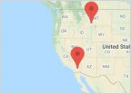 West Coast Road-trip Recommendations
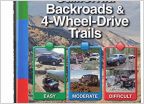 Easy Bay Area Trails
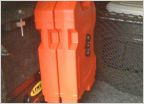 Jerry Cans
 Which winch?
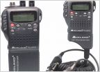 WALKIE TALKIE/ 2 WAY RADIOS AND CB RADIOS
 How do you document your trips?
Deer Peak trail via Drinkwater trail SoCal
Discussion in 'Off-Roading & Trails' started by Sandtaco, Apr 11, 2016.


