

-
Welcome to Tacoma World!
You are currently viewing as a guest! To get full-access, you need to register for a FREE account.
As a registered member, you’ll be able to:- Participate in all Tacoma discussion topics
- Communicate privately with other Tacoma owners from around the world
- Post your own photos in our Members Gallery
- Access all special features of the site
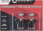 Off-road valve stem replacement
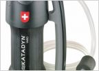 Lifesaver Jerry can (water filtration)
 High Lift & Accessories: Am I Missing Anything?
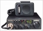 Uniden Off-Road Compact CB radios - any reviews?
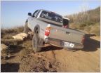 Fun Trails to do at night?
 Options to level Tacoma for camping
App?
Discussion in 'Off-Roading & Trails' started by char18yot, Feb 8, 2018.
Page 1 of 2
Page 1 of 2


