

-
Welcome to Tacoma World!
You are currently viewing as a guest! To get full-access, you need to register for a FREE account.
As a registered member, you’ll be able to:- Participate in all Tacoma discussion topics
- Communicate privately with other Tacoma owners from around the world
- Post your own photos in our Members Gallery
- Access all special features of the site
 Mojave trail run - March 18th, 2018
 Big Bend 2014
 The Mojave Road, Central
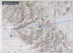 Titus Canyon - Death Valley, CA - 1/1/2016
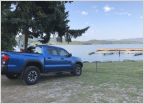 Took a Trip (San Diego to Banff)
 Colorado passes trip plan needed
New Mexico / Colorado Adventure
Discussion in 'Trip Reports' started by WebberLander, Aug 29, 2019.


