1. Welcome to Tacoma World!

    You are currently viewing as a guest! To get full-access, you need to register for a FREE account.

    As a registered member, you’ll be able to:
    • Participate in all Tacoma discussion topics
    • Communicate privately with other Tacoma owners from around the world
    • Post your own photos in our Members Gallery
    • Access all special features of the site

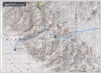
Coyote Flats Trail, E. Sierras in a DCLB

Discussion in 'Trip Reports' started by Rollin-slow, Sep 29, 2021.

  1. Sep 29, 2021 at 9:22 PM
    #1
    Rollin-slow

    Rollin-slow [OP] Member

    Joined:
    Sep 9, 2020
    Member:
    #340334
    Messages:
    11
    Gender:
    Male
    First Name:
    Blue
    San Mateo
    Vehicle:
    ‘15 DCLB
    C4373BF9-0B5A-4979-8765-F1C70953ED21.jpg

    Hit the coyote flats trail south out of Bishop 9/24/21. It was my first time on this trail and it was awesome. It was doable in a fully stock rig, but not advisable for your first or third off roaring excursion. I am moderately experienced off-roading but I made a few choices I would have done differently.

    I drive a 2015 Double Cab Long Bed 4x4 no lockers with no lift and 265/70/17 all season tires. An unpolished gem compared to most of the rigs on here. My main reason for posting this report is to assure other stock 4x4s that they don’t need 33s and kings to hit this trail. The only mods I wish I had were an aftermarket front skid and some rock sliders.

    I did have a few low speed frame kisses but I probably could have avoided them if I had my spotter get out. I’ve been wanting to add some armor for a while now but have been secondary to making payments.

    The trail was in pretty good shape overall. I’m sure there are better accounts of the trail on here already. I can say that there were only two places where a diff lock would have been useful. One of which was a section of offset washboard ditches up a hill where I had to put the pedal down to bust through. 80% of the trail was pretty easy work by Sierra standards. 19% was spent picking lines but not too complicated. 1% of the trial was spent stopping, scoping, and clenching. But like I said I only had a few scrapes. It took us about 4 hours to make it up to baker creek and 2.5 hours to come back down. Would highly recommend to anyone in CA or West Nevada.

    85A25854-0767-42B1-9A58-9B593273AFFF.jpg
    6A670D3C-4FB4-4EF1-A5F2-90D4295F1F2C.jpg
    ACA98AF5-F8DD-4049-A6BF-5CF446350D48.jpg
    8219FA31-9188-4B19-8948-9A20C095ABA3.jpg
     
    ETAV8R, tacoconvoy, Kronk21 and 7 others like this.
  2. Sep 30, 2021 at 6:25 PM
    #2
    BalutTaco

    BalutTaco Moja_Przygoda

    Joined:
    Apr 2, 2019
    Member:
    #288885
    Messages:
    3,324
    Gender:
    Male
    Vehicle:
    2019 Cement Limo Trail Edition -> 2022 Magnetic Grey OR
    Bird nest engine bay.
    Damn.... I wish you had more pictures!
     
    Kronk21 likes this.
  3. Sep 30, 2021 at 7:26 PM
    #3
    Rollin-slow

    Rollin-slow [OP] Member

    Joined:
    Sep 9, 2020
    Member:
    #340334
    Messages:
    11
    Gender:
    Male
    First Name:
    Blue
    San Mateo
    Vehicle:
    ‘15 DCLB
    I have some more on my camera that I’ll upload this weekend.
     
    BalutTaco likes this.
  4. Oct 4, 2021 at 1:14 PM
    #4
    elmontemike

    elmontemike Well-Known Member

    Joined:
    Mar 2, 2017
    Member:
    #212154
    Messages:
    4,291
    Gender:
    Male
    First Name:
    Mike

    That looks like my old truck. I had a 2015 DCLB with a shell in MGM

    That looks like an awesome trail. I need to do this one. Looking forward to more pictures.
     
  5. Oct 4, 2021 at 9:29 PM
    #5
    Rollin-slow

    Rollin-slow [OP] Member

    Joined:
    Sep 9, 2020
    Member:
    #340334
    Messages:
    11
    Gender:
    Male
    First Name:
    Blue
    San Mateo
    Vehicle:
    ‘15 DCLB
    Alright photos part two as promised:

    1. Looking NW from the top of the switchbacks, ~1-1.5 miles from the Trailhead (TH)

    2. From same location as 1, looking NE

    3. LC FJ80 taking the lead, ~2.5 miles up from the TH

    4. Taken just after the first water crossing, looking up the trail. The water level and flow were mild, maybe 12” max. Shockingly smooth trail here, a welcome break

    5. 4Runner attacking the offset double washboard I mentioned before. It had a locker and big tires, handled it well. This feature is at most a mile uphill from the first water crossing. You should know that there is a wide stretch in the trail just before this, ideal for passing. Make use of it before you get to the obstacle. You’ll be coming out of a left turn and it’s like a two lane road with the right hand side down lower by several feet, reconnects ~50’ ahead. That’s how you’ll know you’re close

    6. First look at the flats, looking South. Especially beautiful with this good air quality. The trail continues up through the flats for about 8-10 miles to Sugarloaf peak

    7. Taking a break ~7 miles from pic 6. Higher and drier here, dusty but beautiful and oh so desolate

    DA7F85AC-0991-4F09-97F7-87AE6E40F0DC.jpg
    62FE3AF9-E4BF-40C3-B597-4B3D42922674.jpg
    D2C653D1-BADC-441A-B7AB-412E29654290.jpg
    354DC053-E9F7-4A4A-8E8C-EB8398F6C75D.jpg
    D5ECE1CE-2E0E-4F51-AB7D-8E386C8B18FE.jpg
    023FF565-C2B7-49A4-90AA-B1B6D8EB1A0E.jpg
    7C8401E6-0429-45D5-8121-6DB5AE972C87.jpg
     
    Kronk21 and Durango95 like this.
  6. Oct 4, 2021 at 9:52 PM
    #6
    Rollin-slow

    Rollin-slow [OP] Member

    Joined:
    Sep 9, 2020
    Member:
    #340334
    Messages:
    11
    Gender:
    Male
    First Name:
    Blue
    San Mateo
    Vehicle:
    ‘15 DCLB
    Part 3:

    8. Two pics looking East from near where we camped, sugarloaf is the big peak, for reference on a map

    9. Looking SE from our campsite at dawn. I can only describe our campsite as ~1/2 mile past the bridge, shortly after you make a hard right in a stand of trees. You’ll see a very clear turnout to your right as you are going up a slow rocky incline. There is a large clearing directly parallel to the trail. The camp area is not very level but has great views

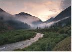
    10. Looking West towards cloudripper at dawn. This view is just a couple hundred yards up the trail from where we camped. If you continue you will reach the creek, but we didn’t care for the camp areas near the creek, too dense and buggy

    11. Looking NE down the mountain towards Bishop. This photo was taken from the end of a trail that’s on the North side of sugarloaf and peaks over the edge of the mountains. To get here, take the last turnout going East before you get to the bridge and keep taking rights until it starts to decline, then you go left up and over the edge

    12. Heading down the switchbacks, this is taken just below where photos 1 and 2 were taken. In the foreground you can see the paved area that other videos and reports mention. There were a couple sneaky high rocks but with a lil planning and a spotter it was simple

    13. My DCLB handling a rocky section, this is higher up the trail than pic 12. Not too bad of an obstacle but choose your line carefully or you will wack your ass

    14. The Land cruiser navigating the same rock section as 13. They were doing well until they stepped off with their back tire and dragged ass, but overall not bad

    Hope this was helpful!
    Have fun, and leave only tire tracks

    EB20AD9B-455B-4B73-A3A2-414B19FF02DC.jpg
    D4E3C4EC-D530-4663-9B7A-7974B3FEF5C6.jpg
    A9BFDD34-7F8D-4B42-9AA8-CE1A62E05D6C.jpg
    1E258F1A-90B3-41CD-9D7F-1AF6B30B5712.jpg
     
    Kronk21, CPS-65 and Durango95 like this.
  7. Oct 4, 2021 at 9:56 PM
    #7
    Rollin-slow

    Rollin-slow [OP] Member

    Joined:
    Sep 9, 2020
    Member:
    #340334
    Messages:
    11
    Gender:
    Male
    First Name:
    Blue
    San Mateo
    Vehicle:
    ‘15 DCLB
    Whoops here’s the rest of the photos

    ALSO if you are looking for a place to camp the night before you head up the trail, it’s gotta be buttermilk boulders. Plenty of other info about the spot online, it’s close to Bishop and it’s free

    B0E6A0B6-3595-482B-98CA-F2325B034B4C.jpg
    C42D257D-AA79-4B98-8FA1-B003F6DDFC3E.jpg
    DF4F5364-A9EA-4537-A640-DF4DD7DBFB1A.jpg
    59E8AB90-2522-44E6-86E3-5A35E80B73C2.jpg
     
    Kronk21 and Durango95 like this.
  8. Oct 4, 2021 at 9:56 PM
    #8
    PuckerbuttPliny

    PuckerbuttPliny Well-Known Member

    Joined:
    Jun 9, 2020
    Member:
    #330948
    Messages:
    72
    California
    Vehicle:
    2018 TRDOR 4X4 DCLB
    275/70r17 KO2 E Load 4R TRD Pro Rims
    Here’s one from Coyote Flats too. Beautiful up there. If you go up in early spring, beware, the kind snow/ice is something I’ve never driven through. It’s like trying to get through a powdery snow cone that goes straight down to a mud pit. Oh, and if you want to camp up there, bring layers, and a way to shield yourself from the wind, cause it can really howl!

    3100D06E-0ECD-40F7-8A15-1CF64692D886.jpg
     
  9. Oct 4, 2021 at 9:58 PM
    #9
    Rollin-slow

    Rollin-slow [OP] Member

    Joined:
    Sep 9, 2020
    Member:
    #340334
    Messages:
    11
    Gender:
    Male
    First Name:
    Blue
    San Mateo
    Vehicle:
    ‘15 DCLB
    Is this one of the “lakes”?
     
    elmontemike likes this.
  10. Oct 5, 2021 at 6:00 AM
    #10
    PuckerbuttPliny

    PuckerbuttPliny Well-Known Member

    Joined:
    Jun 9, 2020
    Member:
    #330948
    Messages:
    72
    California
    Vehicle:
    2018 TRDOR 4X4 DCLB
    275/70r17 KO2 E Load 4R TRD Pro Rims
    So I’d call this one like a seasonal pond. Sometimes it’s there, sometimes it’s not. There are a couple of lakes up there, but the trails to get to them become more rock crawling than the trail coming up.
     
    elmontemike likes this.
  11. Oct 5, 2021 at 9:11 PM
    #11
    Rollin-slow

    Rollin-slow [OP] Member

    Joined:
    Sep 9, 2020
    Member:
    #340334
    Messages:
    11
    Gender:
    Male
    First Name:
    Blue
    San Mateo
    Vehicle:
    ‘15 DCLB
    Got it. We heard there were some other lakes you could drive to but we chose to hike and do some dirt trail riding on our full day up there.
     
    elmontemike likes this.
  12. Oct 22, 2021 at 10:53 AM
    #12
    B17Rex

    B17Rex Active Member

    Joined:
    Nov 20, 2020
    Member:
    #347289
    Messages:
    27
    Gender:
    Male
    First Name:
    Brian
    Vehicle:
    2021 Tacoma TRD 4x4 Off Road
    Nice! I was actually up there at the same time myself. Camped at Funnel Lake from 9/22-9/24, then drove down to Baker Creek and camped by that Friday night, then back to San Diego on Saturday. Was a really fun trail.

    -Brian
     
    Rollin-slow[OP] and elmontemike like this.
  13. Nov 8, 2021 at 11:31 AM
    #13
    clenkeit

    clenkeit Well-Known Member

    Joined:
    Apr 30, 2019
    Member:
    #291841
    Messages:
    2,431
    First Name:
    Colin
    Lakewood, CA
    Vehicle:
    2010 White DCLB TRD Sport
    I gotta try this trail sometime - hopefully this spring. Thanks for the pics!
     

Products Discussed in

To Top