1. Welcome to Tacoma World!

    You are currently viewing as a guest! To get full-access, you need to register for a FREE account.

    As a registered member, you’ll be able to:
    • Participate in all Tacoma discussion topics
    • Communicate privately with other Tacoma owners from around the world
    • Post your own photos in our Members Gallery
    • Access all special features of the site

AdventureTaco - turbodb's build and adventures

Discussion in '1st Gen. Builds (1995-2004)' started by turbodb, Apr 4, 2017.

  1. Feb 21, 2022 at 11:18 AM
    #4341
    Yetimetchkangmi

    Yetimetchkangmi Well-Known Member

    Joined:
    Jun 19, 2013
    Member:
    #106605
    Messages:
    3,482
    Gender:
    Male
    First Name:
    Benjamin
    Newcastle, WA
    Vehicle:
    03 Tacoma 4x4 The Yeti
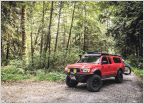
    ARB front locker, Custom high clearance rear bumper, Custom plate front bumper, mile marker winch PE8, safari snorkel, Deck Plate Mod Fox 2.5 rr DSC, Camburg UCA, squeaky Dakar leafs, 5125 10" and custom 7.5" shackles, thee finest PNW pinstripes, MT-R, Nissan crew cab roof rack??? wtf is that about??? Allpro skids, Rigid duallys President McKinley CB with PA Recaro SRD with Wedge Engineering Morimoto retrofits Champion Rad - Failed Tundra brakes
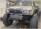
    images_bf0c0ba5c4f54e36fe1a47a85bb582fead017511.jpg
    Mine?
     
    turbodb[QUOTED][OP] likes this.
  2. Feb 21, 2022 at 6:16 PM
    #4342
    Kronk21

    Kronk21 IG @uniquely_Us_adventures

    Joined:
    Aug 31, 2021
    Member:
    #375788
    Messages:
    1,346
    Gender:
    Male
    First Name:
    Monte1
    Vehicle:
    2021.DBLCB.LB.GRN
    King 2.5 with reservoirs, CBI sliders, RCI skids, Leer camper shell, Methods, K02, switch-pro
    Random question of the day.. I see you have a full loop bumper. Now that you have really used your truck and it’s more than a Instagram model, would you stay with that style and with steal or aluminum with the miles you have put on it? I have a very similar road trip/adventuring style and though who better than you to ask! Also keep up the good work love your story telling!!!
     
    CowboyTaco and turbodb[OP] like this.
  3. Feb 21, 2022 at 6:57 PM
    #4343
    turbodb

    turbodb [OP] AdventureTaco

    Joined:
    Feb 9, 2016
    Member:
    #177696
    Messages:
    7,807
    Gender:
    Male
    First Name:
    Dan
    PNW
    Vehicle:
    2000 Tacoma Xcab 4x4 SR5 V6 TRD
    AdventureTaco
    Someone got it!!! :D

    This is a great question.

    First of all, I have had to cover my Tacoma's headlights so it can't read your statement that it's not an Instagram model. I mean, we all know it's ugly as sin and only getting uglier with time, but a truck can have dreams, can't it? Of course, the bigger problem for the truck is that I hate Instagram and can't really figure out how to use it, since I'm over 40. So it wasn't ever going to be a successful model anyway. :rofl:

    OK, so back to the great question. I think that 99% of the time, an aluminum bumper is a better option. Way lighter, and just as good looking. The lightness helps with fuel economy, but also with things like cracking of various bits of the truck - where weight is really the thing that causes a lot of our trucks to beat themselves to death a lot of the time.

    But, there's still the issue of that pesky 1% of the time. And really, it might be less than 1%. But, due to that 1%, I still think steel is worth a hard think before settling on aluminum. Here are the 1% considerations:
    1. Hitting animals. I've hit two deer and a baby(ish) cow. Actually, I didn't hit the cow, it ran into me - cows are dumb animals - when I was completely stopped. Regardless, I hit the two deer at speed - one at 35mph (video, near the end of the post), the other at 45mph (photo, again, at the end) - and in both cases, I would have totaled the truck had the bumper not completely "absorbed" the impact (or, rather, handed the entire brunt of it to the deer). Would aluminum have worked just as well? I don't really know.
    2. Winching. I'm sure there's a solution to this, and likely that solution is already implemented in existing bumpers, but it seems to me like the strength of a steel bumper is a good thing when winching heavy loads. This is a distant second to the animals for me, but still something to think about.
    3. Modification. I haven't had to do this with my front bumper, but I have had to modify my rear. That's a lot easier with steel (for me) than aluminum. (I've never used the metal glue gun to work with aluminum, so it probably scares me more than it should.)

    So yeah, I think that probably only #1 is a real consideration. It also doesn't happen often, but when it does, I want my bumper to do its job. Since we've already established that it's job is NOT looking good (since the truck isn't a model), the only think left is for it to protect the front end (of which I probably have the ugliest of the three 1st gen options... another reason the truck can never be a model, hahaha).
     
    Arctic Taco and Ridgewalker1 like this.
  4. Feb 21, 2022 at 7:10 PM
    #4344
    Kronk21

    Kronk21 IG @uniquely_Us_adventures

    Joined:
    Aug 31, 2021
    Member:
    #375788
    Messages:
    1,346
    Gender:
    Male
    First Name:
    Monte1
    Vehicle:
    2021.DBLCB.LB.GRN
    King 2.5 with reservoirs, CBI sliders, RCI skids, Leer camper shell, Methods, K02, switch-pro

    First off I think your truck is beautiful!
    Second thank you for such a detailed response very valid points! I never even considered the toll the weight would be over the years. I am heavy leaning towards steal up front but man when we pay so much for the truck and then the bumper I don’t want to get it wrong. Almost overwhelming the time I’ve spent going back and forth lol. But this helps..
    Again I can’t say it enough you (and your truck) are such an inspiration!
     
    4xThad, Ridgewalker1 and CowboyTaco like this.
  5. Feb 21, 2022 at 9:17 PM
    #4345
    Winkle99

    Winkle99 Don't Look Back

    Joined:
    Jul 19, 2017
    Member:
    #224477
    Messages:
    837
    Gender:
    Male
    First Name:
    David
    CO
    Vehicle:
    99 XCab 3.4 Manual 4x4 TRD SR5
    [QUOTE="turbodb, post: 26953001, member: 177696”]protect the front end (of which I probably have the best looking of the three 1st gen options).[/QUOTE]
    FIFY
    :cookiemonster:
     
  6. Feb 22, 2022 at 10:23 AM
    #4346
    TenBeers

    TenBeers Well-Known Member

    Joined:
    Jun 5, 2009
    Member:
    #18067
    Messages:
    7,087
    Gender:
    Male
    First Name:
    Rich
    Bentonville, AR
    Vehicle:
    2018 TRD Pro Cavalry Blue
    CBI bed rack and sliders, Backwoods Adventure Mods front and rear bumpers, etc. And some stickers.
    I have a hybrid bumper, where the winch cradle and reinforcement brackets are steel, and the bumper shell bolts to that. It's a total of 86 pounds, and then a 10k Warn winch with synthetic cable about doubles that weight. Not sure how much weight was removed, but guessing about 30 pounds of steel, aluminum, and plastic. I lost a tiny bit of height in the front, but it's pretty negligible. I might go with the Eibach replacement springs when it is time to rebuild/replace the shocks, but it's been fine like it is for several adventures. I really don't want to find out how it holds up to a deer, though.

    Thanks again, OP, for sharing!
     
  7. Feb 27, 2022 at 5:43 PM
    #4347
    turbodb

    turbodb [OP] AdventureTaco

    Joined:
    Feb 9, 2016
    Member:
    #177696
    Messages:
    7,807
    Gender:
    Male
    First Name:
    Dan
    PNW
    Vehicle:
    2000 Tacoma Xcab 4x4 SR5 V6 TRD
    AdventureTaco
    Thought I'd post a short little video of some flyovers from my most recent trip to the park (Hiking Saline Valley). Trip report coming soon, but I figured this might get buried in the post. Was a super cool experience for me because I got to see my first pair of A-10s. I was surprised by how quiet they were.

    https://www.youtube.com/embed/UkFKm8zDjoo
     
  8. Mar 1, 2022 at 9:09 AM
    #4348
    turbodb

    turbodb [OP] AdventureTaco

    Joined:
    Feb 9, 2016
    Member:
    #177696
    Messages:
    7,807
    Gender:
    Male
    First Name:
    Dan
    PNW
    Vehicle:
    2000 Tacoma Xcab 4x4 SR5 V6 TRD
    AdventureTaco
    Snowy Roads, Dusty Roads, and a Small Tug - Hiking #1
    Part of the Hiking Saline Valley (Jan 2022) trip.

    More and more I've found that I enjoy hiking - more than driving - in Death Valley. Getting out into a canyon, walking across the desert, hiking up a sand dune - these are the times when I really find joy in the beauty of this grand place.

    And so, for the fifth time in two months, I'm headed back. The plan this time is to hike for three days, to three very special places. These are places that not many people visit, and that I'll do my best to keep a little more obscured than normal.

    Oh, and of course, no trip would be complete without a little "excitement" in the motorized vehicle department... but now I'm getting ahead of myself as usual.

    I will be organizing this trip report a bit differently as some of the hiking locations have little or no reporting on the internet and I feel they should remain that way; as such, locations will be redacted and/or not mentioned and the ordering will be randomized.

    The first and last posts will cover some of the driving, in order to separate it - and location information - from the hikes. Please, if you know the locations of the hikes, I encourage you to enjoy them as much as I did - and follow my lead to keep them a little less well-known.

    The trip started off like so many others - a long drive south. Having left at 3:30am, I figured that I'd get to Walker Lake - just north of Hawthorne, NV - just after dinner time, where I'd get a good night's sleep and head out at sunrise - for two more hours of driving and a completely new (to me) entrance into Eureka Valley. However, as I neared my destination, I happened to be chatting with my dad on the phone and he suggested an alternate camp location: ********* Hot Well - a hot spring that he and my uncle had visited a few times. "It's a pretty nice one," he said, "I like it because there are lots of birds there." (Of course!)

    Getting a bit more info from him, it turned out to be on my route and only a few miles from my entrance to the park. Given that it was still relatively early, I pushed on, pulling into camp and deploying the tent just before 9:00pm. It'd been a long day and I was pooped, but on the plus side, I appeared to be the only one at the springs - a situation that I could tell from the size of the parking area, was not common.

    It was a cold night - temperatures dipping into the high teens - but I slept warmly under my comforters, my alarm set for just before sunrise.

    [​IMG]
    Such a peaceful calm when I awoke.

    [​IMG]
    I can't say that the snow on the mountains gave me the warmest of fuzzy feelings. I'd have to cross some mountains to reach Eureka Valley... at least via my planned route.

    Now with a bit of daylight, and as I waited for the sun to crest the horizon, I gave the springs a bit of a look-around. It was definitely a nice place - the soaking area consisting of a clean, concrete pool in front of a couple of large, warm ponds where waterfowl were paddling to and fro.

    [​IMG]
    Well, that sign is a bit ominous.

    (He says as he looks over his shoulder to make sure he's the only one around.)

    [​IMG]
    Nicely developed and a reasonably warm 101°F.

    [​IMG]
    Happy ducks under the fiery glow of sun on the snow of the White Mountain to the west.

    After a few photos, it was cold enough that my previously-almost-full camera battery died and I headed back to the truck to put away camp. A nice layer of dew-turned-ice on the entire outside of the tent made this a crunchy undertaking. Not only did I get to put the tent away wet, but by the end I wasn't sure if I had any fingers on my hands. Yay, me!

    [​IMG]
    Amazing how just a few minutes can change the light so dramatically in the morning!

    And with that, I was off! Still headed south, I decided planned to head into Eureka Valley via Cucomungo Canyon, a new-to-me route that travels in a slightly east-west direction. This would, hopefully, put the sun - at least partially - to my back.

    [​IMG]
    On the plus side, the sun isn't in my face. There is, however, a little issue of white powder everywhere...

    Doing my best to ignore the obvious issue of snow before I'd even climbed in elevation at all, I have to say that the Cucomungo Canyon Road is full of interesting tidbits of history. Over the first couple of miles, I ran into the remains of more than half a dozen cabins, mills, vehicles, and other mining relics. As much as I wanted to push on, I couldn't help but to stop at each of them for a look around.


    Today, these locations are all on private property; be respectful - as you should be with ANY historical site - if you stop at them.

    [​IMG]
    The Pigeon Spring Mill - once also the site of a saloon, store, and roadhouse.

    [​IMG]
    Nearby, an old dump truck had seen better days.

    [​IMG]
    The mill at the Midway Placer Mine - a tattered flag still flying atop the pole.

    [​IMG]
    A screen deck and separator at the Midway Placer Mine.

    I think I travelled a sum total of about five miles before I realized that I for the last quarter mile, I was no longer on my planned route. Strange, I thought - given that I'd not seen any other clear roads as I'd wound my way up into the mountains. Of course, that's because the route into the park was covered in snow!

    [​IMG]
    Impassable at 6500', the road topped out at 6800'.

    Making my way a quarter mile through the crusty-on-top-but-super-soft-underneath snow, I soon decided that the smart move was to find a different way into the park - no need to slip off the side of the road and down the hillside before I even reached my destination!

    And so, a bit deflated, I backtracked some 50 miles to North Eureka Valley Road. This is a route I've taken into - and out of - Eureka Valley several times, and I knew that it topped out at 5500' or so, well below the snow line.

    [​IMG]
    As I sped through the Joshua Tree forest along North Eureka Valley Road, I resigned myself to run Cucomungo Canyon at a later time.

    If there's one thing you should know about me, it's that I'm stubborn. Even as I tried to put my disappointment behind me, I watched as the intersection of Cucomungo Canyon and North Eureka Valley Road got closer and closer on my GPS. Before I knew it, I was at the intersection and I had a decision to make - I could be an adult about this and just keep going, or I could waste time and fuel heading up a road I knew to be impassable, just to see how much of it was blocked by snow.

    [​IMG]
    Adulting be damned! Heading up into Cucomungo Canyon.

    Ultimately, I ran into impassable snow at a point two miles from where I'd turned around on the way in - a distance that would have been slow and treacherous at the very least, and trip-ending at the worst. Turning around, I headed back toward my destination - happy for my decisions, even if I was two hours behind schedule at this point.

    [​IMG]
    The second Death Valley trip in a row where Winter got in the way! Isn't this place supposed to be hot?

    [​IMG]
    Even if I'd wasted time, driving down through Cucomungo Canyon was a beautiful experience, so I was glad to have done it.

    [​IMG]
    This splash of color - where I rejoined North Eureka Valley Road - always elicits audible admiration from me.

    [​IMG]
    Anticipation. Just around that corner, I know Eureka Valley is going to dazz...

    A nice thing about Eureka Valley is that most of the roads allow for reasonably fast travel - at least in the right vehicle. Mine happens to be such a vehicle, and I made quick work of the 15 miles between me and the spectacularly dramatic Eureka Dunes. These - the first dunes I ever climbed in the park (on our In Search of Overlooks trip in 2019) - have always held a special place in my heart, and I couldn't help but stop several times along the way to capture them as they filled more and more of my view.

    [​IMG]
    Hello old friends.

    [​IMG]
    Oh, how deceptively climbable those ridges look. Surely it can't be more than 10 minutes to the top.

    It was as I was snapping that last photo that I glanced further up the road and noticed a white Ford F150 coming the opposite direction - or at least, I thought it was coming the opposite direction. After taking a few pictures, I realized that it wasn't actually moving, and that there appeared to be dust being kicked up from spinning tires as the driver attempted to free themselves from an unfortunate situation.

    I knew exactly what was going on.

    This, you see, is a several-hundred-foot-long section of road that is a disaster. As if deep sand wasn't treacherous enough, this is a place where the sand has been completely displaced by the finest, lightest, fluffiest dust you've ever seen. The wrong line, not enough momentum, or ground clearance that is just a little too low can all spell trouble. And if you get stuck, well, you'll be swimming in it.

    Swimming is the best way I can describe the scene I pulled up on. Laid out on his belly, his shovel extended under his truck in a futile attempt to clear the liquid silt, ***** noticed me only after I'd come to a complete stop, just at the edge of the pit. The entirety of his being was a monochromatic yellow.

    "Want me to pull you out?" I asked, a big smile on my face - the question more rhetorical, and really just my way of saying hello.

    The relief I saw spread over ****** face was palpable. He was, I could tell, unaccustomed to the situation in which he found himself - the recipient of assistance rather than the giver of such. Walking over to my position on the side of the pit, I recognized his comfortable - if a bit sheepish at the moment - stride as my own. Within seconds, our introductions turned to conversation, each of us sharing our recent experiences in this vast wilderness we both loved, the rescue of his truck a foregone conclusion before we'd even begun.

    [​IMG]
    Pulling from the side seemed to be the quickest way out of the dust river.

    [​IMG]
    Out we go.

    Turns out that ***** had been trying to free himself for 4½ hours before I'd shown up - a period of time I can hardly fathom wading around in that mess. Hauling rocks, placing boards, and scooping out one shovel full of dust at a time, I'm sure he'd have freed himself within moments of my appearance - but less than 10 minutes after pulling up on the scene, a little tug from the Tacoma was all we needed to get him onto much firmer footing.

    Smiles - which had been a constant from the beginning - grew larger. As though we'd known each other for years, the easy conversation alternated between more talk of desert experiences and the usual thanks and deprecating reassurance that it was no big deal. Helping in situations like this is just part of the adventure, and something we all do for each other, building up karma for the inevitable rescue that we'll undoubtedly need in the future.

    After another ten minutes, I realized that I was consciously going to have to pull myself away - to not do so would result in my staying to chat all day with a future version of myself! And so, to continued thanks, I bid ***** farewell and a safe trip home as I continued on my way, thinking only after I turned around a half mile later that I ought to give him my contact info so we could continue our conversation later!

    Departing for a second time, I was soon climbing out of the valley and away from the dunes as I approached the narrow track through Dedeckera Canyon - one of my favorite stretches of road, and one that I've traversed several times in the past.

    [​IMG]
    Starting up through the first of three obstacles.

    [​IMG]
    Tough tires and a good line are the most important factors to success on this part of the trail - as is the case with so many trails.

    [​IMG]
    Up we go.

    [​IMG]
    Lots of stacked rocks from previous attempts made the trail as easy as I've ever seen it.

    As I climbed through the canyon, I found myself extremely cognizant of the time, for several reasons. The first was that I still had much planned for the day - with quite a bit of driving and hiking still to come. Even more importantly however, I found myself hoping that I'd catch a plane or two streaking through the canyon once I was clear of its upper end. I've found that there are often several of these passes each day, but that they tend to take a break for lunch, and as it was getting on 1:30pm, I was sure that it wouldn't be long before I heard a roar overhead.

    And so, as I exited the canyon and the landscape of Steel Pass opened up before me, I pulled to the side of the road and ate breakfast. Or lunch. Or an early afternoon snack. Whatever it was, I consumed it slowly, my hopes high. And then I putzed around a bit. Still, nothing!

    [​IMG]
    I've never hiked any of Dedeckera's side canyons, but the geology here sure makes them look enticing.

    [​IMG]
    With a view all the way down to Eureka Valley, I was hoping to see a mechanical bird banking its way toward my position.

    Eventually, I could procrastinate no longer and I continued on - too much adventure ahead to wait in hope for something that may never happen.

    Between Dedeckera Canyon and the northern end of Saline Valley, a vast high-desert plain gives Steel Pass an understated beauty. Dotted with Joshua Trees, the road here is a pleasure to drive, allowing for high speeds and full cycling of the suspension. I took full advantage to make up a bit of time.

    [​IMG]
    Even the Tacoma didn't escape the Eureka Valley silt unscathed.

    [​IMG]
    A young Joshua Tree, impersonating a yucca.

    [​IMG]
    Even in the desert, there are splashes of green if you know where to look.

    [​IMG]
    I think the Joshua Tree wore the view to Saline Valley better.

    As with Dedeckera Canyon, I covered the route through Steel Pass - and into Saline Valley - in record time, the rough road where I've previously lost skid plate bolts and carefully picked my way through tight turns with large rocks, gliding uneventfully blow my tires.

    [​IMG]
    Poser. :wink:

    Along the way, I was disappointed to discover that an old road - one that's been signed as closed for years - had been heavily travelled over the last year. Pulling over, the problem was quickly evident - disrespectful humans had destroyed the closure sign. This sort of thing really pisses me off, and I spent the next 15 minutes trying to put things back together again.

    [​IMG]
    It's disrespect like this that make me wonder how much longer we'll be able to enjoy our public lands the way we do today.

    [​IMG]
    Hopefully the NPS can get out to repair this the right way, reasonably quickly.

    [​IMG]
    Further along in my descent into Saline Valley.

    Ultimately, for the next three days, I'd enjoy myself immensely. Desert hiking was the main attraction, but I didn't complain at all about the fabulous fighters overhead! In fact, I encountered my very first pair of A-10's, which I was so excited about that I couldn't even hold the darn camera steady as I filmed them roaring above.

    https://www.youtube-nocookie.com/embed/UkFKm8zDjoo
    Iron Eagles soaring over Saline Valley.

    I'd also find myself camped in various locations around a valley primarily known for the warm springs it contains. I'd never spend any real time at the springs, the hundreds of vehicles I could see arriving - at all hours of the day - enough to keep me in my more solitary camps and canyons.

    [​IMG]
    The golden glow of late afternoon.

    [​IMG]
    A fiery sunset.

    [​IMG]
    My own little slice of paradise.

    [​IMG]
    Sunrise over the landscape.

    [​IMG]
    Mornings were no less dramatic than evenings.

    I'd see only one other person in my time roaming Saline Valley - and even then, only because I'd been expecting them. That though, is another story - one that must wait until after I finished Hiking Saline Valley, alone.
     
  9. Mar 1, 2022 at 9:48 AM
    #4349
    Kronk21

    Kronk21 IG @uniquely_Us_adventures

    Joined:
    Aug 31, 2021
    Member:
    #375788
    Messages:
    1,346
    Gender:
    Male
    First Name:
    Monte1
    Vehicle:
    2021.DBLCB.LB.GRN
    King 2.5 with reservoirs, CBI sliders, RCI skids, Leer camper shell, Methods, K02, switch-pro
    Wow just wow! Those first pics where they takin? That range is beautiful. Again I’m envious of your trip!
     
    turbodb[QUOTED][OP] likes this.
  10. Mar 2, 2022 at 3:29 PM
    #4350
    acdubstaco

    acdubstaco Well-Known Member

    Joined:
    Aug 21, 2020
    Member:
    #338368
    Messages:
    191
    Gender:
    Male
    First Name:
    Adam
    NorCal
    Vehicle:
    2011 TRD OR
    I was 80% sure we drove by you that night on our way out of Steel Pass, now I am 100% sure! We stayed on the other side of the valley that night up by the Big Silver Mine.

    A few weeks later my dad and I stayed at the campsites in front of the sign you pieced back together. Sad to see it broken but you did a good enough job where I can say it was still the way you left it. I always enjoy reading your Death Valley reports and making mental notes of places to visit next time I find myself down that way. Thank you!
     
  11. Mar 2, 2022 at 5:22 PM
    #4351
    turbodb

    turbodb [OP] AdventureTaco

    Joined:
    Feb 9, 2016
    Member:
    #177696
    Messages:
    7,807
    Gender:
    Male
    First Name:
    Dan
    PNW
    Vehicle:
    2000 Tacoma Xcab 4x4 SR5 V6 TRD
    AdventureTaco
    That range is a bit north of DV, but I'm technically going to leave it unnamed because the person who told me about the hot spring there asked that I not share the location. Still, given the details in the story about where I entered the park, you can probably figure out the range (but please don't mention it once you do :) ).

    Awesome, hope you guys had a good time at the Big Silver Mine. Did you have a chance to hike up the hillside and check out the adits?

    And, nice to hear that the sign is still there. I let the NPS know about it, but never heard back. I hope they are able to get out there and make a more permanent fix!
     
  12. Mar 2, 2022 at 5:53 PM
    #4352
    acdubstaco

    acdubstaco Well-Known Member

    Joined:
    Aug 21, 2020
    Member:
    #338368
    Messages:
    191
    Gender:
    Male
    First Name:
    Adam
    NorCal
    Vehicle:
    2011 TRD OR
    We did! We arrived late but was treated to some great views of the valley. I actually discovered it from one of your write-ups!

    We did hike up to the upper mine shaft but it was very washed out to the point where it was pretty dangerous. One of us slipped in a bad spot and if he fell all the way I’m not sure he would have made it. I’d say in another year or so it won’t be accessible, at least in regards to the way we took, Im not sure if there is another way up. However, the mine itself was amazing and the views were incredible!
     
    ian408 and turbodb[QUOTED][OP] like this.
  13. Mar 3, 2022 at 12:26 PM
    #4353
    ETAV8R

    ETAV8R Out DERP'n

    Joined:
    Feb 20, 2008
    Member:
    #4832
    Messages:
    4,678
    Gender:
    Male
    Republik of Commiefornia
    Vehicle:
    MGM 09 AC 4WD V6 TRD-OR w/ Tradesman Shell
    Just the basics
    Nice report of familiar places. The first hot springs are interesting and I raced and won a family en-route but when they got there they all hopped in so I didn't soak.

    The talc section behind the dunes is more worrisome to me than Dedeckera Canyon. That talc bed and the one in Hidden Valley, and two others I know of, have gotten much worse in the past five years or so. Dedeckera looks much more manageable with the rock stacking. Good on you for attempting to recreate the boundary sign and contacting the park. Hopefully they get out there.

    Saline Valley Warm Springs are something I have a hard time not enjoying...during the right times. I got back yesterday from five days in the park, three of which were spent at the springs. They weren't that crowded (it was the week after President's Day Weekend, i.e. 300 people there) and temps were good. The noseeums got me again.
     
    Arctic Taco, Cwopinger, Skada and 2 others like this.
  14. Mar 4, 2022 at 10:25 AM
    #4354
    turbodb

    turbodb [OP] AdventureTaco

    Joined:
    Feb 9, 2016
    Member:
    #177696
    Messages:
    7,807
    Gender:
    Male
    First Name:
    Dan
    PNW
    Vehicle:
    2000 Tacoma Xcab 4x4 SR5 V6 TRD
    AdventureTaco
    In Search of Grand Views - Hiking #2
    Part of the Hiking Saline Valley (Jan 2022) trip.

    As I mentioned in the first post, I have organized this trip report a bit differently than most. Some of the hiking locations have little or no reporting on the internet and I feel they should remain that way; as such, locations will be redacted and/or not mentioned, and the order of the trip will be randomized.

    The first and last posts will cover some of the driving, in order to separate it - and location information - from the hikes. Please, if you know the locations of the hikes, I encourage you to enjoy them as much as I did - and follow my lead to keep them a little less well-known.

    I can't tell you how excited I was to hike up the canyon this morning. A trek I'd been planning for months, its remote location relative to much of the rest of the park was the only reason I hadn't done it sooner. Boasting phenomenally polished narrows, an enormous chockstone, and a short side trip to Death Valley's largest arch, it was sure to be a highlight of my trip.

    That is, if the treacherous route didn't end in disaster. :rofl:

    I got a relatively late start - having gotten up at sunrise, I still didn't reach the trailhead until just before 11:00am - distances in the park, deceiving as always. Still, I figured that with sunset still six hours away, I had plenty of time for my trailless hike up the alluvial fan and into the *****************.

    [​IMG]
    As I turned around to get my bearings for the hike back, the Tacoma was already growing small at the bottom of the wash.

    As I trekked across the desert, I once again immersed myself in the familiar sights and smells of the golden cholla and fragrant creosote. From high above I must have looked like an ant, slowly making my way the nearly two miles to the canyon mouth. Along the way, I stopped several times to admire the views along the way.

    [​IMG]
    After half an hour, I'd certainly covered some ground, but I wasn't exactly there, yet.

    [​IMG]
    A baby cholla glowing gold.

    [​IMG]
    Grandma cholla.

    [​IMG]
    Barrel cactus seem much more common on sheer canyon walls, but there were several reaching toward the sun as I climbed the fan.

    [​IMG]
    Every now and then, the bright green of a Joshua Tree broke up the generally-yellow landscape.

    An hour after setting out, I finally reached the mouth of the canyon - the grandeur of what I was about to experience, still buried behind several colorful low hills. The hike had been easy to this point, and I found my anticipation growing as the walls began to rise up around me.

    [​IMG]
    Still looks unassuming, but oh, how looks can be deceiving!

    [​IMG]
    The uplift of this gray-green hillside was so striking as I looked back over my shoulder.

    Immediately the geology of this place jumped out at me. This would be a recurring theme over the duration of the trip - and my hikes into the bowels of the ***************** - and I found myself stopping time after time to admire the mosaics of color and structure that made every step of the hike a visual splendor.

    [​IMG]
    Petrified mosaic.

    After a medium-length stint up the wide mouth of the lower canyon, the walls began to narrow and I knew the real fun was about to begin. Shortly, I found myself at the first of several dry falls I'd have to navigate, should I want to continue along my way. Certainly - at this point - I wasn't about to turn around, and so careful hand-and-foot placement were the order of the day.

    [​IMG]
    One of my favorite parts of desert hikes are the challenging sections.

    It is at this point that I should probably mention some extra preparation I'd done for this trip. Knowing that I'd be in slightly more dangerous situations than "just a hike in the desert," I'd made sure to bring along a few extra pieces of kit. Most importantly, I had my Garmin inReach Mini, along with having instructed those at home how to interpret the messages I planned to send. In addition, I'd also brought along some rubberized gloves and a homemade walking stick - both of which would prove extremely valuable in navigating the sharp - and sometimes loose - terrain.

    [​IMG]
    Ready for a bit of climbing, and rougher-than-normal terrain.

    After climbing the first dry fall, the canyon changed dramatically. Gone was the wide, crumbly wash - the walls pushing in closer and closer, the surfaces polished from centuries of floods and the associated gravels that now spilled out into the valley below. Around every turn in the canyon, I craned my neck as I looked skyward.

    [​IMG]
    A horseshoe bend, polished smooth by water that once rushed through.

    Note: From this point on, many of the photos are in portrait, since shooting a slot canyon requires that vertical framing. Since TW doesn't do a great job with tall photos, you may want to read the rest over at my web site, where they will be resized appropriately for any size screen. Click this link to pick up at exactly this spot in the story: https://adventuretaco.com/in-search-of-grand-views-hiking-2/#photo54

    For me, the highlight of the hike was a huge chockstone that I'd seen in a the initial trip report I'd found on this place, and then more recently - only increasing my desire to visit this place - from Ken @DVexile who also happened to have this special place on his list. An audible celebration escaped my lips as I rounded a corner and caught my first glimpse.

    [​IMG]
    If gravity hasn't won yet, I'm sure there's nothing to worry about ...mostly.

    [​IMG]
    Admiration.

    Continuing on, I had a hard time putting my camera down. The steely blues and warm browns continued to decorate the walls around me, a few easy dry falls presenting themselves along the way. I knew my luck could only hold out for so long - eventually a fall too high to negotiate would mark the end of my adventure. Until then, I soaked it all in.

    [​IMG]
    Colorful contrast; mid-afternoon sun lending a warm glow as it worked its way into the depths.

    [​IMG]
    Narrow passage.

    It wasn't all that much later that I hit the dry fall that I knew should be my last. While not significantly taller than the first, the surface was much smoother, making the ascent - and more importantly the descent - a much more tricky proposition. For a while, I contemplated my next move.

    [​IMG]
    Doesn't look too bad.

    [​IMG]
    Human form added for a little scale.

    [​IMG]
    Even finding the highest point on which to place a toe, I wasn't going to scale this one easily...

    [​IMG]
    Maybe I can approach this from a different angle.

    [​IMG]
    Success!

    Now, I should note several important aspects of this climb, since there will be those who may want to follow in my footsteps.
    1. Please don't do anything that makes you even a little bit nervous; this is not a place where an injury is easily recovered. Additionally, the high canyon walls make satellite communications iffy at best, and so SAR (Search and Rescue) may never get your SOS should you press the button on your communicator.
    2. Remember - up is significantly easier than down. In making climbs like this, I have found that climbing up and then down, then up a bit further, and down again, and repeating the process helps to ensure that I never reach a point where I can't get down. It takes longer, but many times, slower is faster, and it's certainly safer.
    3. Lastly, this climb was tricky enough that I wasn't comfortable attempting it with any gear strapped to my body (camera, etc.), so you'll notice that I have no photos of anything above the fall. As an athletic person who has been climbing things all his life, that should give pause to anyone who finds this fall and is contemplating what to do. Please, see my first point and don't do anything that makes you even a little bit nervous.
    Having thoroughly enjoyed myself in ********** Canyon, I descended the way I'd come and gathered up all the gear I'd left stacked near the bottom of the fall. As my heart rate returned to normal, I fired up my inReach to send a message. Meant to alert those who I fantasized were on the edge of their seats waiting to hear that I was OK - but were probably hadn't even noticed my absence - the message wouldn't actually escape until I'd reached an area with a larger view of the sky, as I headed back through the same labyrinth of twisty walls that I'd enjoyed so much just an hour before.

    [​IMG]
    Looking up, a small double arch, high above!

    [​IMG]
    A mosaic of gray and brown, sheared off, but not yet polished smooth.

    [​IMG]
    Captivating conglomerate.

    As the canyon opened up, it was time for the second highlight of my day - a climb of more than 500 vertical feet to the largest arch in Death Valley National Park. Looking out across Saline Valley, this arch is rarely noticed, it's annual visitation surely countable on a single persons' digits. A perfect - I thought - way to end what had already been an awesome day!


    While this is the largest known arch in the park, it was only brought to the attention of the National Park Service (NPS) in late 2013. Previously, the largest known arch was Telephone Arch. ********** Arch was first discovered by Lizard Lee many years ago, so if you are interested in learning more about the history of the arch, stop by and see him sometime.


    [​IMG]
    ********** Arch, high above the canyon.

    [​IMG]
    Eye on the prize, it was just a matter of getting there.

    If the climb through the canyon had been technical, the scramble to the arch was treacherous. No one describes the treachery better than Ken, so I'll add his observations here:

    I - most definitely - was glad for my gloves and hiking stick as I made my way slowly up and down this treacherous path.

    [​IMG]
    Looking out over the valley, this arch certainly lived up to its name.

    Note: views (light, really) from this vantage point are best in the morning hours.

    [​IMG]
    I'm not sure why, but I always like to find blue sky through an arch.

    Having achieved both my goals for the day - and with it getting on 3:30pm in the afternoon - I set my sights on the valley floor and made my way off the mountain and out of the canyon, the sun now streaming through high, wispy clouds, its golden glow highlighting the already warm landscape.

    [​IMG]
    Goodbye canyon.

    [​IMG]
    Down the alluvial fan.

    [​IMG]
    Across the valley, a rainbow in the rainless sky!

    I'd reach the Tacoma an hour later - my trek down through the washes only a bit quicker than my hike up. From there, some driving, a bit of scouting for a camp site, and the ceremonial unfurling of the tent as the light began to fade were familiar rituals that I reveled in as I reflected back on the day.

    [​IMG]
    Alone in the desert on a warm evening.

    Dinner - of course - hit the spot after my long hike, and not long after eating it I found myself nodding off despite the still-early hour. Knowing I had several days of these hikes before I was done, I switched off the lights and listened as the gentle desert breeze ruffled the rain fly.

    Tomorrow, I'd set out in search of a bath. Or some marbles. Or both!
     
    Last edited: Mar 4, 2022
  15. Mar 4, 2022 at 10:45 AM
    #4355
    TenBeers

    TenBeers Well-Known Member

    Joined:
    Jun 5, 2009
    Member:
    #18067
    Messages:
    7,087
    Gender:
    Male
    First Name:
    Rich
    Bentonville, AR
    Vehicle:
    2018 TRD Pro Cavalry Blue
    CBI bed rack and sliders, Backwoods Adventure Mods front and rear bumpers, etc. And some stickers.
    Love the shot of you squatting in the arch looking out over the valley.
     
  16. Mar 5, 2022 at 2:21 PM
    #4356
    mk5

    mk5 Probably wrong about this

    Joined:
    Mar 15, 2018
    Member:
    #247373
    Messages:
    1,296
    Gender:
    Male
    SoCal
    Vehicle:
    '05 access cab 4x4
    Epic photography Dan! I admire the way you were able to capture the texture and contrast in the canyons.

    And I can share in the delight of catching the oddball winter atmospheric effects... saw a nice set of sundogs coming home from Providence Mountains the other week:

    sun dogs.jpg

    Of course I botched the photo, but whatever, it was nice to see. Hope you are having some fun adventures, my truck is still taken apart with no hope of getting out for at least another few weeks.
     
  17. Mar 5, 2022 at 4:54 PM
    #4357
    ETAV8R

    ETAV8R Out DERP'n

    Joined:
    Feb 20, 2008
    Member:
    #4832
    Messages:
    4,678
    Gender:
    Male
    Republik of Commiefornia
    Vehicle:
    MGM 09 AC 4WD V6 TRD-OR w/ Tradesman Shell
    Just the basics
    What a great report. The caution you and Ken express cannot be understated. Even in terrain one is familiar with accidents can happen.
    The hike to the arch with the views of Saline Valley looks amazing. I hope to make it there one day. I've used climbing poles for dry falls...maybe for falls in locations coming in your next report.
     
    Cwopinger, essjay, DVexile and 3 others like this.
  18. Mar 7, 2022 at 6:53 AM
    #4358
    TacoTime55

    TacoTime55 TT57

    Joined:
    Sep 28, 2021
    Member:
    #378314
    Messages:
    6,011
    Gender:
    Male
    First Name:
    Ed
    Delaware
    Vehicle:
    2021 Midnight Black TRD Sport AT/DCSB
    OTT Tune, LED HLs&Fogs,TRDSkid, TalonCAT
    beautiful photos!

    Ed

    ****
     
    turbodb[OP] likes this.
  19. Mar 7, 2022 at 2:01 PM
    #4359
    boston23

    boston23 Well-Known Member

    Joined:
    Sep 4, 2019
    Member:
    #304290
    Messages:
    3,356
    Gender:
    Male
    First Name:
    Adam
    NM
    Vehicle:
    2019 SR5 DCSB 4x4
    Incredible post, Dan. Absolutely gorgeous shots. Makes me miss the west. Keep it up, love your photography.
     
    turbodb[QUOTED][OP] likes this.
  20. Mar 7, 2022 at 4:10 PM
    #4360
    turbodb

    turbodb [OP] AdventureTaco

    Joined:
    Feb 9, 2016
    Member:
    #177696
    Messages:
    7,807
    Gender:
    Male
    First Name:
    Dan
    PNW
    Vehicle:
    2000 Tacoma Xcab 4x4 SR5 V6 TRD
    AdventureTaco
    I don’t know if you’ve used the rubberized gloves when climbing dry Falls before, but I found them to be fantastic, and something I’ve never tried before. They are now going to be a staple when I’m headed into canyons in Death Valley.

    Thanks very much to both of you, I’m glad you’re enjoying and hopefully you will like the rest of this trip report as much as the last couple posts!
     

Products Discussed in

To Top