

-
Welcome to Tacoma World!
You are currently viewing as a guest! To get full-access, you need to register for a FREE account.
As a registered member, you’ll be able to:- Participate in all Tacoma discussion topics
- Communicate privately with other Tacoma owners from around the world
- Post your own photos in our Members Gallery
- Access all special features of the site
 2004 Long Travel Taco
 Otis24's Otisbound Outdoors Bodonkadonk Supercharged Twin Locked Micro Camper Build (OOBSTLMC)
 JTFisherman's 2004 DC
 LAL00O00 Build
 95 taco's 2003 DC 4x4 not much of a build
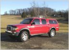 2001 DC Build and 2000 XC Tribute
AdventureTaco - turbodb's build and adventures
Discussion in '1st Gen. Builds (1995-2004)' started by turbodb, Apr 4, 2017.
Page 240 of 281
Page 240 of 281
Products Discussed in


