

-
Welcome to Tacoma World!
You are currently viewing as a guest! To get full-access, you need to register for a FREE account.
As a registered member, you’ll be able to:- Participate in all Tacoma discussion topics
- Communicate privately with other Tacoma owners from around the world
- Post your own photos in our Members Gallery
- Access all special features of the site
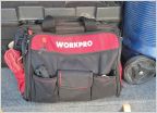 Show Me Your Toolbags!
 Fun Trails to do at night?
 Stock TRD level trails near Shaver Lake CA
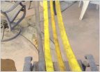 ? on choosing a snatch strap
 Bakerla does Ouray 2013
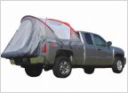 Truck Tent Advice?
Help plan my road trip? Tips appreciated!
Discussion in 'Off-Roading & Trails' started by Pinatacoma, Mar 8, 2024.


