-
Welcome to Tacoma World!
You are currently viewing as a guest! To get full-access, you need to register for a FREE account.
As a registered member, you’ll be able to:- Participate in all Tacoma discussion topics
- Communicate privately with other Tacoma owners from around the world
- Post your own photos in our Members Gallery
- Access all special features of the site
 Gears and Lockers
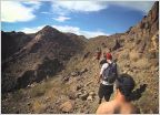 Joshua Tree Labor Day Weekend Exploring
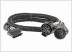 [Pomona or Upland] Need help connecting reverse light to tailgate light bar
 Help with So. Cal Camping Recommendations
 Good brick and mortar locksmith in OC
This trail beckoned like the road less traveled!!!
Discussion in 'Southern California' started by Topanga Taco, May 8, 2024.