1. Welcome to Tacoma World!

    You are currently viewing as a guest! To get full-access, you need to register for a FREE account.

    As a registered member, you’ll be able to:
    • Participate in all Tacoma discussion topics
    • Communicate privately with other Tacoma owners from around the world
    • Post your own photos in our Members Gallery
    • Access all special features of the site

2017 BAJA EXPEDITION #3, Mexicali-San Felipe; Blue Palm Canyons; Chapala to San Quintin

Discussion in 'Trip Reports' started by David K, Mar 10, 2017.

  1. Mar 10, 2017 at 4:49 PM
    #1
    David K

    David K [OP] Well-Known Member

    Joined:
    Jun 27, 2009
    Member:
    #18969
    Messages:
    12,356
    Gender:
    Male
    Pala Mesa, California
    Vehicle:
    2010 4WD Off Road DC
    Differential Breather Mod Light Bar: 4 Cree LED lamps Bilstein 5100s Ride Rite Air Bags
    March 2-8 (Thu-Wed) of this week and last week was my third week (or longer) expedition to research roads, campos, and points of interest for travelers. Most places are 2WD accessible, but I also include places suitable to the Off Road TRD 4x4 Tacoma!

    I initially post on the Baja Nomad forums (where many members are Tacoma owners and are members here, too)... However, I want the rest of the Tacoma driving world to know how fun (and safe) it is to travel, camp and off road in Baja California, Mexico. A place I have been camping and four wheeling in for over 50 years, and on my own since I turned 16 back in the 70's!

    I am making posts with photos for each of the 7 days. So, if they are not all here when you look, just come back later!

    2017 Baja Expeditions: Project Outline

    To bring everyone up-to-speed:

    In 2017, I have begun to retravel roads from my past and travel roads I have not yet been on. Here are the regions of info gathering done to date:

    Trip 1, New Years 2017: SanFelipe to Punta San Francisquito
    Trip 2, Feb. 2017: San Ignacio to Loreto area + San Javier, Comondu, La Purisima, San Borja.
    Trip 3, March 2017: Mexicali to San Felipe, San Pedro Martir canyons, Laguna Chapala north to San Quintin.

    All this to document the conditions and report on places Baja travelers may enjoy seeing or staying at. The data (which includes location GPS, photos, observed conditions, history, etc.) will be available online via a "living map" as well as printable versions that would be a road log. That is all yet to be determined based on the requests we get.

    The Baja Almanac is still the best all-road map, even though it is almost 8 years old. The AAA map was last reprinted in 2010 and the only new data was gathered from the three maps of 2003, 2004, and 2007.

    Traveling to and throughout Baja is what we all like. But, so many of us find a spot.... and then keep going to that same spot! Guidebooks and maps give us a hint of what's over that hill or across that salt flat and can open up new areas of fun and potentially provide economic growth to locals. I have many Baja friends and one thing we all share is an interest in exploring. We know a road on a map is just a line, or a photo is just a hint, and words can never fully describe how each of us will react to any one location. Guidebooks and maps do not spoil the thrill or take away the personal discovery one has. If you just don't want any clue about where a road goes, simple... don't read my trip report or get the map-guide!

    To travel that line on a map and experience that road is as much fun for some as where the road ends up going. Baja is a land of many roads... and they all go somewhere! Most of the time, they go somewhere interesting and fun.

    Trip reports here on Baja Nomad are the greatest, and often a most important feature to all Baja travelers. However, searching for a trip report to the area you want to read about is not easy for many. The same question is asked, that may have been answered a couple days earlier.

    My sharing my trips here on Nomad creates feedback if: the road changed, or the restaurant got a new cook, or I missed a nice beach because the tide was too high, and so on! Now, with this new data, we can update the map-guide to everyone's benefit. If you don't need the guide, then don't look at it, but just remember a guide of some sort was how ALL of us learned about Baja or got us to go there. The "guide" may have been a story from a friend, an article in a magazine, or a book... maybe your mom or dad dragged you there as a kid, and you became addicted to this magic peninsula?

    Hank and Geoff of Baja Bound Insurance (as well as their staff) have agreed with me about a need for an updated map/guide. Hank and I talked about the idea over 15 years ago. Now, with the technology and Internet expertise available we are creating a map that will have hundreds of waypoints that can be clicked on, and that will open up info about that place. It may include photos and comments. Being online, this "living map" can be updated as conditions change or data needs correcting. All of you can contribute to keeping the information fresh and accurate.

    A road log is being created that utilized kilometer markers (where possible) to easily find a turnoff, taco stand, or motel. This way, the doing math with your odometer to find a point is reduced, as well as the issue of odometers not all reading the same, especially when we put on oversize tires!

    Before your trip, just print the part of the road log you need or the map area. The possibility of publishing (printing) these, is always an option. Let's see how things progress. I look forward to your positive feedback and constructive criticism to make this a more beneficial project for both travelers who are "Baja Bound" and for the people who live and work in Baja California.

    This next report will be of trip #3 for this project. This year, so far, I have travel 4,000 miles for information gathering for the Baja Bound Map-Guide. It won't cover all roads in Baja or all the great places, there are just too many! I do hope to travel all the roads that go to places that sound or are known to be interesting or special.

    A few roads will require four-wheel drive, off-road driving skill, or deflating tires for improved traction. They will be listed as 4WD only or 4WD recommended. Naturally, some of us can get into places with 2WD that others wouldn't attempt or don't mind spinning tires or some rock damage. My job is to report and you can decide to go or not. As most of you know, I use a 4 door Tacoma 4WD truck that is almost stock. Just a small lift and 1" taller than stock tires. I travel alone, so I won't take a road that could require a buddy along to spot my tire placement or pull free from a rock high center (hopefully).

    A few places included will be for hikers, but not far if you have 4WD. Now, a message for the special group here who like to surf: I personally won't be listing anybody's surf location recommendations or directing people to the surfing breaks. There are already maps and surfing guidebooks that do that.

    OKAY AMIGOS?

    FOLLOW ME TO BAJA!

    IMG_5603_eb5ca04d528153ec1a447296e685f050c0c5966b.jpg


    Trip 3 photos and notes coming next!
     
    grdgz97, Chefjuan09 and Spintly like this.
  2. Mar 10, 2017 at 4:50 PM
    #2
    David K

    David K [OP] Well-Known Member

    Joined:
    Jun 27, 2009
    Member:
    #18969
    Messages:
    12,356
    Gender:
    Male
    Pala Mesa, California
    Vehicle:
    2010 4WD Off Road DC
    Differential Breather Mod Light Bar: 4 Cree LED lamps Bilstein 5100s Ride Rite Air Bags
    Thursday March 2, 2017

    Bought pesos for the trip at the money exchange in Calexico in the Auto Zone parking lot. The exchange today was 18.80 pesos per dollar. It was 20.20 last month and 20.00 the month before.

    Crossed into Mexico at the downtown Mexicali border. Purchased a new 180-day FMM tourist card for 500 pesos. Confirmed with the INM officer that it was good for multiple trips and that it did not need to be returned to INM when leaving Mexico.

    Noted mileages and kilometer markers on Hwy. 5 to San Felipe. GPS spotted Pemex stations (outside of the city), campgrounds, and points of interest.

    The following are just my notes and not embellished or how they will appear in the final publication.

    Km. 0 is at the San Luis Rio Colorado (Hwy. 2) split from Hwy. 5, 4.9 miles from the border. This is where you cross the railroad tracks a final time.

    Km. 8 is the Toll Road (2-D) to Tecate exit.

    Km. 23 the highway is west from the volcano, Cerro Prieto.

    Km. 38 is the Hwy. 4 junction (access to El Golfo de Santa Clara).

    Km. 48.5 is the north access to Campo Mosqueda on the Rio Hardy river (3.3 miles)

    Km. 49 is a graded, but rough road west over the mountain to Laguna Salada and an abandoned Sulfur Mine (7 mi., take right fork at mi. 3.7).

    Km. 53.5 is south access to Campo Mosqueda (1.3 mi.). It passes two other campos going in.

    Km. 55+ Campo El Mayor

    Km. 74+ Failed canal from the 1980s made to fill Laguna Salada.

    Km. 86.5+ Ejido Saldaña road, right.

    Km. 105 La Ventana, store, rest area.

    Km. 126 La Fortuna Gold Mine entrance.

    Km. 136+ El Chinero, historic hill.

    Km. 140.5 Hwy. 3 junction.

    Km. 141.5 Military Checkpoint

    Km. 160 Begin 4 lane highway.

    Km. 171.5 Villas Cortez (2.4 mi.). Palapas, pool, nice looking! But, no in-vehicle camping (RVs or out of your truck). You must unload at a turnaround loading spot, carry your things across the sand 100 feet to a palapa, then park your vehicle even further away, behind a building (out-of-sight).

    Three camp signs follow, but are either chained up or are not for camping, just lot leasing: San Marino, Don Abel, Campo Amigos.

    Km. 173.5 Playa Grande (1.9 mi.) Palapa camping.

    I am running out of daylight, the wind is blowing too hard to have a nice camping night, so I get a room at the Hotel Diamante (Km. 185.5) for 480 pesos. Next time, I will try the Blue Sky... which is just a bit north.

    I go into San Felipe, get some fish tacos and Pacificos, and all is good.

    Tomorrow, I will cover the San Felipe to Pete's Camp to Playa Grande campos.

    Here are the DAY 1 Thursday photos:
    I will add captions later and answer any questions.

    Sulfur Mine:

    IMG_5408_483accd7e76a1fc1c72e0b0c8809e9f8107be0bc.jpg

    IMG_5410_313bd1448b6017ab33253d0b6158fa09d993720e.jpg

    IMG_5412_c22d3c014b9258cc9d5e6b20bb7ec6a5d662c130.jpg

    IMG_5414_f527363c1e2efb428a8b541a7880fe23f5c88ae3.jpg

    Campo Mosqueda:

    IMG_5417_8d199d161a8974150d0c450b6ba7516b70be3681.jpg

    IMG_5418_29c89056e18ff81f7f1f2d17f7ad14f57d0998c5.jpg

    IMG_5419_37031a0d6c4dace3741998e677d36df820ccaee7.jpg

    IMG_5420_4555481fc311a9628f97c23333eeb5f05f23a816.jpg

    Playa Grande:

    IMG_5421_37abd4b2258047ec40c807d6d2c3fb232eda55b7.jpg

    IMG_5422_59c4caa57500e8999a5308c4c1a776461ef4c88d.jpg

    IMG_5423_c76e5f44129431fc3a6a6872ecaed8460b547068.jpg

    Villas Cortez (as close as you can drive to palapas to unload):

    IMG_5424_1381a5869cb9f0d30561fb338b54c127e4d63d73.jpg

    More coming. Stay tuned for Day 2, Friday...
     
    Last edited: Feb 14, 2019
    Chefjuan09 and Spintly like this.
  3. Mar 10, 2017 at 4:51 PM
    #3
    David K

    David K [OP] Well-Known Member

    Joined:
    Jun 27, 2009
    Member:
    #18969
    Messages:
    12,356
    Gender:
    Male
    Pala Mesa, California
    Vehicle:
    2010 4WD Off Road DC
    Differential Breather Mod Light Bar: 4 Cree LED lamps Bilstein 5100s Ride Rite Air Bags
    OK, so you may have caught my comment about the Hotel Diamante in that next time I will go to the Blue Sky motel, just north on the same side of the highway.

    When I got to the hotel, after dinner, Thursday night... I was the only customer, I think... I asked for a quiet room as I was pretty tired from the day's long drive and research. I got the next to the last room, way down in the far corner of the back building courtyard. Nice! It was a simple room, had Spanish only TV, but the bed was fine.

    After I was in bed, a car pulled up (a couple) and went into the room RIGHT next door, the corner room. Then their TV goes on, etc. etc. The whole complex is empty so the lady at the front desk puts client #2 next door.

    Wait, it gets better...

    About 10 pm (and I want to be asleep), 2 more cars pull up next to my truck, they go upstairs, and in the room right above mine goes a family with small kids who begin to stomp on the floor and run back and forth above my bed! Their friends in the room next door have a baby, which naturally cries. I look around the rest of the hotel rooms and parking and nobody else is there! I get dressed and go up the stairs to where the family inside the room with the doors open sees me and I ask them to please have their toddler stop running back and forth (at 10:30pm) so I can sleep.

    Thankfully, they do, and I get to sleep! The logic of the lady to jam all the guests into adjoining rooms and get happy returning customers does escape me!

    Next time Blue Sky (if it is too windy to camp)! I later that day, met a couple at breakfast who were staying there, and they seemed to like the Blue Sky.
    -----------------------------------------------------------------------------------------------------------------
    Friday March 3, 2017 Day 2 of 7

    OK Friday Morning... I drive south from the Hotel Diamante to the entrance arch of San Felipe to record all the campos that are actual camping places and other points of interest to travelers:

    So you understand my kilometer marker notes:
    If the point is right at or within visual sight of a kilometer marker, that will be what is given: Km. 179 (for example).

    If it is about 1/4 kilometer after then it will have a + sign added: Km. 180+ (for example).

    If it is approx. halfway between two markers, then a .5 is added: Km. 177.5 (for example).

    If 3/4 a kilometer after, then a + sign is added after the .5: Km. 181.5+ (for example).

    I am not sure if I will amend the notes for the plus sign to maybe .2 and .7 making sure we are all on the same page that this is approx. and could be a couple hundred feet + or - from the exact kilometer point.

    ROAD LOG NOTES (going north):
    Km. 189.5+ San Felipe Entrance Arches
    Km. 184+ Campo El Pescador (entrance closed)
    Km. 184 PEMEX (on west side)
    Km. 183 Playas del Sol (1.1 mi.) Palapas www.playasdelsol@live.com.mex is posted.
    Km. 182 Campo Ocotillos (not camping, lots for lease)
    Km. 181.5+ Pai Pai Campo (0.9 mi.) Beach only.
    Km. 181 Colonia Morelia (Valle Chico/ Agua Caliente/ Matomí access) Road. San Felipe Storage.
    Km. 180+ Campo Los Compadres (0.9 in) Many palapas overlooking beach or arroyo.
    Km. 179 Playa del Oro entrance. Road-Runner Restaurant/ Deli. GOOD FOOD! Had a nice breakfast here, many cars in front.
    Km. 178.5+ PEMEX STATION (on west side)
    Km. 177.5 Pete's Camp El Paraiso (1.0 mi. to restaurant, 1.1 to palapas)
    Km. 173.5 Playa Grande (see Day 1 post for details).

    From Highway 5, I take the Colonia Morelos Road (at Km. 181):

    There are kilometer posts on this road, but don't go the entire distance to Agua Caliente Canyon road.

    First, the beach campo photos taken Friday...

    Playas del Sol:
    IMG_5425_8766abc8f5ce13a488f1027216f5fd81cda86064.jpg

    IMG_5426_ad30e0ede7a74b803eb1a70e4f2614882da7aed9.jpg

    Campo Los Compadres:
    IMG_5427_04bdb0ee7767ea7e352f404bb955d23f9fbfb573.jpg

    Pete's Camp El Paraiso:
    IMG_5428_e19c699d9cc14a2eb687a329c8e251f5f0f0cdfd.jpg

    IMG_5429_8e2216abf9a558c2f10beee0230eeda93daba02a.jpg
     
    Last edited: Mar 12, 2017
    Chefjuan09 likes this.
  4. Mar 10, 2017 at 4:52 PM
    #4
    David K

    David K [OP] Well-Known Member

    Joined:
    Jun 27, 2009
    Member:
    #18969
    Messages:
    12,356
    Gender:
    Male
    Pala Mesa, California
    Vehicle:
    2010 4WD Off Road DC
    Differential Breather Mod Light Bar: 4 Cree LED lamps Bilstein 5100s Ride Rite Air Bags
    Colonia Morelia Road: Km. 181

    This road leaves Mex. 1 about 5 miles north of the San Felipe arches and is the replacement road for what was the new Zoo Road that now passes through the El Dorado Ranch residential zone. That road is at Km. 178.5 and is signed for residential use only.

    MILE:
    0.0 Highway 1 (Km. 181) Signed: Colonia Morelia 60 km.
    4.2 (Km. 7) Junction with Km. 178.5 private road.
    5.1 Junction with original Ensenada-San Felipe road (left goes to Km. 189+)
    12.5 Cattle Guard
    12.8 Major Fork: Right to Diablo Dry Lake/ Left to continue into Valle Chico.
    19.5 Unsigned road right (to Rancho El Cajon?).
    24.6 Rockpile at road to left.
    25.9 Cattle Guard
    26.0 (Km. 42) Road right to Arco de Triunfo, rehab facility.
    29.6 Cattle Guard
    31.5 Junction: Ahead to Rancho Algodon and old Valle Chico road on north. Left to continue south:
    36.4 Abandoned Farm Project, on left. (Linda Vista on some maps)
    37.2 (km. 60) where Colonia Morelia is supposed to be!
    38.2 Cattle Guard
    39.4 Enter abandoned farm ejido village (Plan Nacional Agrario/ Agua Caliente).
    39.6 Ranch house surrounded by fence and trees. Major fork here. To right side (north side) of ranch, the road goes west to Agua Caliente Canyon. To left, and stay along the east side fence of the ranch on the southbound road to continue south.

    A side trip to Agua Caliente Canyon, goes from the ranch, onto a former airstrip for the ejido, enters the canyon at Mile 2.0, passes a metal water tank at mile 2.2, Comes to a gate at Mile 2.4 (petroglyph viewing), and goes to Miles 2.6 mile where the road was washed out. A track has been blazed to the left that does continue but going solo I had to resist trying to get to the hot springs today!

    PHOTOS:

    IMG_5430_9380a5542e56b1cc18a9ca625328dd8fdf3fb69f.jpg
    Diablo Mountain.

    IMG_5431_bc91c4670591b838b8613c6eac29846bab5e1119.jpg
    Fork at Mile 12.8

    IMG_5432_611d967560312febf8c1d85e2c0479dd8a64bca7.jpg

    IMG_5433_c5baaf8a43b6cb0a03dd90587ac6ca7097a2dae5.jpg

    IMG_5434_cd4994d8e7afada5619b1c9581467d59a1f6810b.jpg
    Sign at Mile 26.0

    IMG_5435_8fbe83d9716284f906b57adb0d5a8490abd6d733.jpg

    IMG_5436_397ee70946d7894472a5b617fc8e742ed1f34509.jpg
    Ditched airport runway Plan Nacional Agrario (Agua Caliente Canyon road)

    IMG_5437_6c676e7e3d100d0f62cf90af257d34b606539969.jpg

    IMG_5447_7d30ce3e9e87306717d84044ca88228772cc2a8c.jpg
    Water Tank at Mile 2.2, looking east.

    IMG_5442_1c3a30d2f12c6a7c993f8bcaed4a1bbc85425f7f.jpg
    Gate at Mile 2.4 on Agua Caliente Road. Petroglyphs are across canyon to the south of here...

    IMG_5445_bd6c25143dcc432fbf2ef060b011c0c91171b23d.jpg
    SEE THEM?

    IMG_5444_bdcb5f4677e70eb371e5e586932ee96017a3b0bb.jpg
    HOW ABOUT NOW?

    IMG_5443_cbbd3dd95c1865bfac6c8e4e4b04796fa7309bf7.jpg
    MAX ZOOM! :light:

    OK, through the gate I go, hoping to get to the hot springs for a soak tonight!

    IMG_5439_3bfa3748a2d9d6b07f54db4a509ce8a3a74a60bc.jpg
    Agua Caliente Canyon stream... near end of road.

    IMG_5440_cbc01ce3fc8609b31ff8928414edeb69ad34c7a2.jpg
    Where road used to cross arroyo again.

    IMG_5441_dfda6e232051a7cd1f57b84da6db6fe10a7e7f23.jpg
    Looking back at the road, dead end!

    IMG_5446_d62944100bd67e90f7d1d10fa77a5d4f632b5fd3.jpg

    South from The Ranch in the former ejido village...

    IMG_5448_dc5746e631dfc0d19dad2f6626a67c030dfdc879.jpg

    Back at the Ranch (Mile 39.6 from Hwy. 5), reset odometer to 0.0 and head south:

    MILE:
    1.7 Corner of fenced area, road to left. Continue south.
    5.4 FORK. Matomí left, Berrendo straight. Going straight to Cañon Berrendo:
    5.5 Rancho Carricitos corral on right. Tracks go west towards Carrizo Canyon. Continue south.
    6.9 Track right to Berrendo. Ahead goes to Parral Canyon. Go right.
    9.3 End of drive. A fence and cable across the canyon is nearly covered with sand. The canyon just ahead of here is choked with boulders. No need to go further. I hike into the canyon a short distance. Running water and blue palms make this an attractive location. Blue palms also grow high up on the cliff side in the granite boulders.

    After my hike, I drove a short distance and make camp on the white sand arroyo. A great location!

    PHOTOS:

    IMG_5449_ff0fd4f15da26c843a6286b07e08523bbae267cb.jpg

    IMG_5450_e03dac6c40264f96a24bda0bdd3bd85a5c377091.jpg

    IMG_5451_86123ee333da1bd82e8f1f4b00c11d1363437da3.jpg

    IMG_5452_643dad8a259e9db0b44bfe1c3347162f36f7f724.jpg
    Cañon el Berrendo

    IMG_5453_04f36d86fd89c52e16cfec96a09003e84a589a00.jpg

    IMG_5454_4d35b55f3326af38ad3b54e9fdf682be87a829d7.jpg

    IMG_5455_0d68fa6dfc43fdea7fa80c1a33a42af383e7747f.jpg
    LOOK CLOSELY and see the blue palms way up there!

    IMG_5456_7c88a75c4357c9002e680652e6943c409def3d3e.jpg

    IMG_5457_43c70d5e5d0dd5d47c9192664555dc906cb364a9.jpg

    IMG_5458_b62453084e8451ce4f8d7cf1c992746747bf36e3.jpg

    IMG_5459_93548821fac44bece8a34c31a856cc6b95cb55d7.jpg

    IMG_5462_40c2b173d0fab16d31ead1934842d6bf7035b423.jpg

    IMG_5464_e7e3b6d7485ddfa2c1e7df27068eed7b3322933b.jpg

    IMG_5465_412e127c0f301755ab13442bc93f4785c025591f.jpg

    IMG_5467_50472a0aeaa621203509ebbb8658109fbaca16fb.jpg

    IMG_5469_2fc783062658481b22c1bbb450233c4aa468dcd1.jpg
    My camp location Friday night.

    IMG_5471_9ee88b1ef2616b235cb1d26352ad094b87380128.jpg

    I zoom in on the top of the canyon to look at the blue palms...

    IMG_5472_0f673881e1f19cb25a8f439b2b115a686b25ece1.jpg

    IMG_5473_feb7fab1b51f77249f5552ec05c8e93bff242388.jpg

    Campfire time:

    IMG_5472_0f673881e1f19cb25a8f439b2b115a686b25ece1.jpg

    IMG_5478_d09a74c2ad5d020f38834c9f0993097e48188d03.jpg

    Goodnight from a very special (like so many others) Baja place!

    SATURDAY, DAY 3, coming up next!
     
  5. Mar 10, 2017 at 4:55 PM
    #5
    David K

    David K [OP] Well-Known Member

    Joined:
    Jun 27, 2009
    Member:
    #18969
    Messages:
    12,356
    Gender:
    Male
    Pala Mesa, California
    Vehicle:
    2010 4WD Off Road DC
    Differential Breather Mod Light Bar: 4 Cree LED lamps Bilstein 5100s Ride Rite Air Bags
    Berrendo20Track_a9c049be1a60c3917e0459c72e9d7178b91c7c12.jpg

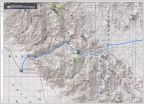
    Map showing Berrendo, Matomí, Azufre Wash routes Day 3 and 4... Mileages between roads and end of drive points.
     
    Spintly likes this.
  6. Mar 10, 2017 at 4:59 PM
    #6
    Spintly

    Spintly Well-Known Member

    Joined:
    Mar 2, 2014
    Member:
    #124416
    Messages:
    780
    Gender:
    Male
    First Name:
    Greg
    Home of the Groundhog
    Vehicle:
    85 Single Cab Pickup & 2000 911
    Great write up. Definitely want to hit baja within the next 5 years.
     
    David K[OP] likes this.
  7. Mar 10, 2017 at 4:59 PM
    #7
    David K

    David K [OP] Well-Known Member

    Joined:
    Jun 27, 2009
    Member:
    #18969
    Messages:
    12,356
    Gender:
    Male
    Pala Mesa, California
    Vehicle:
    2010 4WD Off Road DC
    Differential Breather Mod Light Bar: 4 Cree LED lamps Bilstein 5100s Ride Rite Air Bags
    For those unfamiliar with the 750-mile long peninsula:

    afb4788f-0a5b-4681-9294-18c27d1d15c1_76be13e7754a4d50087faeb55a9e95a07144b301.jpg
     
    Rakso likes this.
  8. Mar 11, 2017 at 12:37 PM
    #8
    David K

    David K [OP] Well-Known Member

    Joined:
    Jun 27, 2009
    Member:
    #18969
    Messages:
    12,356
    Gender:
    Male
    Pala Mesa, California
    Vehicle:
    2010 4WD Off Road DC
    Differential Breather Mod Light Bar: 4 Cree LED lamps Bilstein 5100s Ride Rite Air Bags
    Saturday March 4, 2017: TO MATOMI CANYON

    Matomí is one of those special places in Baja to many.
    It is one of the few arroyos that has been used as a travel corridor into the mountains over 30 miles long.

    In the 1962 edition of the Lower California Guidebook, it mentions that four-wheel-drive vehicles may follow Arroyo Matomí for a considerable distance. Arnold, owner of the Del Mar Café in San Felipe told my parents about a waterfall fed pool in an oasis at the far end of Arroyo Matomí. That was in 1967... He even drew notes in our Lower California Guidebook to show it.

    I was hooked on getting to Matomí since I was 9 years old! I finally did, but not until I had my own 4WD vehicle and was 21 years old (December of 1978), but I could not get to the waterfall as the river (flash flood) was flowing. I returned 6 months later and got there! I have been back to Matomí several more times, but the last was in 2006.

    Saturday morning, Cañon El Berrendo, 7:53 am.

    I had a great night's sleep and was up to enjoy the silence of the canyon broken only by the sounds of birds beginning their day. Made a fire to sit by while having breakfast. Soon enough, I had camp packed and loaded onto my Tacoma and was driving down the white sand arroyo to my next goal.

    It was almost 4 miles to get back to the Valle Chico-Matomí road (by Rancho Carricitos).
    Reset odometer to 0.0 at Matomí/Berrendo junction.
    Road Mile
    2.7 Corner of fenced area, fenceline road goes left (north).
    2.8 Fork, the well-worn road goes left (and I assume this to be the Azufre Wash route, so I go right. However, after a mile going south (and a text message from StuckSucks on the inReach satellite device) I turn back and go back to Mile 2.8 and take the left fork.
    3.1 Azufre Wash (Cañada el Parral) road, along fence, heads east across the valley. This goes 23 miles to the old Puertecitos road, just south of the Sulfur (Azufre) Mine.
    The Matomí bound road now begins over four miserable miles of cross-grain and moguls (whoops) driving.
    7.6 Cattle Guard, new fence.
    10.8 Top of Matomí Canyon ridge. Road begins steep descent to arroyo floor.
    11.1 Arroyo Matomí. Main traffic went left 29 miles to Hwy. 5 (but blocked to most vehicles in only 2.8 miles, now). Rancho Matomí (and the waterfall) is 5 miles to the right... very difficult driving and has not been used recently.

    PHOTOS:
    IMG_5479_4719c88a8663cbc1e0ccfbddcf49952ad0a4d5a2.jpg
    Bye bye Berrendo!

    IMG_5480_617a36ae0ba6531ecde2acad340721696059727c.jpg

    IMG_5482_bcdd07aab1ddbe2c1ca4d9ce4aa42b1a355eb807.jpg

    IMG_5486_da0420787fe4745e9167352a7043b12ea3477b41.jpg

    IMG_5488_10e30edd5e09a9c0f303da9bfb5969e4036378a7.jpg

    IMG_5489_800acaf20f88b5425f505621667a303cb47a41a9.jpg
    Top of Matomí Canyon entrance grade/ south end of Valle Chico.

    IMG_5490_987c84855befb2a2914cd6ca70396cd6a534bdf4.jpg
    First Matomí palm.

    IMG_5491_72b55fef902009feebedddbaff75b1b911aa1fc0.jpg

    IMG_5493_a243260131ac847f35f89f712634357d325992e8.jpg
    Abandoned (or unoccupied) Rancho Matomí.
    The oasis waterfall fed pool is down a path from east of the house.

    IMG_5496_830f52f13ca0eb757239d028f8158272d111376d.jpg

    IMG_5497_3fc39aa87ac11a848f8f1cf6759143d349398f0f.jpg

    IMG_5500_eaa6372c73e8aedf0b3d38bd515f3ef1d3e5c795.jpg
    From above.

    IMG_5501_fbd1fa7f754af42cd88c602970e28f6b0e9908d4.jpg
    The arroyo west from the waterfall.

    Looking into the ranch house:
    IMG_5506_b5fd806e24043fd05d6e33c9086dd7b6e3a8d24b.jpg

    IMG_5507_23ac653222c1558cf8c55149d66a09c32de37faf.jpg

    IMG_5508_cc3de25c0dc423e3f20990d7660325c247859d39.jpg

    Time to leave, 11:41 am.

    Where a flash flood almost took my Subaru in 1978!
    IMG_5509_be0468348adaf056968acd0eb096f17316daa0c6.jpg

    [​IMG]

    The goal for me was to go see the natural arch, 9 miles on a side wash south from Arroyo Matomí, and eventually be on the Puertecitos highway.

    IMG_5511_8788f53f632ab59fc2f6a82551786c33c55211fb.jpg
    The first narrow pass heading east.

    IMG_5512_7aa88a242b55642da4f1a2764421105aeda9d6ef.jpg
    When vehicle tracks end and only motorcycle tracks are seen, I begin to get concerned, but remain hopeful!

    IMG_5513_8d6f2a8eee1805b620c98f7f2d7802f5731e0229.jpg

    IMG_5514_4f435722ab94aa39b5d5b187a322021cb5338a4f.jpg

    IMG_5515_16c2400cca122348936a8b4c55f8f710a7bd1c8a.jpg
    DAMN!

    I walk ahead to see if there is any chance if I make a ramp to clear the first block, to have a clear path...

    IMG_5516_570da67a4adfee0ea39816ea4e6419b7c0160d7a.jpg
    Looking back to where I parked, I head to the Matomí Squeeze (narrows).

    IMG_5517_db764d0bb5a338ab4825cd6f696017b55ee4e48b.jpg
    It doesn't get better.

    IMG_5518_78477f611baca4cc50a5a949cee74d1728575259.jpg
    The sand level at the squeeze is also a few feet lower than my last time driving through here, making the gap narrower.

    IMG_5519_1dfdfb58c32eb690564096bfe590ba6725b1e093.jpg
    Looking back to the rock garden from the east side of the squeeze.

    BUMMER!

    I drive back to the steep grade out of the canyon to Valle Chico...

    IMG_5520_3bcfcf8defbc3d7221056fac85e786b9c9792f62.jpg
    This is pretty steep with a ledge. Lockers or traction control here to prevent tire spin and further road damage.

    My revised goal is now to use Cañada el Parral (Azufre Wash/ Crazy Horse Canyon) to cross over to the Puertecitos road. I will revisit the sulfur mine, as well.

    STAY TUNED! More coming...
     
    Rakso and Chefjuan09 like this.
  9. Mar 11, 2017 at 2:36 PM
    #9
    David K

    David K [OP] Well-Known Member

    Joined:
    Jun 27, 2009
    Member:
    #18969
    Messages:
    12,356
    Gender:
    Male
    Pala Mesa, California
    Vehicle:
    2010 4WD Off Road DC
    Differential Breather Mod Light Bar: 4 Cree LED lamps Bilstein 5100s Ride Rite Air Bags
    Saturday: Matomí to Azufre Wash

    IMG_5521_9ac04172e6c60a9f3198421e7afe5aff04f3b121.jpg
    Here's Mount Diablo (Baja's highest mountain, 10, 154') from the south end of Valle Chico.

    So, those 4 miles of moguls are seriously annoying... but without an exit through the Matomí narrows, I have no other choice.

    8 miles from Arroyo Matomí I arrive at the cross-valley fence line which is the route into Cañada el Parral (what SCORE calls Azufre Wash and Bruce Barber calls Crazy Horse Canyon, in his book "Of Sea and Sand").

    IMG_5522_dd8bad2f3603e4c5a6543c5893d3919c3eb59ab7.jpg
    Looking East

    It is over 4 miles to the other side of the valley.

    IMG_5523_8fb799d7cf06630bcc1f39e03ed85cb15927737e.jpg
    Looking back west.

    IMG_5524_42694a34c4618e0426b15ecf88c44f61864134b8.jpg
    Some nice cardón catus trees in the pass.

    The high point of the pass through the hills is 6 miles from the Matomí road, elevation 2,270'. The pass or canyon is a very gentle drop from Valle Chico to the Sulfur Mine area.

    IMG_5525_3180e8421a14dac8678c6f1afd455d547d453cc8.jpg
    A cardón after it dies.

    IMG_5526_be0a8cf42549c4af60bba4d8167fbe87af9af8e4.jpg
    Neat geology!

    IMG_5527_ce0ea5d4dc98b0e05dedf67cb0bc27e2cd3f5f89.jpg

    IMG_5528_11a2cea3a2fdfe40965e0c463318040a591ddc4d.jpg

    IMG_5529_9cf5c2362e129216705bbb2adf39eb55c43e20da.jpg
    While there are some moguls near the west end of Azufre Wash, it is mostly easy driving.

    IMG_5530_3b98b681a9f571662923816ffd3519b51e89d60f.jpg

    IMG_5531_6f51e53da0e806751ef795aaa9a92dbffda1ad04.jpg
    I make camp at Mile 15.0 from the Matomí road.

    The evening is warmer than it was at Berrendo, as I am closer to the sea and lower in elevation. There are a few mosquitos at sundown. I have Deet!

    This is my 3rd night away from home and second-night tent camping. I enjoy texting with my wife and with a few Nomad friends as I have a nice campfire. An old pallet was nearby, and that helped me pick this spot.

    So, it was windy anytime I was not in a narrow part of the canyon, and the desert was in bloom... I am getting a case of allergy or a cold. Both act the same on me. I send an email to Baja Cactus Motel and Antonio answers, he will be there the next night. Great, I want to bring him up to speed on this new Baja Bound project, give him a couple more books he can sell to raise money for his emergency rescue service and have a comfortable place to sleep and have hot showers.

    Good Night from Azufre Wash!

    Azufre20Wash20Track_5e24793d415397c1ccf446093bdf07f4fb434133.jpg
     
    IronPeak likes this.
  10. Mar 11, 2017 at 4:57 PM
    #10
    David K

    David K [OP] Well-Known Member

    Joined:
    Jun 27, 2009
    Member:
    #18969
    Messages:
    12,356
    Gender:
    Male
    Pala Mesa, California
    Vehicle:
    2010 4WD Off Road DC
    Differential Breather Mod Light Bar: 4 Cree LED lamps Bilstein 5100s Ride Rite Air Bags
    Sunday March 5, 2017 Sulfur Mine, La Poma Lunch, and on to Hwy. 1.

    I was packed up and rolling at 8:43 am.

    Soon, I came to the folding rock layers I have photographed since my first time through Cañada el Parral (1978).

    IMG_5532_14bcf41883550c1c73d601c79817928b7a3487fc.jpg
    2017

    [​IMG]
    2006

    [​IMG]
    GeoRock explains on our 2004 Matomí tour.

    [​IMG]
    Jim Todd, a traveling friend. 1978

    IMG_5533_354360d13138fa28b256d651bbe4ca9e17b0c5ae.jpg
    The desert is in color.

    Just when I thought I was home free...

    IMG_5534_52490d5ebe963a7c12ffe7b66c195786fc3ae157.jpg

    There was no way around the tree, in the road. Quad tracks on the other side made a U-turn. It had to be dealt with!

    IMG_5535_c8ed276cd9caf249ad309e18566f6ac639bdcb3d.jpg
    Done!

    I reach the old Puertecitos road 23.3 miles from the Valle Chico-Matomí road and turn left (north) to visit the Sulfur Mine. A major landmark before the newer road was built in 1982, that stayed closer to the coast.

    IMG_5536_8f1248de400badff976673ef03d0ecfc83863f60.jpg

    From the Azufre Wash junction, going north:
    Mile 1.3 cross old airstrip runway and later road to Campo La Roca (joins Nuevo Mazatlan road in a mile)
    Mile 1.7 Nuevo Mazatlan road (4 miles to Hwy. 5 at almost Km. 32)
    Mile 1.9 Sulfur Mine area... about a half mile all around from here was mined for sulfur.

    IMG_5537_c2783d8125187fcf256ac518a6c2954fdbc67d80.jpg

    IMG_5538_c3c01475fdff2b9ce2cced54ed352b0f543113a3.jpg

    IMG_5539_f6fa73515afa2e6ba6386f530b3f991e8f90c4ae.jpg
    Sulfur was mined here to the 1950s. Before 1956, the sulfur mine and Agua de Chale (Nuevo Mazatlan now) was the end of the automobile road from San Felipe.

    IMG_5540_ed1e8be2770699a5bd5f792ecbda4bcb890730fd.jpg

    IMG_5541_28d7900defc20fe29e4faefec2b42354e9144a76.jpg

    IMG_5542_ae9db1a9f38b21716dd19cf446371115dcc8caab.jpg

    763e9972-4863-4aea-b863-c0c2d39cd75c_d5f67cc42b551617ee2cb193e321c3c42938b8f5.jpg
    Sulfur is used to make gunpowder, matches, fertilizer, and is a rock that burns when ignited with a match and emits a deadly gas. So no campfires here!

    f9238557-e696-496c-95e0-bdd59640b86c_ee1d02dbdcb66e95fc447b02636ada296c486b48.jpg

    From the sulfur mine, take the road east towards Nuevo Mazatlán (Km. 32).

    When I reach the highway near Km. 32, I bring my tires back up to 34 psi from 24 psi, which worked great at off-road traction and rock-puncture resistance.

    I was under a half tank of fuel and debated to drive the 25 miles north to San Felipe or take a chance on the Pemex being open in Puertecitos or Gonzaga. In Baja, everything works out, so I turned south.

    At Colonia Delicias market (Km. 36) I got some bags of ice a few cans of beer.

    At Puertecitos (turn off the highway at the paved fork, at Km. 74.5) I got gasoline. The attendant says they are open every day to 8 pm. It was 700 pesos for 43.4 liters. I had traveled 156 miles since filling up in San Felipe, with most of that off road driving, maybe 50 miles in 4WD.

    Leaving the gas station via the old road I took this photo of Puertecitos (at low tide):

    IMG_5546_af732408854234d71d97b98b10b05baeeef612a5.jpg

    The paved road is rejoined at Km. 76.5+, at the Pez (Fish) Market.

    Km. 133.5 is the road to La Poma, restaurant, camping palapas, lots for lease. Camping is $10 US and the owner will add the tarp to the frame when you arrive. Good idea to preserve the life of the tarps.

    IMG_5547_a6ab9023a71b53e9315f717a1f5b954fbfcd93e5.jpg

    IMG_5549_08f3f6379524ade43bbd27894c4e7652d4655d59.jpg

    IMG_5551_0856d0e0222846c2cbd6c78741e47d05f43905a2.jpg

    IMG_5553_96ed755d33727fd9664d4dad7816d14c3dd26097.jpg

    IMG_5550_1e9a0e4a0a7877b7d12b0767203d5fdd9763d94e.jpg

    IMG_5552_1ca364ff1af8c430277d62fc19f13f3c79bfbddf.jpg
    My lunch was great... halibut! With beer + tip, 300 pesos

    I was at La Poma from 11:30-12:37 Sunday. The only customer.
    The owner is the brother of the owner of Punta Bufeo, which has a small motel and landing strip for pilots... 2 kilometers south. They are related to Papa Fernandez, as well.

    From here I drive south to Hwy. 1 then north to El Rosario and a bit of heaven at Baja Cactus Motel. Details in my next installment... Stay tuned!
     
    Last edited: Mar 11, 2017
    IronPeak and Chefjuan09 like this.
  11. Mar 11, 2017 at 7:16 PM
    #11
    Chefjuan09

    Chefjuan09 Well-Known Member

    Joined:
    Jan 20, 2017
    Member:
    #208152
    Messages:
    110
    Gender:
    Male
    First Name:
    Juan
    Love all that your documenting and the fotos... keep them coming. I plan on making trip like that down that way very soon!
     
    David K[QUOTED][OP] likes this.
  12. Mar 11, 2017 at 7:39 PM
    #12
    David K

    David K [OP] Well-Known Member

    Joined:
    Jun 27, 2009
    Member:
    #18969
    Messages:
    12,356
    Gender:
    Male
    Pala Mesa, California
    Vehicle:
    2010 4WD Off Road DC
    Differential Breather Mod Light Bar: 4 Cree LED lamps Bilstein 5100s Ride Rite Air Bags
    You bet, more of the 7 day trip coming!
     
    Chefjuan09 likes this.
  13. Mar 12, 2017 at 7:47 AM
    #13
    natas1321

    natas1321 mischief monkey

    Joined:
    Apr 4, 2015
    Member:
    #152467
    Messages:
    990
    Gender:
    Male
    First Name:
    natas
    san antonio
    Vehicle:
    1990 Honda NC30 stock for now
  14. Mar 12, 2017 at 8:10 AM
    #14
    shawnMc

    shawnMc Well-Known Member

    Joined:
    Sep 25, 2015
    Member:
    #165143
    Messages:
    237
    Gender:
    Male
    First Name:
    Shawn
    Santa Barbara
    Vehicle:
    2009 Tacoma regular cab 4x4
    Awesome. Thanks
     
  15. Mar 12, 2017 at 10:46 AM
    #15
    David K

    David K [OP] Well-Known Member

    Joined:
    Jun 27, 2009
    Member:
    #18969
    Messages:
    12,356
    Gender:
    Male
    Pala Mesa, California
    Vehicle:
    2010 4WD Off Road DC
    Differential Breather Mod Light Bar: 4 Cree LED lamps Bilstein 5100s Ride Rite Air Bags
    Sunday Afternoon: Gonzaga to El Rosario

    Just like last month, last year, all of 2105, and back to January 2014, the paved road driving still ends 20.5 kilometers (12.7 miles) south of the Gonzaga Pemex and that is about 10 miles (10.2) north of Coco's Corner and another 12.9 miles to Hwy. 1 for 23 total unpaved miles.

    The unpaved condition was improved over February in that the rocky 4 miles just south of Coco's had been scraped over by a grader. It was just less than an hour from Gonzaga Bay to Highway 1 (Laguna Chapala) in my Tacoma.

    Highway 1 from Chapala to Cataviña/ Santa Ynez has a lot of potholes to dodge currently. One road crew was a couple miles south of Santa Ynez shoveling black top into the holes. Without a roller, this will be a short-lived solution.

    70a77ce6-4deb-49ce-aecc-72a65af2d868_8bffb1b1fd36c31b331bc70c87481dbc58481d1f.jpg

    I take a photo of El Pedregoso, the boulder mountain midway between Chapala and Cataviña. It is passed at Km. 210.


    At Km. 191.5, and across the highway from the new San Ignacito restaurant, is the monument to the meeting of construction crews, in September 1973, building the transpeninsular highway. Crews going south from San Quintin and crews coming north from San Ignacio met at this point. The official plaque that was on this concrete monument was stolen some time ago. The memory is preserved by this sign the new restaurant owner made, he only got the year of the plaque dedication wrong.

    IMG_5555_4ea466890976e03339fba9ff89ac6ae131a67e84.jpg

    The original plaque of Oct. 17, 1973:

    SanIgnacitoPlaque_afbf6c0f233e404a8fb57e1bf7b6d8ebdc12ef98.jpg

    It's 32 miles from Laguna Chapala (Km. 233+) to the side road for Rancho Santa Ynez/Inez/Inés just after Km. 181. It is 0.7 mi. to the campground and ranch/ restaurant of Santa Inez/Ynez/Inés (spelling depends on what sign you read). The road to the ranch was paved in 1973 as was the airport runway here. The driveway is lined with white painted rocks. Wide open camping is popular here and Matilda's cooking was always a treat at the restaurant. The pavement is mostly gone now. Santa Ynez was a major checkpoint of the first several Baja off-road races (1967-1973) and occasionally of some of the newer ones when the course runs this way.

    IMG_5556_840ccda7929f7472df8b71f1c55c3f9ef83fe113.jpg

    IMG_5557_f8c2a9a91b05cbaa2925bbcd03eb04ff1011bbf6.jpg

    IMG_5558_97cc3a508e731142a997cafebd02c4478142cf95.jpg

    IMG_5559_9baf253498c953ffdd2a944f23d3932bc34971f3.jpg

    The place (Ranch, Restaurant, Bunk rooms) looked all closed up. A couple was walking from their camper towards the restaurant when I asked them if it was ever open while they were there. They said it was always open and good... to which I had to say it was closed now.

    Back out to Highway 1...
    The south arroyo crossing is being worked on, and was dry this day.

    Enter Cataviña, a town that didn't exist before 1974. Here, a hotel (now called the Misión Cataviña) and a 'parador' (across the highway) was built to service the needs of highway travelers were nothing much existed before. A Pemex station, cafeteria, showers, sunken room air conditioned rest area and an RV Park nearby were all part of the parador complex. Other than the hotel, all the rest of it has been abandoned.

    At Km. 179+, a local began to bring cans of gasoline from El Rosario to sell here, and that continues to this day. The cost currently is US$5 per gallon. That $1.75 additional price over Pemex's price covers the businessman's time and effort to make a 150-mile round-trip to bring gasoline to this spot.

    At Km. 179 is the Cabañas Linda motel. Reviews in years past have not been kind.

    Leave Cataviña, northbound.


    6a1ea56a-d4de-4069-9cf6-8ba5148b04f6_907f801dc761c4ed19d1873a3bec094c56831541.jpg
    The north Arroyo crossing near Km. 176.5 (also being rebuilt due to past flooding).

    Km. 176 is the parking area for the painted cave site (which is on top of a boulder hill, requiring a bit of a climb.

    More to come!...
     
  16. Mar 12, 2017 at 5:43 PM
    #16
    David K

    David K [OP] Well-Known Member

    Joined:
    Jun 27, 2009
    Member:
    #18969
    Messages:
    12,356
    Gender:
    Male
    Pala Mesa, California
    Vehicle:
    2010 4WD Off Road DC
    Differential Breather Mod Light Bar: 4 Cree LED lamps Bilstein 5100s Ride Rite Air Bags
    Here are some of my road notes I scratched down driving north from Cataviña.

    Km. 168 Faro San José road (signed to Rancho El Marmolito 38 km.).
    Km. 166.5 New La Virgen shrine
    Km. 160.5+ New Agua Dulce access
    Km. 158 Water truck access road from 1973 highway construction to Agua Dulce.
    Km. 149+ Rancho Sonora, onyx gifts
    Km. 149 El Marmól road (15 km.)
    Km. 145 San Agustín (abandoned Pemex station, military checkpoint [not today], abandoned highway maintenance facility, RV park.
    Km. 121+ El Progreso, abandoned café at road to Mission San Fernando (2.5 mi.)

    e8f70bf1-fd6e-415b-9da1-67e01bbcdc50_68bc7dd8f2f8067f8eb3caed8f06bfa70584dafb.jpg

    a6e20fc8-3c2c-49d8-81dc-40d0eb2b5860_71b24fd971a86ffffd883ac1d0c5a499f4468d6c.jpg

    cc8fb63e-9bee-4b7a-967a-4e43044a9040_f04fc560748a7658a90394ba11d346b9ec74bc5f.jpg

    I arrive in El Rosario, about 4:30, I think. I check in at Baja Cactus Motel (next to the Pemex station, Km. 57+). Antonio (the owner of the motel and Pemex station, and founder of the emergency rescue service in El Rosario) has not arrived from Tijuana as of yet. The newer deluxe rooms are taken, but the recently remodeled economy rooms are available. The beds are comfortable and all is good.

    My super halibut fish meal at La Poma, a few hours ago, is still fresh in my mind and I can skip dinner this night... a few crackers and beer is enough. Antonio's cable TV has English channels.

    Sunday is in the books! Tomorrow, I will explore around El Rosario, make notes of the restaurants, motels, stores, etc. I will also go to the beach and look for petrified wood in the hills where a dinosaur skeleton was discovered and transplanted to the San Diego Natural History Museum, back in the 60's.

    Stay tuned for lot's more on Monday, Tuesday, and Wednesday!
     
  17. Mar 13, 2017 at 8:59 AM
    #17
    David K

    David K [OP] Well-Known Member

    Joined:
    Jun 27, 2009
    Member:
    #18969
    Messages:
    12,356
    Gender:
    Male
    Pala Mesa, California
    Vehicle:
    2010 4WD Off Road DC
    Differential Breather Mod Light Bar: 4 Cree LED lamps Bilstein 5100s Ride Rite Air Bags
    DAY 5: March 6, 2017 Monday: EL ROSARIO, a settlement older than the United States!

    First off, I top my gas tank, which is just below half full. The price for Magna at Baja Cactus Pemex is 16.09 pesos/liter ($3.24/gallon @ 18.80 pesos: dollar).
    My fuel mileage from Puertecitos (192 miles) is 17 mpg.

    This morning, I record motels, markets and restaurants along Hwy. 1 going through El Rosario. There are more, actually, there are so many. Not all are open in the morning. Going southbound through El Rosario:

    Km. 56.5+ Wence Market
    Km. 57 Car Wash El Popeye
    Km. 57+ PEMEX
    Km. 57+ Baja Cactus Motel
    Km. 57+ Las Cabañas Motel
    Km. 57+ Mama Espinoza's Restaurant
    Km. 57.5 Highway turns left. To the right is the road to El Rosario de Abajo (1802 mission location) and on to the coast.
    Km. 57.5+ Oxxo Market, El Grullense Restaurant/Pizza
    Km. 58 Mi Casita Restaurant, Town Plaza, Police Station
    Km. 58.5 Mi Pueblito Restaurant
    Km. 58.5 Concrete street left to Mission El Rosario, 1774.
    Km. 58.5 Taqueria El Rosario (Tacos)
    Km. 58.5+ Restaurant Sinahi, Motel Sinahi, RV Park Sinahi
    Km. 59 Luncheria El Faro
    Km. 59.5 Restaurant La Pasadita
    Km. 60.5 Baja's Best Bed & Breakfast/ Restaurant
    Km. 60.5 Turista Motel, Valentino's Restaurant

    I have breakfast at Baja's Best, owned by Ed Lusk. He has the best quality chorizo for breakfast burritos.

    PHOTOS:

    The first Dominican Baja California Mission, founded on July 24, 1774:

    IMG_5570_0ca4e9e0d69583f20ce2c95113a78454a8e1874d.jpg

    IMG_5571_44d69dbe38eff6b98a4efda3cd2d6b947deae85f.jpg
    El Camino Real, the first "highway" through California (Baja and Alta).

    IMG_5564_2d21d839336b5b5758dedbc11b9b423f8dd763dc.jpg

    IMG_5565_770df4ab6d0a306d492340b50aa0dceab61424a4.jpg

    IMG_5566_eda02bcb137118fefb1727611be452c91093e321.jpg

    IMG_5567_ff9f5673e35282abb15d054114306b6137a61875.jpg

    IMG_5568_6422bcb431f9694518fd1390f90208623f5b0f36.jpg

    IMG_5569_d6c7484d757cb21b1848f9ad2f4483184872e6ef.jpg
    The Rosario mission was a large complex of buildings. The site is made into a park with walkways, signs (in Spanish) explaining each area, and a view of the large valley. In 1802, the spring located in the gully here suddenly dried up and forced the padres to relocate the mission about 2 miles to the west, and closer to the river.

    IMG_5572_88f046f6287a7f959a6427e1b68cf198cc18c018.jpg
    Just west (northbound) of the mission street, is Km. 58 at this restaurant and a tire repair next door.


    More to come...
     
  18. Mar 13, 2017 at 3:10 PM
    #18
    David K

    David K [OP] Well-Known Member

    Joined:
    Jun 27, 2009
    Member:
    #18969
    Messages:
    12,356
    Gender:
    Male
    Pala Mesa, California
    Vehicle:
    2010 4WD Off Road DC
    Differential Breather Mod Light Bar: 4 Cree LED lamps Bilstein 5100s Ride Rite Air Bags
    El Rosario de Abajo, La Bocana Beach, Petrified Forest

    Next, I am off to investigate is the old town of El Rosario de Abajo (Lower El Rosario). This is where the mission moved in 1802 and the post-mission town was primarily located. With the coming of automobiles, a second Rosario developed along the route that in 1973 would become a paved highway. The newer town was called El Rosario de Arriba (Upper El Rosario) to distinguish it from the older town, across the river and 2 miles west.

    Set odometer to 0.0 at the sharp curve in Hwy. 1, across from Mama Espinoza' Restaurant and drive west.
    In a couple hundred feet the street to the left was the main road to Abajo, but traffic has mainly gone to a new crossing ahead.
    0.4 End of paved (concrete) road surface.
    0.8 Fork. Right to Las Palapas recreation area, 0.6 mi. The road beyond once went to Diamante Del Mar project. Road now badly damaged by rains. Go left.
    1.2 Junction in the middle of the river valley. Left is route back to Hwy. 1. Ahead to continue on.
    1.9 ADB Market, center of town of El Rosario de Abajo.
    2.0 Mission Ruins, on the right. Park setting, signs. Mission moved to this spot in 1802.
    2.9 Fork. Left goes south to Agua Blanca, San Antonio, San Carlos. Go right.
    3.3 Junction. Left goes to Punta Baja (7 miles). Go straight ahead.
    5.3 Parking for beach of La Bocana.
    A drive north then turning into the hills goes 2.3 miles to the edge of a small canyon. A hike into the canyon will take you through a prehistoric forest (using your imagination). Petrified wood is scattered about. Look but do not remove.

    I drive back into town on the former Diamante Del Mar high road, but it is not maintained and large gullies in the road make travel a challenge. 4WD and large tires only. La Palapas is passed returning to town.

    Photos:
    IMG_5573_adc25a793142ffe12c3c46045e9194308201f3ea.jpg
    El Rosario de Abajo ruins as seen from the road.

    IMG_5574_91ac04fae53e3be5bd2ac51c89dc26ae139bc703.jpg
    La Bocana Beach

    IMG_5575_22c1b3dbc6ab585c981a9fb28ecf0bc12483bea8.jpg
    Just over 2 miles north from the beach are the canyons that cut through a former forest, whose trees have turned to stone.

    IMG_5576_60412d57b677c66cb32378040df5a0152a2a5a73.jpg

    IMG_5577_5c494a6eae6f2a7fe8febb527b81063f23cd68a1.jpg

    IMG_5578_1140a490786330cc47d429e4d5436babc35a1c8d.jpg

    IMG_5581_f13de6999c68a54d599ce463a4d2cd1f7f4f6daf.jpg

    f35bfad2-6f9b-4591-a5e4-55c335b901ed_ad50ee18f868329a95b5895f7099d5ed3f356e15.jpg

    IMG_5583_ef0dfa4dc717ad637ce36a6b3df08be30d59bcbc.jpg
    A Mexican coin added for scale.

    Returning back to Baja Cactus Motel, I find Antonio. He is a busy man having been part of an emergency rescue after midnight (an off-road motorcycle tour member hurt), as well as his two businesses in town.

    We get together for dinner that evening at La Pasadita with Isela and daughter Itzel, who is doing fine and growing fast since her heart surgery of 2010: http://forums.bajanomad.com/viewthread.php?tid=48946

    After dinner, we stopped at the Hot Dog stand (very busy place) between the La Pasadita and Sinahi restaurants. There Isela asked for several cups to go, of a hot Mexican dessert drink, that is similar in concept to hot chocolate, thick and hot. It is called Champurrado and was quite good. https://en.wikipedia.org/wiki/Champurrado

    Monday is now in the bucket! Two more days in Baja...
     
  19. Mar 14, 2017 at 4:33 PM
    #19
    David K

    David K [OP] Well-Known Member

    Joined:
    Jun 27, 2009
    Member:
    #18969
    Messages:
    12,356
    Gender:
    Male
    Pala Mesa, California
    Vehicle:
    2010 4WD Off Road DC
    Differential Breather Mod Light Bar: 4 Cree LED lamps Bilstein 5100s Ride Rite Air Bags
    DAY 6: Tuesday Mar. 7, 2017 RANCHO EL SAUCE

    To have some interesting side trips for the new map-guide, I asked Antonio about a place I had heard Doug and family talk about and show photos of back in November 2006: http://forums.bajanomad.com/viewthread.php?tid=21098

    I had wondered about this 'recreation' place, and with some rough directions and only the name of the owner to use as a name (Señor Alcides and daughter Clarissa), off I went...

    Km. 82+ (15.5 miles southbound from El Rosario Pemex) turn right on unmarked road. Just a mile from the highway, I stopped to well, stretch my legs, and I saw dust and a truck racing towards me. I just waited until it arrived. It was a cammo painted army pickup with four machine gun toting soldiers in back. It pulled up along side and infront partially to block me from making a run for it! Once they were satisfied I wasn't waiting for a drug plane to land, they turned around and headed back to the highway.

    1.7 mi from highway you merge with a parallel route and soon go downhill from the side of Mesa la Sepultrura and into Arroyo El Sauce where you curve left, upstream. This is the route of El Camino Real between Mission San Fernando and El Rosario.
    5.7 mi from Hwy. 1 arrive at the palapas and a pool is to the left (empty).
    6.3 mi from Hwy. 1 arrive at Rancho El Sauce. Cabins rent for 300 pesos (bring bedding) and palapas are free off season. Perhaps 100-200 pesos during busy times?

    Two caretakers gladly show me the rooms, the other pools and were happy to have me tell my American amigos to come here to camp.
    This is truly one of those Baja suprises...

    IMG_5586_17d457ecfd8294f908e765a8d77823aed418bdaf.jpg
    The desert is green and flowers were blooming along Hwy. 1.

    IMG_5588_5b328e2237773c0ce148c456d4e300d12d892101.jpg
    A interesting boojum tree along the road to El Sauce. See Doug's photo of it, over 10 years ago.

    Dougs%20Boojum%202006_d7ad8166bb0e6c69033e12b27e80daef9f252ac5.jpg
    In 2006, we can see how 10 years has changed other boojums, as well.

    IMG_5589_8450afc34ca458b064d760f8f1a1efeca7f6ef15.jpg

    IMG_5590_782ccb65cefe14ae393fe211cdc1495b7b6ae91d.jpg
    Entering Rancho El Sauce

    IMG_5600_d3469c05cc16090d118f67a2aed256aa66012b3f.jpg
    Camping palapas

    IMG_5591_2bc792a8c00a6cf8616988b7a324af36865024f2.jpg
    The spring provides excellent water, I am told.

    IMG_5592_c059ac7deb16a464fc7d304ad15cb7628d70efa9.jpg
    The kitchen.

    IMG_5599_4215ba1685c0b9fd4e2a5828f28be36052f234e5.jpg

    IMG_5593_00775678b694ffb8deb47a3d84a11b574390a4e7.jpg
    Path to the cabins

    IMG_5594_baad2265c85f740de471e51e9cc4ef3a067bdf56.jpg

    IMG_5595_483bfcb724f390b73e0037c8e6716b7efeac53d5.jpg

    IMG_5596_07d3147128f22bfb0570bdab8596a6fa63eca487.jpg

    IMG_5597_331b4d8dade941d9e825fe920fae94add1daeda1.jpg

    IMG_5598_1bd94413d735968f1e3a3b3468cbe7d47ae5d146.jpg

    Solar electricty, hot water, and solitude from the rest of the world. Need a place to hide out?

    Next: San Juan de Dios...
     
  20. Mar 14, 2017 at 4:58 PM
    #20
    David K

    David K [OP] Well-Known Member

    Joined:
    Jun 27, 2009
    Member:
    #18969
    Messages:
    12,356
    Gender:
    Male
    Pala Mesa, California
    Vehicle:
    2010 4WD Off Road DC
    Differential Breather Mod Light Bar: 4 Cree LED lamps Bilstein 5100s Ride Rite Air Bags
    El20Sauce_9698bbe92cc5efaae60d4f6e0400d18d3baefe18.jpg
    Map of my El Rosario area side trips
    1) Park here (truck) is where I hike to the petrified forest
    2) El Sauce (house) is the palapa and cabin recreation site.
    3) San Juan de Dios (X) is the mission-era ruin.
     

Products Discussed in

To Top