1. Welcome to Tacoma World!

    You are currently viewing as a guest! To get full-access, you need to register for a FREE account.

    As a registered member, you’ll be able to:
    • Participate in all Tacoma discussion topics
    • Communicate privately with other Tacoma owners from around the world
    • Post your own photos in our Members Gallery
    • Access all special features of the site

AdventureTaco - turbodb's build and adventures

Discussion in '1st Gen. Builds (1995-2004)' started by turbodb, Apr 4, 2017.

  1. Feb 1, 2025 at 12:49 PM
    #5461
    turbodb

    turbodb [OP] AdventureTaco

    Joined:
    Feb 9, 2016
    Member:
    #177696
    Messages:
    8,450
    Gender:
    Male
    First Name:
    Dan
    PNW
    Vehicle:
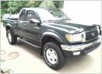
    2000 Tacoma Xcab 4x4 SR5 V6 TRD
    AdventureTaco
    Oh, I know that MPGs aren't usually calculated for beasts like our, but it's what I've got, so it's how I calculate it, hahaha. And as for distance/both directions - that makes sense for a window sticker, but for me, I want to know what it's like for my real-world driving, so I'm OK with it being "whatever MPG I'm getting on the highway when I'm out exploring wherever I'm exploring." I mean, it's all throughout the US West, so at some point, it's "all the same roads in different directions, lol.

    Hopefully the 4% holds up, and eventually gets even better when I go back to different wheels/tires. We'll see!

    Yeah, for sure. I think 4.88s with 35s would be great, definitely closer to stock 31s on 4.10s:
    • 4.88s increase gearing by 19% from 4.10s
    • 35s decrease gearing by 13% from 31s
    So the 4.88+35 combo is a gearing increase of 6%, which isn't all that much (6% higher RPMs than stock).

    4.88s+33 combo is 19%-6% = 12% gearing increase (12% RPM increase over stock)

    This gearing change brings whatever you have down 14%, so I'm now 2% lower RPMs (in 5th gear) than the stock 4.10+31s. It'd be brutal to have this 5th with 4.88+35, that would put you at -8% from stock!
     
    chrslefty[QUOTED] likes this.
  2. Feb 1, 2025 at 12:52 PM
    #5462
    Speedytech7

    Speedytech7 Toyota Cult Ombudsman

    Joined:
    Feb 20, 2014
    Member:
    #123587
    Messages:
    57,252
    Gender:
    Male
    924 W Garland Ave, Spokane, WA 99205
    Vehicle:
    96 Turbo Taco V6 405WHP & 482lbft
    It's less Tacoma and more mod
    4.56 and 35s, are about stock, obviously untenable with the power loss from an auto but quite nice with a manual
     
    chrslefty likes this.
  3. Feb 5, 2025 at 1:19 PM
    #5463
    turbodb

    turbodb [OP] AdventureTaco

    Joined:
    Feb 9, 2016
    Member:
    #177696
    Messages:
    8,450
    Gender:
    Male
    First Name:
    Dan
    PNW
    Vehicle:
    2000 Tacoma Xcab 4x4 SR5 V6 TRD
    AdventureTaco
    Towne Peak is Not the Goal | Following Giants #4
    Part of the Following Giants (Dec 2024) trip.

    On a dark, cold night in January 1952, a distress call went out over Death Valley.

    “Mayday. Mayday. Mayday. This is Air Force 001 bailing out north of Barstow, California,” the official crash report would later read. Soon after, the crew of six jumped out of the CIA's 16-ton, dual-engine, SA-16 Albatross plane into total darkness. The plane - under power of only a single engine and its backdoor hanging open - continued on course for several minutes before scraping a couple of summits. Then, against all odds, landed on its own - with surprisingly little damage - on an insanely steep talus less than a mile south-southwest of Towne Peak.

    More than 70 years later, the wreckage - severed in its midriff, its two halves resting at a mortal 90° angle - is still there.

    - - - - -

    With a story like that, there was no way our hike up Towne Peak would be solely to reach the summit. Though we knew that the trek itself - climbing more than 2,900 feet from Towne Pass over 3.5 miles (one way) - would be a surreal experience, finding our way to a spy plane - another mile and 1,200 feet of elevation - would surely be a highlight of our discoveries in a desert with no shortage of secrets.

    Having decided to spend the night in the lower, warmer elevations of Panamint Valley, we got underway early - half an hour before sunrise - knowing we'd need every last minute of daylight in order to conquer the longest hike of the trip on nearly the shortest day of the year.

    [​IMG]
    Descending the last few miles of Wildrose Road, the Argus Range glowing across the valley.

    [​IMG]
    Towne Peak (high point on right) reached up into the morning light.

    [​IMG]
    Just after 7:30am, we left the Tacoma at the cool, shady trailhead.

    From the get-go, the route to Towne Peak was imposing. West of CA-190, a steep ridge rose 800 feet in less than three-quarters of a mile. Trailless, our ascent to the crest of the Cottonwoods was an exercise in finding the easiest path through a mountain of basalt, black with desert varnish. We did our best to gain a localized ridge, straying from its spine only to avoid the larger boulder fields that punctuated the already steep terrain.

    [​IMG]
    Up, up, and more up.

    [​IMG]
    After half an hour of quad-busting, we glanced back to see the Tacoma, now bathed in sun.

    The most notable thing when we initially reached the crest was the wind. Ripping across the bitterbrush and ephedra at a near-constant 20mph, the extra layers we'd shed on the climb were quickly put back on so we could soak in the dramatic views that presented themselves to the west. There, the land spilled down into the rough, 2-mile-wide Dolomite Canyon, a spectacularly colorful caldron in which simmered a mosaic of faulted and warped Paleozoic formations.

    [​IMG]
    Reaching the ridge was like opening a door to a whole new world.
    (Can you find the Albatross wreck, visible in the distance?)

    [​IMG]
    Soaking in the scenery.

    [​IMG]
    The entirety of Dolomite Canyon, wiggling through sharp ridges before eventually emerging into Panamint Valley, the Argus Range rising in the distance.

    From here, our route followed the ridge to the north, eventually looping around the head of Dolomite Canyon as a serpentine route climbed - and descended - several false summits before finally ascending to the summit of Towne Peak. Here, high above the heavily travelled highway, we were in a world of our own. Faint foot trails - when we could find them - were welcome discoveries, as our legs, chests, and hearts pumped in rapid succession as our elevation increased rapidly.

    [​IMG]
    We would wrap our way around the ridge to the right and eventually approach Towne Peak (center, high point) from the left.

    [​IMG]
    As we wrapped around the head of Dolomite Canyon, the views to the Panamint Valley Playa - and the Argus Range beyond - continued to improve.

    We first noticed a steel fence post when we gained the initial ridge, but after a quick inspection - and not finding anything but a single rebar pounded into the ground nearby - we moved on. A quarter mile later, as we stumbled on a bundle of posts, our curiosity was piqued, and after a more thorough search, we discovered a survey marker embedded in a nearby stone.

    [​IMG]
    Why are you up here fence posts?

    Ultimately, we would find five of these survey markers, each labeled with "DEVA 1977 BDY ####" as well as two arrows pointing to the adjacent markers. This, we realized, must have been the boundary of the National Monument in 1977, or perhaps the surveyed boundary for what would eventually become the National Park in 1994. And, perhaps the fenceposts - and associated wire - were never erected, as the boundary then changed to one running up the Panamint Valley floor.

    upload_2025-2-5_13-16-52.png
    Markers B439, B435, B430, B428, and B411. Clearly, we missed quite a few!

    Climbing the first false summit was a reasonably quick affair - our legs still fresh from a long night's sleep. The second took more effort. The final ascent - up Towne Peak's 30% southeast ridge - was a slog, the trail following the crest over a floor of silvery rocks (quartz-olivine basalt), formed when lava flowed over wet ground and shattered.

    [​IMG]
    By the time we reached the first false summit, the sun was high enough in the sky to shorten the shadows in Dolomite Canyon.

    [​IMG]
    Above us, planes danced in the sky, their thunderous roar, music to our ears.

    [​IMG]
    At the second false summit, the summit was closer, but still seemed every bit of the 1.2 miles - and 700 feet - away.

    [​IMG]
    Just before the final ascent, we could clearly see the Albatross, precariously perched on the steep hillside, the snow-capped Sierra rising in the distance.

    Four hours after our departure - and with five hours until sunset - we reached the summit. It was 11:24am. We were hungry. Searching for a sheltered area on the southern flank of the peak so we could assemble the PB&J sandwiches without fear that our bread would blow away, we scarfed down a quick meal before opening up the ammo box that contained the summit log to search through the entries of those who'd come before us.

    [​IMG]
    A view from the high point.

    [​IMG]
    Someone has been watching too much Foresty Forest.

    upload_2025-2-5_13-17-34.png
    The three 1949 survey markers - No. 1 (left) and 2 (right) pointing to the marker at the high point (center) - of Towne Peak.

    [​IMG]
    It was nice to see Mike Reynolds - who became park superintendent in 2015 - still out and about, enjoying this wonderful place.

    upload_2025-2-5_13-18-26.png
    Following in the footsteps of giants. Jeremy Stoltzfus (left) and Steve Hall (right) showed up within only a few days of each other, back in April 2006!

    [​IMG]
    The earliest entry we found - from 1967!

    [​IMG]
    Late to the party.

    Having painstakingly lifted ourselves to this remote height, we'd found outrageous vistas - glimpsed by few - but we hadn't yet achieved the ultimate goal: visiting the wreckage of the CIA Albatross scattered across a steep talus slope, a mile beyond - and 1,200 feet below - the summit.

    After a quick conversation as to the remaining daylight as well as the difficulty of reaching the site, we decided that it would be a journey that I'd be making alone.

    Dropping off of the summit and continuing north along the ridge, several wind-brushed juniper and a few Joshua Trees decorated the terrain, the microclimate that existed on the northern face of the mountain providing just a little more water than the southern exposure.

    [​IMG]
    In the hot summer months, the shade from this juniper would surely be a wonderful place to take a well-earned break and soak in this sumptuous panorama

    [​IMG]
    A family of Joshua Trees, basking in the glory of Panamint Dunes, the Nelson Range, and in the distance, the Sierra.

    For the first half-mile to the crash site, I made spectacular time. Following the GPS route I'd found online, I quickly dropped elevation as I worked my way towards the end or the trail and a waypoint that marked the crash site.

    Except, it didn't. Instead, reaching the waypoint after only 20 minutes, I realized that it marked a rocky outcropping that had a view of the crash site, still approximately half a mile away. Chuckling to myself for not validating the route against satellite imagery before embarking on the trip, I pushed on, the terrain becoming significantly steeper, my rate of progress significantly slower.

    [​IMG]
    I suppose, technically, you can see the crash site, but if you've come all this way, do yourself a favor and keep going.

    [​IMG]
    At a saddle, I found a large geocache and stopped to take a look.

    upload_2025-2-5_13-19-10.png
    Once again, in the good company of Steve and Jeremy. (left) | Bringing up the rear. (right)

    From the saddle, it took another 10 minutes to descend the steep talus slope to the crash site. This was most definitely the trickiest hiking so far, with only one wrong step between me and a tumble down the mountain. How a plane could stay perched - much less land - on such a precarious perch was top of mind as I struggled for secure footing. And then, I arrived!

    [​IMG]
    The tailsection is the most recognizable part of the plane, and is the first part I encountered.

    [​IMG]
    An engine - though I have no idea whether this is the one that initially failed.


    That crash - later known as "Operation Albatross" - illuminated a shadowy chapter from the Cold War. But the real story wasn’t just about the crash - it was about what the Albatross was doing in the air that night and the lengths to which the CIA and Air Force were willing to go in the name of national security.

    The Albatross wasn’t on a routine training flight. It was part of a covert operation born in the secret corridors of the CIA. Back then, the United States was locked in a high-stakes chess match with the Soviet Union. Every move had to be calculated, every pawn a potential game-changer. The CIA teamed up with the Air Force to form the Air Resupply and Communications (ARC) Wings, specialized units tasked infiltrating Communist-controlled territories with agents, supplies, and sensitive equipment. These were the cloak-and-dagger days of Cold War espionage, where missions like this operated under the radar, often with no safety net.

    The 580th ARC Wing flew out of Mountain Home Air Force Base in Idaho, practicing their routes under cover of darkness. On this particular night, they were enroute to San Diego and back - flying over Death Valley, then a remote national monument, with jagged peaks that offered little forgiveness for mechanical failure.

    At first, everything was going according to plan. But around 6:30 p.m., one of the Albatross’s two engines gave out with a violent blast. It jolted the crew awake, shaking the plane as they scrambled to stabilize it. They funneled all the power into the second engine, but it wasn’t enough. The plane was losing altitude - 500 feet per minute and dropping fast. Telescope Peak, standing at over 11,000 feet, loomed somewhere in the darkness.

    With no other options, the men bailed out at 9,700 feet. It was a leap of faith, the kind where survival depends on the thin threads of a parachute and the grace of fate.

    Decades later, the wreckage remains on that lonely mountain, but its story speaks to more than just a botched flight. It’s a reminder of the risks CIA operatives and their counterparts have taken - then and now - to protect the country. These missions were dangerous by design, conducted in the murky world of espionage where failure wasn’t an option, and success was rarely celebrated.


    [​IMG]
    While any markings on the exposed side of the plane have all but faded away, those on the underside are still clear and bright.

    [​IMG]
    A single seat, still secured to the floor, with no protection overhead.

    [​IMG]
    The rear door, through which the CIA operatives abandoned the plane.

    By now, it was 1:30pm and I knew that - with my hike back to Towne Peak plus the hike back to the Tacoma - we'd be pushing it to arrive by sundown. Radioing @mrs.turbodb to let her know that I was wrapping up my investigation and on my way back, I kicked my already-tired legs into overdrive and pushed for my second summit - of the same mountain - in a single day!

    Covering the mile - and more to the point, the 1,200 feet I'd dropped to reach the crash site - I arrived at the summit right 35 minutes later, my legs nearing a state most similar to Jello.

    Not wasting any time - of which there was none to waste - we set our sights on the ridge and plowed over the edge. Downhill - no surprise - turned out to be significantly faster than our ascent, and with only a couple of stops to admire the view along the way, we covered the 3.5 miles in record time.

    Or at least record time for us, given that it was our first and only time.

    [​IMG]
    A few minutes after sunset and two hours after leaving the summit, we started down the final descent towards Towne Pass and the waiting Tacoma.

    [​IMG]
    What a day!

    We'd used every last minute of daylight that we could muster on what was nearly the shortest day of the year, but we'd done it! Flush with success, we climbed into the Tacoma and sat for a minute, our legs overjoyed to surrender our weight to the seats.

    It was time to go to camp - still more than an hour away - for a well-deserved rest. We'd rest for an entire day - in fact, the first "down day" we'd ever taken - just sitting around and enjoying ourselves in a place we love. But that is another story...


    PS - Remember the crew at the beginning of the story? They survived.
     
  4. Feb 6, 2025 at 3:53 PM
    #5464
    TenBeers

    TenBeers Well-Known Member

    Joined:
    Jun 5, 2009
    Member:
    #18067
    Messages:
    7,663
    Gender:
    Male
    First Name:
    Rich
    Bentonville, AR
    Vehicle:
    2018 TRD Pro Cavalry Blue
    Yeah.
    Love the color contrast in that first photo!

    My dad was an Air Force radio operator on an Albatross, stationed up in your home neck of the woods. He was a college grad so only had to do 2 years. Between that and working in various plants as a chemical engineer, he's been pretty much deaf for the last 15-20 years. Pretty cool story about the plane.

    I did a whole Excel spreadsheet (you know, that Microsoft Office spreadsheet program) on the 3rd gen gearing before deciding to go to 5.29's. Conditional formatting and everything to show where the RPM's were in a good zone based on the tire size, gearing, and speed. Because nerd. I honestly doubt that 6th gear was ever used for more than a few miles before the regear. Stock gearing is awful unless you are totally stock, carrying nothing, and always going downhill with the wind. Gearing goals between the 3rd gen and best gen are a bit different, though. My gas mileage still sucks, but the truck is way more enjoyable to drive and actually uses 6th gear.
     
    ian408 and turbodb[QUOTED][OP] like this.
  5. Feb 6, 2025 at 8:10 PM
    #5465
    D~Mo

    D~Mo Member

    Joined:
    Jan 31, 2025
    Member:
    #465148
    Messages:
    9
    Gender:
    Male
    First Name:
    Dale
    Vehicle:
    '23 Tacoma TRDOR DC LB
    I just got it!

    I'm new here, so not sure if we're supposed to quote long posts, or just like them. I just wanted to say how much I enjoyed the recap, and the phenominal photos. As a history nerd, I really appreciate your time.
     
    turbodb[QUOTED][OP] likes this.
  6. Feb 7, 2025 at 7:22 AM
    #5466
    Speedytech7

    Speedytech7 Toyota Cult Ombudsman

    Joined:
    Feb 20, 2014
    Member:
    #123587
    Messages:
    57,252
    Gender:
    Male
    924 W Garland Ave, Spokane, WA 99205
    Vehicle:
    96 Turbo Taco V6 405WHP & 482lbft
    It's less Tacoma and more mod
    I bet he doesn't know a thing about that
     
    turbodb[OP] likes this.
  7. Feb 7, 2025 at 9:40 AM
    #5467
    turbodb

    turbodb [OP] AdventureTaco

    Joined:
    Feb 9, 2016
    Member:
    #177696
    Messages:
    8,450
    Gender:
    Male
    First Name:
    Dan
    PNW
    Vehicle:
    2000 Tacoma Xcab 4x4 SR5 V6 TRD
    AdventureTaco
    Awesome, glad you enjoyed it! Quoting or liking, or even just enjoying is totally fine by me. As a history nerd, feel free to weigh in on anything I get wrong. I pretend to know what I'm talking about, but I really have no idea.

    :cheers:


    :p :anonymous:

    Microsoft Excel Hero Banner (LinkedIn - 1584x396).png
     
    Last edited: Feb 7, 2025
  8. Feb 10, 2025 at 3:19 PM
    #5468
    turbodb

    turbodb [OP] AdventureTaco

    Joined:
    Feb 9, 2016
    Member:
    #177696
    Messages:
    8,450
    Gender:
    Male
    First Name:
    Dan
    PNW
    Vehicle:
    2000 Tacoma Xcab 4x4 SR5 V6 TRD
    AdventureTaco
    Following a Knife's Edge to Ubehebe Peak | Following Giants #6
    Part of the Following Giants (Dec 2024) trip.


    From the edge of the Racetrack, an old mining trail climbs to the stark heights of Ubehebe Peak, across rocky slopes sparkling with heavily varnished plutonic rocks. The summit views are awesome, encompassing the Racetrack's eerie mud flats on one side, Saline Valley's deep sink on the other, and many ranges all around. You might find it more difficult to leave than to get there.

    Depending on who's telling it, Lippincott Pass is either a treacherous, near-death experience or a straightforward shortcut between Saline and Racetrack Valley's, hardly worth a second thought.

    For us, it has always been the latter, and today - headed up for our first time - it would once again be the same. Our destination - a popular pullout near the northern end of Racetrack Playa, generally used to wander it's astonishingly flat surface to the Grandstand - would serve as our access point for a climb to the summit of Ubehebe Peak.

    Unlike some of our other hikes, this one was short - just under six miles with a little detour we had planned - though the trail was steep, gaining 3,000 feet of elevation over the three mile climb. Still, knowing that we'd have none of the time issues that we'd experienced on some of our longer hikes, we soaked in the sunrise over Saline Valley as we readied ourselves for the day.

    [​IMG]
    Alpenglow on the Inyo Mountains, the entirety of Saline Valley seemingly ours on this beautiful morning.


    https://www.youtube.com/embed/6bCbDLjA4DY?atp=1
    A morning in camp. (a 97 minute timelapse, 1 photo every 15 seconds)
    Allowing ourselves an hour-and-a-half to ascend Lippincott Pass, it was 8:30am when we finally rolled out of camp. It wasn't that we thought the 5.5 mile route would present any trouble, but we'd spotted the remnants of the Bonanza Prospect - a copper working we'd never noticed on our previous visits - and knew we'd want to poke around a bit in the warm morning sun. Plus, there would surely be photos - framed to add a sense of narrow, shelf-road drama - as we climbed the reasonably gentle grade to the trailhead.

    [​IMG]
    I've always felt that the best views from Lippincott are near the valley floor.

    [​IMG]
    Today, the waste pile at the Bonanza Prospect would make a fantastic camp site.


    The Bonanza was a copper prospect first assessed around 1880, during the early days of the Ubehebe Mining District. It was then known as the Hessen Clipper, and it consisted of a 65-foot tunnel and a 30-foot shaft.

    It became the Bonanza Prospect in 1951 when it was acquired by George Lippincott, Jr., whose father owned the nearby silver-lead mine. Subsequent surface mining obliterated the older workings and produced the 50-foot wide quarry that now dominates the site.

    [​IMG]

    Forgotten riches. (Mostly malachite and azurite.)

    The large number of minerals exposed here will put your rock identification skills to the test. The host rocks are marble, tactite, and skarn. Malachite, chrysocolla, and a little azurite still stain the steep quarry walls. Other minerals include silver and traces of gold, tungsten, and uranium. There are also diopside, garnet, wollastonite, idocrase, zoisite, and thulite.


    After poking around the workings for a bit - the surface mining and subsequent reclamation resulting in little left to see - we continued to climb toward the sun on a Lippincott Road that seemed nearly paved.

    [​IMG]
    Is it just me, or is it wider than it's ever been?

    [​IMG]
    We always appreciate that this sign was left in place.

    [​IMG]
    Switchbacks double as passing lanes.

    [​IMG]
    I guess views from the top aren't too shabby either!

    By 10:00am - somehow we'd planned exactly the right amount of time for the ascent - we reached the trailhead and set about our now familiar routine of gathering peanut butter, jelly, and the other components of a lunch we'd make while enjoying a spectacular view from higher elevations. Solar panels were deployed as a sunshade over the windshield, and all manner of electronics were secured to our selves to capture the climb.

    [​IMG]
    Our destination - Ubehebe Peak (left) - and the more interesting, yet nameless subordinate peak (right) that henceforth I'll refer to as "Ubeshebe."
    Unlike every other hike we'd complete on this trip, a well-defined trail - likely built by miners to haul out their ore by mule - was easily discernable over the entire length of our excursion. Beginning at the Grandstand, rocks lined a well-worn path that - after climbing gently for the first mile - led to a series of 36 steep switchbacks, and a saddle just north of Ubeshebe.

    [​IMG]
    I've always ventured out onto the playa to photograph the Grandstand, but I think I've been going the wrong direction!

    [​IMG]
    Climbing gently across the alluvial fan.

    [​IMG]
    Enjoying the view over Racetrack Valley.

    [​IMG]
    Gleaming island in a golden sea.
    "...a curious dry lake, almost a perfect oval in shape, and resembling a racetrack. The illusion is heightened by the fact that an extraordinary rock formation near it appears to be a grandstand for spectators." -Phil Townsend Hanna, 1930

    Even having begun our morning in Saline Valley, we were unprepared for the views as we crested the saddle after the final switchback. There - more than half a mile lower the valley behind us - Saline Valley stretched out before us, the salt lake in the distance, dwarfed by the two-mile high wall of the Inyo Mountains, even their peaks not high enough to block the snow capped Sierra, beyond.

    [​IMG]
    Layers of stone and sky.

    While the switchbacks made the climb up the east side of the ridge bearable, we were both hungry by the time we reached the top. Knowing we still had a lot of up before reaching the summit, we decided instead to go down - to the workings of the Copper Queen No. 1 - in search of a spot to enjoy lunch, and - we hoped - to find some brilliant blue ore.

    [​IMG]
    As the trail rounded a ripple along the western slopes of Ubeshebe, a small adit and large waste rock pile caught our eye.

    [​IMG]
    Jackpot!

    Descending first to the short adit, the colors we found were unbelievable. Having excavated no further than 15 feet into the side of the mountain, the entirety of what was extracted seemed to be a combination of the most brilliant greens and blues we've seen.

    [​IMG]
    @mrs.turbodb especially was in geology-nerd heaven.


    The Hunter Mountain Pluton

    The geology of Ubehebe Peak is dominated by a mid-size batholith of quartz monzonite that crystallized in the Late Jurassic or Early Cretaceous. Picture a huge bubble of hot magma slowly forcing its way up through the Earth's crust, shoving aside whatever formations happen to be in the way.

    [​IMG]

    Intrusion.

    The contact between the magma and the native rocks produced what is called a contact metamorphic zone, a region tens to hundreds of feet thick where rocks on both sides are metamorphosed - the native rocks from being heated and crystallized, the intrusive rocks from being cooled, and both from exchanging chemical constituents. Shales were transformed into hornfels, dolomite into marble and tactite, quartz monzonite into granite, diorite, gabbro, or syenite. Later on, rising metal-bearing solutions preferentially soaked up the weakened metamorphosed native rocks, slowly turning them into rich lodes.

    Today, uplifting and erosion have exposed the pluton all over the southern Racetrack region. Ubehebe Peak, the mountain facing it across the playa, the north face of the Nelson Range, and Hunter Mountain are all made mostly of quartz monzonite from this same batholith, now known as the Hunter Mountain Pluton. Here and there, islands of the original sedimentary rocks are also exposed, and on their edges are the metal-rich contact zones that sparked the Ubehebe mining rush in the early 1900s. When miners searched for metals, unbeknownst to them, they were identifying contact metamorphic zones. On modern geology maps, their mines magically retrace the shattered outlines of the Mesozoic pluton.

    Still in awe of the relatively small pile of colorful ore we'd found at the adit, I was immediately on the hunt for the old miner trail that would deliver us to the much larger waste pile further up the hillside. This, I figured, would be a good spot to eat lunch, and perhaps offer an even larger adit that we could wander our way through, in search of the ever-elusive ore carts.

    Alas, on reaching the workings, the adit was a ladderless, 50-foot deep, vertical shaft, but if we'd been amazed by the copper lode below, we were quickly distracted by the situation we found here.

    [​IMG]
    Incredible.

    [​IMG]
    So much left behind.

    Prior to this, the Copper World Mine - in the Clark Mountains of the Mojave Preserve - was the greenest ground we'd encountered. Not. Any. More. How the miners could leave so much - seemingly copper-rich - ore was all we could talk about as we spread PB&J over four slices of bread, before greedily stuffing our face with the gooey goodness.

    [​IMG]
    Million dollar lunch view.

    Our bellies no longer complaining loudly, we retraced our steps for half a mile to the regain the trail that would deliver us to the peak. Here, we dropped a few of our supplies and pushed upward along the western flank of Ubeshebe, views of Saline Valley getting better and better with every switchback and rock stair we encountered.

    upload_2025-2-10_15-18-28.png
    Local riff-raff. (side-blotched lizard)

    [​IMG]
    Golden folds of the Last Chance Range contrasted fantastically with the dark face of the Inyo.

    [​IMG]
    For much of the hike our views of Racetrack Valley to the east were obscured by Ubeshebe, but a break in the ridge provided a peak at the Grandstand below.

    [​IMG]
    Wandering a lunar landscape.

    It was here - just under the summit of Ubeshebe - that we got our first look at the final ascent of Ubehebe Peak. "I don't even see a route up that ridge," I confided in my companion, the saddle between the two - not to mention the 500-foot climb - so knife-like as to seem unclimbable.

    "I think I'm good here," she replied. "Yep. That's a nope for me."

    Not knowing if I'd be able to make it, but knowing that I'd kick myself if I didn't check it out more closely, I slowly worked my way down to the saddle, before carefully skirting the razor edge as I began to climb.

    [​IMG]
    Somehow, I continued to find the route as I ascended Ubehebe Peak, Ubeshebe gleaming behind - and below - me.

    [​IMG]
    I know that girl!

    [​IMG]
    I originally thought that these inclusions were once spherical, pressure and time having stretched them into thin bands, but more likely, this is igneous porphyry in a style I've not seen before.

    [​IMG]
    Colorful coverings.

    [​IMG]
    "I hereby claim this impossible to reach place for my mine." -some crazy dude in the early 1900s

    Miraculously, the route that'd been completely unidentifiable from Ubeshebe turned out to be reasonably easy to follow - for someone comfortable with more than a bit of exposure - all the way to the summit. There, as usual, the rewards made it well worth the effort. There, I was confronted with two very different worlds. On one side, the pristine Racetrack playa and a now-tiny island of dark rounded rocks.

    [​IMG]
    East.

    On the other, a nearly mile-deep plunge into the depths of Saline Valley, the salt lake and sand dunes gleaming in the distance.

    [​IMG]
    West.

    All around, mountains. The Nelson Range to the south, Inyo Mountains to the west, Cottonwoods to the east, and the Saline and Last Chance Ranges to the north.

    [​IMG]
    Infinite views.

    After soaking in my surroundings for a few minutes, I set about my search for the summit log. This turned out to be a longer process than I expected. With no cairn marking the summit and the well-camouflaged ammo box well hidden in the shadow of a large stone, I nearly concluded that someone had absconded with the log as a souvenir, before finally stumbling upon it as I was about to radio my companion that I was on my way back to her position.

    [​IMG]
    Made it!

    upload_2025-2-10_15-19-19.png
    Nice artwork on the ammo box. (left) | A PNW vibe on the cover of the summit log seemed like a bit of wishful thinking.

    I have to admit that I was a little disappointed to see that the summit log was placed in March 2024, the previous log carried back down the mountain, now - hopefully - stored in the Cow Creek museum. But then I discovered an entry from the park superintendent himself, only a couple months earlier!

    [​IMG]
    Last climbed this peak in Sept, 2002. It's a good day to have a great day!
    -Mike Reynolds, DVNP Superintendent

    [​IMG]
    I had fun being the first to note the naming of Ubeshebe - a nickname suggested in previous summit logs - for future visitors.

    It was only a few minutes after 2:00pm when I plunged off the summit and began to make my way back toward the boulder on which I'd left @mrs.turbodb. From there, we enjoyed an uneventful descent down 36 switchbacks, spilling out next to the Racetrack Playa, the return trip consuming a mere 75 minutes, and much more pleasant on the now-shady-side of the mountain we'd climbed.

    [​IMG]
    Headed back to pick up my "she" - at Ubeshebe - on the way down.

    And with that, it was time to find our final camp site of the trip. High in the Cottonwoods, we had no idea that it would lead to an unexpected addition to our already-packed agenda.
     
    d.shaw, unstpible, Cwopinger and 9 others like this.
  9. Feb 10, 2025 at 3:44 PM
    #5469
    ian408

    ian408 Well-Known Member

    Joined:
    Nov 8, 2009
    Member:
    #25619
    Messages:
    19,515
    Gender:
    Male
    First Name:
    Ian
    Santa Clara, CA
    Vehicle:
    09 Tacoma
    I remember when JT Reynolds was coming to the end of his time as superintendent, he took a lap around the park and did some of the things he enjoyed. I cannot imagine what it'd be like where you look over at your assistant and say "I'm gonna be gone for a couple of days checking the park out". What a treasure that must be.
     
  10. Feb 24, 2025 at 12:22 PM
    #5470
    turbodb

    turbodb [OP] AdventureTaco

    Joined:
    Feb 9, 2016
    Member:
    #177696
    Messages:
    8,450
    Gender:
    Male
    First Name:
    Dan
    PNW
    Vehicle:
    2000 Tacoma Xcab 4x4 SR5 V6 TRD
    AdventureTaco
    Wiggly Slots of O'Brien Canyon | Following Giants #8
    Part of the Following Giants (Dec 2024) trip.

    A few weeks earlier - as we'd thoroughly enjoyed our hike through the upper 7 miles of Bighorn Gorge - we'd known that a return trip through O'Brien Canyon was an option. In fact, based on a description I'd found in what we lovingly refer to as the Death Valley Bible, I'd planned for us to return via this alternate route.

    The thrilling part of this little-known place is its superb narrows about 2 miles down from the [Silver Crown] mine. For several hundred yards the canyon squeezes through a series of tight passages, shaded underworlds of slick bedrock, faceted chutes, chockstones, and wiggly slots confined between high polished walls. One of the falls, crowned by a huge boulder, requires a precarious bypass high on the south side.


    Unfortunately, as the hours ticked by - and with many miles left to complete Bighorn Gorge - it became increasingly clear that risking a precarious bypass might not be the best of ideas after trekking 12 miles through a remote canyon. And so, we left it for another time.

    Now! :yay:

    Lucky for us, access to O'Brien Canyon is via White Top Mountain and the roads originally serving the Silver Crown Mine, so after winding our way along a narrow two-track in the Cottonwood Mountains, we found ourselves at a trailhead much like the one that'd led us into Bighorn Gorge. We hope the rewards would be as grand.

    [​IMG]
    Not many people come this way.

    After grabbing our stuff - lunch fixings, camera gear, sunscreen, and a few location finding devices - we set off into the canyon. From the get-go, it was familiar, with pinyon pine and dry falls decorating the upper elevations.

    [​IMG]
    Plenty to look at, but not so dense as to impede progress.

    Ultimately, hiking through the upper drainage here turned out to be much easier - and quicker - than Bighorn Gorge. "Why," we wondered to each other, "did Digonnet not make this the 'main' route for his hike?"

    Thinking out loud, I reasoned that there aren't many canyons in Death Valley that one can hike completely - from the valley floor to the head of the drainage - thus making the ability to do so with Bighorn Gorge irresistible to a man who never turns down the opportunity to hike a road that could be driven, if only to prolong his time in the desert!

    [​IMG]
    Less than an hour after our departure, we were nearing the narrows, as the canyon walls rose around us.

    [​IMG]
    Sunstar.

    [​IMG]
    A Mojave Mound Cactus?

    After another half hour of wandering - most of it spent wondering, "are we in the narrows already?" - we poured ourselves over a 12-foot dry fall and into an entirely new world of cool stone and polished walls.

    [​IMG]
    To answer our previous ponderings - no, we had not been in the narrows!

    upload_2025-2-24_12-20-53.png
    I always love how the light and rocks play together in a place like this.

    [​IMG]
    Bathed in blue.

    Within moments, my hiking companion disappeared. Whether it was around a corner, over a fall, of through a wiggly slot, @mrs.turbodb was way ahead of me. Or, more likely, the constant clicking of my camera meant that I was way behind her. No matter, I knew we'd be reunited once she found the precarious bypass that'd precluded our enjoyment of this place a few weeks earlier.

    upload_2025-2-24_12-21-23.png
    Whether on the walls (left) or over slick dry falls (right), I love the dichotomy of blue and orange that Death Valley's canyons reveal to those who revel in their passages.

    [​IMG]
    Captured chockstone.

    [​IMG]
    Tight turn.

    The length of the narrows in O'Brien Canyon was impressive. For more than 15 minutes, we wandered our way through tight passages, and over faceted chutes. We climbed around chockstones, wormed our way through wiggly slots confined between high polished walls.

    An owl - rodent in tow - glided by gracefully over heads.

    Eventually - my moving pace just fast enough to overcome my just-one-more-picture-I-promise pace - I caught my companion as she approached the fall that might turn us around.

    I spotted the bypass. Steep, yes, but precarious? Not really.

    Still, as we peaked over the edge of the chockstone, I thought, "That doesn't look so bad." And, as though I was decades younger than I actually am, "I bet I could climb that."

    So, that's what I did.

    [​IMG]
    @mrs.turbodb at the top of the fall. Queen of the chockstone.

    Usually, I find that up is easier than down in climbing situations, but we both knew that this particular instance was going to buck the trend.

    I don't know if it was the mass of footsteps below the fall and lack of footsteps above the fall, or the absolute grace with which I'd bumbled my way beyond the blockage, whatever the reason, @mrs.turbodb was content to wait right where she was as I explored the last few hundred feet of the narrows.

    So, as I stood there hoping that "up" would be attainable, she handed down my pack - which she'd kindly held in case I'd taken a tumble as I bridged my way down - and we powered up our radios.

    [​IMG]
    A wide spot, the lego-like strata stretching into the sky.

    [​IMG]
    Suddenly, things got tight again, though not quite as high as before.

    [​IMG]
    And with that, I was out, the wash widening once again as it worked its way toward Bighorn Gorge.

    Working my way back up to the chockstone, the next trick was going to be finding a way up. An easy task if not for gravity and overconfidence. I started by delaying my climb, so I could hand my gear back up to @mrs.turbodb.

    Now - with all the lunch fixings on the "up" side of the fall, and my stomach growling - I had no choice but to bridge myself between the walls and wonder why I'd made the decision to descend in the first place. Ultimately though, I was successful, and soon we found a sliver of sun where we could enjoy freshly made PB&J sandwiches before enjoying the wiggly slots a second time.

    [​IMG]
    Just before we sat down to eat lunch, I spotted this fossilized barnacle, clinging forever to its home.
    (or, is it just an inclusion?)

    upload_2025-2-24_12-21-53.png
    The trip back up through the narrows was just as enjoyable as the trip down. Perhaps more so without worry that we'd find part of it to be impassable.

    [​IMG]
    Eventually, we transitioned out of the narrows and back into the upper drainage.

    It was 2:00pm on our seventh day of following those that we consider to be giants through Death Valley as we trudged our way toward the Tacoma. Our legs - by this point, the consistency of Jello - seemed to sink into the sandy surface of the wash. Like climbing a sand dune - albeit one two miles long and 1,500 feet tall - every step up was a workout.

    Digonnet-style, I'd considered parking the Tacoma a quarter mile from the trailhead. Thank goodness cooler minds - in the passenger seat - prevailed.

    [​IMG]
    Thank goodness for seats. Time to go home.

    It'd been another glorious trip in the park. Longer than most but still leaving us hungry for more. After, that is, a few well-deserved showers.
     
  11. Feb 27, 2025 at 9:04 AM
    #5471
    turbodb

    turbodb [OP] AdventureTaco

    Joined:
    Feb 9, 2016
    Member:
    #177696
    Messages:
    8,450
    Gender:
    Male
    First Name:
    Dan
    PNW
    Vehicle:
    2000 Tacoma Xcab 4x4 SR5 V6 TRD
    AdventureTaco
    3000 Feet Down at Toroweap | Chilly Strip #1
    Part of the A Chilly Strip (Jan 2025) trip.

    After spending two weeks (one) (two) in Death Valley, and a week in the Mojave Preserve before that, I figured it was time to get out of the Mojave Desert for a bit. My first inclination was to head east towards Cedar Mesa to continue my search for the Juniper Tree ruin. This, I figured, would be a relatively straightforward affair, since I'm confident that I've narrowed down its location, so I knew I'd need more to fill a trip.

    Pouring over my usual sources of inspiration, I came upon a reference to the Shamans Gallery along the North Rim of the Grand Canyon and was blown away. For those - like me - who are unfamiliar, the Shamans Gallery is one of only a handful of rock art sites that fall into a group known as the Grand Canyon Polychrome, nearly all of which are found on the Esplanade.

    [​IMG]
    Shamans Gallery.

    Over the next several days, I searched diligently for clues to any of the remaining sites. Alas, those who know where they are, also know how that keeping them special means keeping their locations unknown. Still, I was able to find several more places in the Arizona Strip to keep me busy over the course of a few days, so I put the Juniper Tree ruin on hold, lined up my permits for the north rim, and set out for the single-digit temperatures that would make for a few chilly days in the strip!


    - - - - -

    Even before stepping out of the airport in Las Vegas, I was worried about the temperatures I'd encounter as I worked my way along the North Rim of the Grand Canyon. Still, as I exited the terminal, a blast of cool air - in the mid-40s °F - caught me off guard, so different than the 60-70°F temps that I look forward to when heading south for the winter.

    I made up my mind right there - as I was waiting for the Uber that would deliver me to the Tacoma - that I would be doing no cooking on this trip. Even if warm food would be pleasant for a moment or two, the process of assembly would chill me to the bone, and washing up afterwards would surely necessitate the removal of my frostbitten fingers. That was if I was even able to clean up after dinner, something that would entirely depend on whether the water in my jerry can was frozen solid.

    And so, after stowing my belongings and grabbing my usual lunch at In-N-Out, I picked up some milk and cereal for breakfast, and several burritos from Chipotle. These, I decided, I would carry around during the day, allowing the sun - and my body heat when I was hiking - to bring them to a warm-enough-to-enjoyably-consume temperature. I'd eat half a head-sized burrito for lunch, and the other half as an early dinner. For water, I hoped that the jerry can would thaw enough over the course of each sunny day - as long as I left it in full sun - that I could fill my water bottles and stow them under my blankets before I went to bed, keeping them from freezing for the following day's adventure.

    It was 2:00pm as I pointed the Tacoma east towards the Arizona Strip and the Tuweep Campground along the North Rim of the Grand Canyon. With six hours of driving, there was no question as to whether I'd arrive in the dark. Rather, this fact raised two additional questions: (1) would the road be open, and (2) how unbearably cold would it be?

    [​IMG]
    Showing up in the dead of winter, I had no trouble finding a camp site; the entire campground was mine alone.

    I'd been worried about the road, not because of weather or muddy conditions, but because Toroweap Overlook is home to the only backcountry outpost - the Tuweep Ranger Station - along the North Rim of the Grand Canyon, and permits for the area make it clear that one must arrive 30-60 minutes before sunset, lest the gates be closed until morning.

    Luckily for me, the gates at Tuweep were open, rangers likely assuming that anyone crazy enough to make their way to this point in the dead of winter - should they take the long plunge over the edge - wouldn't be missed by many. After a quick jaunt to the dark, bottomless, edge of the canyon, I worked my way back to the campground where I quickly settled on site #3. Off the main route, it was nicely level, allowing for a quick tent deployment in the frigid night air. It was still only a few minutes after 8:00pm.

    Not sure I wanted to spend quite such a long night under the covers - sunrise wasn't until 7:40am the following morning - I decided that a quick wander around the campground could be a good way to pass a bit of time.

    All sites in Tuweep Campground are first-come, first-serve, and as I worked my way further along the road, it didn't take long for me to realize I'd made a mistake. Site #3 was nice, but wow, site #7 was fantastic! Soon, I was folding up the tent and blasting the heater as I made my way deeper into the campground!

    [​IMG]
    Setup under the red sandstone and bright Milky Way.

    After redeploying the tent and distributing a bit of lighting along the ledge for a few photos, I cozied down under my comforters. It was going to be a cold night, and - I assumed, with plans to head to the overlook an hour before sunrise - an even a colder morning!

    Sometime while I was asleep...

    Unbeknownst to me, Mike @mk5 departed the greater Los Angeles area just as I was climbing into bed. I'd sent him my location using my Garmin inReach Mini, knowing that he wanted to join me for a little more than a day, but not knowing if he'd actually be able to make it, largely due to the Southern California wildfires.

    At some point along the way, he posted this to TacomaWorld:


    [​IMG]

    Hey Dan, why don't you pick the destination this time... maybe just not super far away, and not too cold?

    The following morning...

    I still had no idea if Mike was coming when my alarm sounded, and after pulling on my freezing clothes, I climbed down the ladder to start the day at my favorite overlook of the Grand Canyon. With just under a mile between my campsite and the edge, I moved quickly to generate heat, my fingers already painful in anticipation of touching the freezing camera body and tripod when the huge gash in the ground presented itself.

    The view was as wonderful as I remembered.

    [​IMG]
    Looking west from Toroweap.

    [​IMG]
    Looking east, it's a long way down.

    I hung out for more than an hour as the sun worked its way toward - and crested - the horizon. My heart raced as I hopped from one precarious place to another, warm blood and adrenalin keeping me warm as played on the edge.

    [​IMG]
    Canyon walls gleamed as the sun kissed them to start the day.

    My tummy grumbling, I eventually pulled myself from the edge and headed back toward camp. As with the overlook, darkness prevented my enjoyment of the landscape the previous evening. And, though the sandstone boulders that backed my camp were splendid, they were nothing compared to the Kanab Plateau that now filled my view.

    [​IMG]
    There aren't many places in the world where the views extend both up and down like they do at Toroweap.

    [​IMG]
    Look at that, a second truck has arrived!

    I'd later discover that Mike rolled into camp just after sunrise. Whether or not he thought I was in my tent at the time, he wasted no time trying to find out - or even say hello - instead pulling out his sleeping bag and sunshade to get as much shuteye as he could.

    I putzed around for an hour or so, enjoying breakfast - Wheat Chex and mandarins - as the sun warmed my back, and putting away the tent as I wondered how long I should let him sleep. Ultimately though, it wasn't for me to decide; as I grabbed my Kindle to read at the picnic table, his driver side door slowly opened, and a weak mumble - that I can only assume was a greeting - emanated from within.

    [​IMG]
    The view east from site #7.

    A few minutes later, the mumbling turned to rustling, and a few minutes after that, a staggering and stumbling Mike wandered over to wonder at what day it was and why I'd chosen such a cold, faraway place to explore.

    "Let me show you," I said, and a few minutes later we were in our trucks, crawling over small ledges and rough roads, on our way to the overlook.

    [​IMG]
    No rest for the weary.

    [​IMG]
    Nap time yet?

    As with many deep canyons, even the parking area at Toroweap - only a few hundred feet from the edge - gives little indication of what one will experience as they reach the rim. And so it was with great joy that I watched a smile - and some trepidation - spread across Mike's face as he finally reached the precipice.

    "Huh," he said, "Probably not a good idea to get to close with the amount of sleep I've had."

    [​IMG]
    "Reasonably Grand." -Mike

    And then, just as I'd done only a couple hours earlier, we hopped about along the edge, enjoying the sun as it warmed us and the red rock cliffs of Toroweap.

    [​IMG]
    No guardrails.

    [​IMG]
    "I might not make it if I fall." -Mike

    Apparently, Mike was also taking photos of me. And, despite his nonchalant photo-taking style - just sort of randomly pointing his camera at things and pressing the shutter button without ever looking at the screen or viewfinder - he seems to have shown me up. Again.

    [​IMG]
    "Hey over there!"

    [​IMG]
    A perfect shot from the hip, and the guy only ever uses a wide-angle lens. I officially give up.

    There are only so many photos you can take on a single morning at a place like this, and by the time we were done, I'd thoroughly exceeded my allotment. As we made our way back to our trucks, Mike asked what was next, hopeful that it would include at least 6 hours of napping, and an increase of approximately 30°F. Neither of those were in the cards, but - I assured him - our hike wasn't too long, and would culminate at what I hoped were some reasonably cool petroglyphs.

    "Cactus petroglyphs?" he asked?

    "They didn't make cacti petroglyphs, Mike," I assured him, as I pulled the door closed and fired up the ignition to get underway. As I did, I could see him talking at me through the window. I'm not sure what he was yelling as I departed, but knowing Mike, he was probably trying to argue with me about cacti rock art again, even though he'd only seen his first petroglyph three months earlier.

    [​IMG]
    This part of Arizona sure does remind me of Utah.

    [​IMG]
    The local riff-raff made sure we were following the rules and keeping to the trails.

    Our destination - Nampaweap, which means 'Foot Canyon' in Paiute - was one that I'd known about since 2018 when I'd approached it from the opposite direction with Mike @Digiratus and Monte @Blackdawg as part of our two-week long adventure that'd become known as F U Rain. On that trip, we'd stopped for lunch at the trailhead on the Uinkaret Plateau, but knew that we didn't have time to tackle the 1.5-mile hike to the petroglyphs themselves.

    [​IMG]
    Out of the Park, and into the Grand Canyon-Parashant National Monument.

    With significantly more sleep over the previous 48-hours than Mike, I arrived at the trailhead several minutes before he did, his reflexes dull and his eyelids continually reminding him that he wasn't as young as he used to be. Still, I reminded him, he was younger than I was, so no complaining.

    We grabbed a bite to eat as we ambled down the old mining road toward the rock art, chatting about the site - an important prehistoric travel corridor from the Grand Canyon to the resources of the ponderosa pine country around Mt. Trumbull - as we wondered what we would discover.

    [​IMG]
    Nampaweap petroglyphs.

    [​IMG]
    Life spiral and a wall of petroglyphs.

    [​IMG]
    Standalone sheep.

    upload_2025-2-27_9-4-19.png
    There were plenty of anthropomorphs in and amongst the other symbols.

    [​IMG]
    "Look, it's a cactus! With spikes!" -Mike
    (It's probably not a cactus, Mike. That looks like a hand...)

    [​IMG]
    The proliferation of bighorn sheep on display may have led to miners eventually naming this canyon "Billy Goat Canyon."

    [​IMG]
    Dappled clothes hangers.

    One of the more interesting glyphs we discovered was that of what could only be described as a horny tyrannosaurus rex. Get your head out of the gutter, I mean "horned." It was unlike any I've seen before, and proof positive that these enormous chickens and the Native American Paiute shared this land as recently as 1,000 years ago. Surely, there is no other explanation. Also, the earth is flat. And did we really land on the moon? :rofl:

    [​IMG]
    Nampaweap dinosaur.

    After wandering along the volcanic stones for half a mile, we reached the end of the art - though I've since seen pictures of figures we never discovered - and worked our way back up the canyon to the trailhead. From there, we were headed to camp, where I assumed that Mike would quickly call it an afternoon, and sleep 15-hours straight, until morning.

    [​IMG]
    Working our way through a juniper forest, toward the Tuckup trailhead.

    As with the previous evening in Tuweep, we'd find ourselves along the edge of the Grand Canyon and inside the National Park boundary, so I'd forked over $8 on recreation.gov for our NL9 backcountry camping permit (same link as above). It was an amount that seemed outrageously cheap for the views that it provided.

    [​IMG]
    All this for $8? Yes, all this, and more.

    After setting up camp, I wandered off to snap a few photos of the sunlight racing across the Esplanade while Mike - I hope - took a nap in his passenger seat.

    [​IMG]
    Last light.

    As the sun disappeared below the horizon, the temperature dropped quickly. A wind - to this point, not terrible - also picked up, freezing our fingers even more quickly. Huddled around Mike's propane fire ring, we turned up the dino juice and danced around the flames as long as we could before calling it a night.

    "Sorry in advance," Mike piped up, as he climbed - fully clothed - into two sleeping bags he'd laid out on his passenger seat, "but you'll probably hear me turn on the engine a few times throughout the night."

    "I won't hear a thing over the flapping of my tent in this wind," I assured him, as I shoved plugs into my ears and turned my electric socks to hot.

    With that, we both settled in for what we were certain would be a long, cold night. But we also fell asleep with anticipation of what the next day had in store. We were going to see - we hoped - ancient eyelashes!
     
    BYJOSHCOOK, Rezkid, unstpible and 9 others like this.
  12. Feb 27, 2025 at 11:09 AM
    #5472
    ian408

    ian408 Well-Known Member

    Joined:
    Nov 8, 2009
    Member:
    #25619
    Messages:
    19,515
    Gender:
    Male
    First Name:
    Ian
    Santa Clara, CA
    Vehicle:
    09 Tacoma
    The drive out to Toroweap/Tuweep can be a challenge in itself. No trailers, slicker than snot in the wet. But the views--there might be better or more beautiful views somewhere else but nothing beats knowing you could get up to take a leak and walk over the edge into oblivion--just kidding, the views are some of the best, ever and regardless of the weather.
     
  13. Feb 27, 2025 at 1:26 PM
    #5473
    Y2kbaja

    Y2kbaja Well-Known Member

    Joined:
    Jun 11, 2013
    Member:
    #106028
    Messages:
    1,340
    Gender:
    Male
    Sacramento
    Vehicle:
    05 Total Chaos Tacoma
    Total Chaos
    Toroweep was one of my first adventures in 2003 and it's an amazing place. Now I want to go back.
     
  14. Mar 1, 2025 at 11:53 AM
    #5474
    turbodb

    turbodb [OP] AdventureTaco

    Joined:
    Feb 9, 2016
    Member:
    #177696
    Messages:
    8,450
    Gender:
    Male
    First Name:
    Dan
    PNW
    Vehicle:
    2000 Tacoma Xcab 4x4 SR5 V6 TRD
    AdventureTaco
    Shamans Gallery | Chilly Strip #2
    Part of the A Chilly Strip (Jan 2025) trip.

    Our night - near the Tuckup Trail - wasn't nearly as miserable as we imagined it would be. I don't know if Mike ever turned his engine to warm up his cab, but my earplugs and heated socks made for sound sleep on the North Rim of the Grand Canyon.

    Photos of deep canyons are difficult to capture once the sun is blazing down from above. With one side of the canyon bathed in light, the other is deep in shadow, a contrast that's hard to balance with anything but the human eye. And so, as is often the case, I found myself up before sunrise to take advantage of the shadowless light that illuminates the landscape for a few minutes every morning and night.

    [​IMG]
    Cracks in the Earth.

    [​IMG]
    Narrow fingers, slowly receding.

    [​IMG]
    Imminent shadows.

    I climbed back into the tent a few minutes before the longest rays of the day streamed over the eastern horizon. Still warm, I burrowed under my two down comforters.

    [​IMG]
    My tent, positioned perfectly to absorb those long, warm rays, of the sun.

    I awoke nearly an hour later, to the sound of Mike's engine warming up his cab. It was the second beginning of a beautiful day. An hour later - after breakfast and the breaking down of camp - we were on our way.

    [​IMG]
    Mike hiking down into Tuckup Canyon ahead of me.

    Visiting the Shamans Gallery - also known as the Spirit Shelter - was our goal for the day. More than that, it was the impetus for this visit to the Arizona Strip. One of fewer than ten rock art sites that fall into a group known as the Grand Canyon Polychrome, Shamans Gallery - like the others - sits on what is known as the Esplanade Platform of the Grand Canyon. This Esplanade is a wide plateau composed primarily of Supai sandstone and located mid-way between the rim and river in the canyon. With an average elevation of 4,200 feet, springs are not abundant, but after heavy rains, water is easily found in natural sandstone pockets. This easily accessible water - along with plentiful bighorn sheep and natural sandstone shelters - must have attracted early inhabitants, some of whom developed their own style of art.

    [​IMG]
    It was Mike who spotted this fossil in the limestone as we worked our way down.

    [​IMG]
    This bunch cactus caught my eye, even though it wasn't yet flowering.

    [​IMG]
    Early morning overlook.

    Making our way down toward the Esplanade, echos of the more recent past - mining, homesteading, and ranching - dotted the landscape. We wondered at everything, content with no answer to any of it.

    [​IMG]
    An old fence, no longer functional.

    [​IMG]
    A small cave, and a few cans.

    [​IMG]
    High ground.

    [​IMG]
    A green blanket spread as far as the eye could see as we neared the Esplanade.

    [​IMG]
    A lone rock.

    [​IMG]
    Once, a shelter.

    [​IMG]
    A fence, unstrung.

    Our investigation of the more modern artifacts we'd discovered complete, we continued on our way. It was nearly 10:30am as we shed layers of clothing that had kept us warm in the shady descent, the sun now high in the sky, keeping us warm.

    Our spirits were high as we neared our destination.

    [​IMG]
    An innocent hiker?

    [​IMG]
    Nope.

    [​IMG]
    A beautiful pricklypear cactus, on full display below the plateau.

    Just before noon, we reached the spot I'd marked as our destination. "Hope this is right," I mentioned to Mike.

    The look on his face - now four miles and 1,500 feet deep in the Grand Canyon - was priceless. For some reason, he'd assumed that the quest for rock art was somehow different than the quest for fish on the end of a rod. That somehow, I knew - with certainty - where I was going and what we would find there.

    Hoping his faith was well founded, I grinned and let out a chuckle. "Even if it's not here, we'll find it - we know it's on the Esplanade somewhere," I joked.

    [​IMG]
    Shamans Gallery.

    [​IMG]
    Behind the gallery, a temple-like view of the plateau.

    It was Mike who spotted the pictographs from the wash, and less than a minute later, we entered the gallery.


    [​IMG]
    Ghosts.

    [​IMG]
    Circles and layers.

    [​IMG]
    Sheep and shield.


    Though closely related to the Barrier Canyon Style rock art of southeastern Utah, and possibly to the Pecos River Rock art of Texas, Grand Canyon Polychrome has its own unique combination of characteristics. These include anthropomorphs with life-like details such as eyelashes, toes and pupils; figures portrayed in a whimsical fashion, such as smiling figures; anthropomorphs whose arms are slender, outstretched, and often originate below the neck/shoulder level. Many figures have narrow shoulders. Arms, legs and feet, as well as torsos, are commonly decorated with stripes, dots, or rectangles. A repeated motif of this type is the "jailbird look." Another recurring attribute is a head with cat Ilke ears. Frequently anthropomorphic figures are depicted with arms and 'horns" but no necks; the bodies of these anthropomorphs are formed by large, decorated trapezoids or by elongated rectangles.

    In addition to anthropomorphs, Grand Canyon Polychrome artwork displays spread-winged birds, bighorn sheep, deer, pelt-like objects, and abstract symbols. The quadrupeds, like the anthropomorphs, are frequently painted with outlined bodies. A small shrimp-like, crescent-shaped creature appears occasionally, positioned near one or more anthropomorphs.

    Another similarity between Grand Canyon Polychrome and Barrier Canyon Styles is the absence of weapons. There are no depictions of atlatls or bow and arrows as are often seen in later rock art. This, and other factors, would point to an early date, probably Archaic, for these styles. However, it is possible this exclusion of weapons may be attributed to the art work's function. Perhaps the panel 's purpose was to illustrate a shaman's vision or a tribal myth, rather than perform hunting magic. This idea conforms with the larger-than-life supernatural aspect of many Grand Canyon Polychrome panels.

    Unlike Barrier Canyon sites which typically have figures spaced out across a panel in a parade-like manner, the composition of Grand Canyon Polychrome work is more crowded. There seem to be instances of contemporary superimposition (i.e. Grand Canyon Polychrome on top of Grand Canyon Polychrome). However, these Grand Canyon sites were utilized over a long period of time; the crowded appearance and superimposition is partially due to additions of later pictographs on top of older Grand Canyon Polychrome figures. Sorting out older versus younger elements on these complex panels can be a difficult task.

    The range of pigments in the Grand Canyon Polychrome panels includes at least nine distinct shades; dark brownish red, light terra cotta red, cream, white, black, lime green, forest green, yellow ochre and light yellow. Dark red and cream are the most commonly used colors.


    [​IMG]
    Double green suns.

    [​IMG]
    Didn't you know? Lime green panthers love to paint their toes.

    I'm not sure how many times we worked our way back and forth through the gallery, but there's no question that we were thankful for the advent of digital photography. The elongated, life-size figures were fantastic, and so large that we had to be careful not to back off the ledge while trying to fit them in frame!

    upload_2025-3-1_11-53-7.png
    Life-sized spirits.

    [​IMG]
    Eyelashes.

    As I ate a quick lunch (Mike seemingly impervious to hunger, I never saw him eat all trip), Mike wandered out of the gallery in search of additional drawings. He didn't find any, but he did return with a fleck of red obsidian that surely originated around the same time.

    [​IMG]
    Lunch view.

    [​IMG]
    Obsidian flake.

    As I photographed the flake, I could tell Mike was - understandably - getting a bit antsy. Having left home while fires raged, his neighborhood - while unburned - was experiencing regular power outages as the utility company worked to keep lines from sparking new fires, and predictably, every generator in the area had been sold almost immediately. He wanted to get back to civilization in time to pick up something that would prevent him from having to throw away a fridge full of food - for a third time - before returning home for an early morning meeting the following day.

    And so, as I started my "really? again?" pass through the gallery, he decided to get a head start on the 4-mile, 1,500-foot climb back to the canyon rim.

    [​IMG]
    Only minutes after Mike left, I discovered that his obsidian discovery was only 25% as good as what was already there for us to see. Typical underachiever.

    [​IMG]
    Time to head back.

    Working my way back the way we'd come, I was surprised how long it took me to catch Mike. He, too, was wondering if something was wrong - each of us thinking through our search plan for the other, had they followed an incorrect wash in a largely uniform landscape. Reality - as usual - was much less intriguing; I'd dillied at the gallery, and dallied off trail to investigate a that-looks-interesting rock formation, each minute of my wandering increasing the distance between us.

    [​IMG]
    Wandering the Esplanade.

    [​IMG]
    A metate and mano I found beneath the interesting rock formation that was once a shelter.

    As I was turning on my afterburners - toward a spot where we'd deposited our jackets on the way down, and where I was hoping to find them retrieved on the way up - Mike was working his way to an overlook, scanning the trail for movement that would indicate my approach.

    Spotting each other from a quarter mile away, quick waves communicated our relief, Mike continuing on in an attempt to claim victory as the first to gain the rim, and ultimately, camp.

    [​IMG]
    Looking back, the Esplanade gleaming green, below.

    I forget who made it back first - though I'd certainly claim victory if I was sure it was me - but it was only a little after 2:00pm, which gave Mike plenty of time to work his way to any number of places in Hurricane or St. George that could satisfy his need for uninterrupted electricity.

    [​IMG]
    After packing up his flag and a few quick until-next-times, Mike almost ran me over as he departed.
    With that, it was time to figure out my plan for the remainder of the trip. With two more nights and a day-and-a-half available for hiking, I knew where I was headed, but not when. My options - to leave now, or the following morning - would trade off camp on the edge of the Grand Canyon against the ability to get an early start the next morning.

    In a somewhat unexpected twist, I opted to forego a night on the rim. It would turn out to be a good decision, but only after I made a miserable miscalculation in my exploration of Snake Gulch.

    [​IMG]
    A final look at what I was leaving behind.
     
    BYJOSHCOOK, Rezkid, AMMO461 and 7 others like this.
  15. Mar 6, 2025 at 9:54 AM
    #5475
    turbodb

    turbodb [OP] AdventureTaco

    Joined:
    Feb 9, 2016
    Member:
    #177696
    Messages:
    8,450
    Gender:
    Male
    First Name:
    Dan
    PNW
    Vehicle:
    2000 Tacoma Xcab 4x4 SR5 V6 TRD
    AdventureTaco
    Miserable Miscalculation in Upper Snake Gulch | Chilly Strip #3
    Part of the A Chilly Strip (Jan 2025) trip.

    There's almost nowhere I like to camp more than on the edge of a cliff or on the top of a mountain. The expansive views and feeling of being on the edge - literally, I suppose - are the reason I love to explore. So, it was with a good dose of hesitation that I made the decision to leave my campsite on the North Rim of the Grand Canyon less than two hours before sunset, opting instead to camp at a trailhead parking area. At least it would allow me to get an early start on the following day's hike.

    [​IMG]
    Away from the edge.

    [​IMG]
    The Vermillion Cliffs and Moccasin Mountains gleamed in the distance.

    My destination - Snake Gulch, in the Kanab Creek Wilderness - was one that had been recommended to me by Randy, perhaps the most avid, rock-art-loving hiker I know. Frankly, I don't really know him, except for being jealous of every photo and trip report he's ever posted, and a few emails, to which he's been kind enough to respond. One day, I hope, that will change, since he seems like a really nice guy.

    Unsurprisingly, I arrived in the dark. Though my elevation was approximately the same as it'd been the night before - right around 6,000 feet - it was significantly colder. "Yay!" I thought to myself, "No view and I get to freeze to death." No matter, I pulled the truck into the corner of the parking area and unfolded the tent as quickly as my numb fingers could muster. Then, hoping I could keep warm in my comforter cocoon, I pulled on my electric socks and crossed my fingers. It was 7:23pm.

    The following morning...

    Something that anyone who likes photographing rock art quickly learns is that direct sun and shadows are the enemy. For this reason, I'd decided I would try to get the "out" portion of my out-and-back hike through Snake Gulch mostly - if not entirely - accomplished before the sun rose too far above the horizon. This, I hoped, would allow me to photograph most of the pictographs in indirect - or even better, reflected - light at the bottom of the gulch.

    My miscalculation began long before I ever made the decision to climb out of the tent at 5:45am - in 8°F temperatures, and 90 minutes before sunrise. It began - I'd realize about four hours into my hike - before I'd ever left home.

    You see, after being presented with the suggestion of hiking Snake Gulch, I'd set about doing a bit of research. This, I've learned over the years, allows me to know - to an extent - what to expect when I'm out in the middle of nowhere. At the very least, I can read trip reports from others and get a sense of landmarks; sometimes, I'm lucky enough to find a GPS track with waypoints that mark some of the interesting highlights. Such had been the case with Snake Gulch. After reading several trip reports - and getting excited for some of the pictographs I'd see - I stumbled on a trip report with a 7-mile roundtrip GPS track and more than a dozen points marking the pictographs along the way. "Jackpot!" I'd thought, before saving the data to my tablet and moving on to researching the next part of my trip. What hadn't even dawned on me at the time - but would have been obvious had I looked at the maps just a little more carefully - was that the track and points I'd found, covered by a small portion of Snake Gulch.

    Still, I was blissfully unaware of my impeding misery as I fumbled around in the dark. Rather, I was dealing with the more immediate misery of pulling on every bit of clothing I'd brought along and trying to warm my fingers after I shoved my too-cold-to-touch camera gear into my bag. In fact, I even remember thinking to myself:


    Thank goodness this is going to be a short hike. I can just wait until I get back to eat breakfast and I won't even bring any water...it'll still be ice by the time I'm done, anyway.
    So yeah, you can see where this trainwreck is headed.

    [​IMG]
    Half a mile into the hike, I was shivering as first light began pushing away the dark.
    (4 sec exposure @ f2.8)

    [​IMG]
    An old homestead at the head of Snake Gulch that I decided to check out more closely on my way back.
    (Or not, it would turn out.)

    [​IMG]
    Toothpick Ridge gleamed, 45 minutes before sunrise.

    Keeping a reasonably speedy pace in order to generate not-quite-enough-warmth-to-counter-a-freezing-camera, I reveled in the soft pre-dawn glow, and commended myself for the perfect plan to explore Snake Gulch.

    [​IMG]
    Magic light.

    As is often the case when I'm hiking, I was making good time while I was moving, but terrible time overall. Though I wasn't stopping for a ton of pictures, the lack of light meant that each stop was longer than usual - to find somewhere to brace the camera, to click off several exposures at various ISOs and apertures, and of course, to spend a bunch of time trying to coax my fingers back from the brink of frozen fish stick land. Eventually I realized that I was eating up all the pre-sunrise light, and I turned on the afterburners, the majority of the pictographs I had marked, beginning at the 2-mile mark.

    [​IMG]
    The first set of pictographs were actually petroglyphs!

    [​IMG]
    Nearby, this red bighorn sheep was more like what I was expecting.

    [​IMG]
    Racing the light streaming into the gulch behind me.

    Soon, I was in the thick of the points that the map I'd found online suggested I would find more interesting than the trail itself.

    [​IMG]
    Lone soldier.

    [​IMG]
    Faded faces.

    [​IMG]
    Across the deep wash, this rock formation reminded me of a crumbling apartment façade for some reason.

    [​IMG]
    On the one hand, I longed for the warmth the sun would provide, on the other, I knew it would bring shadows and contrast.

    Most of the artwork in Snake Gulch was likely the work of the Basketmaker culture - pre-Ancestral Puebloans that began about 1500 BC and continued until about AD 750. People of the Early Basketmaker lived a semi-nomadic, hunter-gatherer lifestyle. The eventual cultivation of corn led to a more settled, agrarian life during which they became known for basketmaking.

    [​IMG]
    Family of five.

    upload_2025-3-6_10-52-32.png
    Not all of the art here was Basketmaker. These black images are probably relatively more modern and of Paiute or even Pioneer origin.

    It was about the time the sun was peaking (or was it peeking?) over the rim of the canyon that I began to realize my miscalculation. Not the scope of it - that would come later - but that something wasn't quite right with my plan. I was nearly to the end of the GPS track - and points of interest - but I could see that the sandstone walls of Snake Gulch continued to stretch into the distance. Surely, there was no reason the rock art wouldn't continue as well?

    And then, I came upon the best pictographs yet!

    [​IMG]
    Time's up!

    [​IMG]
    Yellow Man Alcove.

    [​IMG]
    Yellowman.

    It was 9:30am as I reached the this-is-definitely-not-the-end-of-the-trail point of GPS track I'd been using as a guide. I wasn't hungry, but I knew that if I returned now, I'd be eating breakfast at lunch time, and I remember thinking that - while I don't drink much on a hike - it sure would be nice to have a little water.

    A smarter - or less hard-headed - hiker probably would have realized their miscalculation at this point, acknowledged their mistake, and headed back to camp, leaving the remainder of Snake Gulch for another time. My head, however, is like a solid rock; unlike a geode, there's no room inside for a brain. Knowing that I could push on a little further without food or water - after all, while I wouldn't have turned down a handful of nuts, I was by no means hungry - I decided to keep going.

    Here, too, I also noticed that the walls on the opposite side of the gulch - across a 15-foot-deep channel with nearly vertical sides - were also decorated with drawings. And thus began a much more strenuous - I ended up crossing the channel at least ten times - portion of the hike.

    [​IMG]
    Two interesting anthropomorphs.

    [​IMG]
    Ghostly mask.

    [​IMG]
    Big foot.

    It was on one of these excursions to the other side of the gulch that I came upon what would be one of my favorite panels of the day. There, high on the wall and in perpetual shadow were six figures in a row. The remainder of the wall was empty.

    [​IMG]
    Mohawk Men.

    Though the trail through Snake Gulch was well traveled and easy to follow, an hour after the point at which I'd planned to turn around, I'd only made it an additional mile. Largely, this was due to the extremely slow progress I was making as I plunged through the three-foot-deep tumbleweed and clambered up and down the sandy sides of the channel to view panels on both sides of the gulch.

    I began looking for a spot on my map where I'd force myself to turn around. Every step I took until then, was one I knew I'd need to retrace on my return.

    [​IMG]
    Big and small.

    [​IMG]
    In a corner.

    [​IMG]
    Yellow twins.

    [​IMG]
    Fading away.

    [​IMG]
    White head in a tuxedo.

    [​IMG]
    Next to a nook.

    [​IMG]
    Lost his Head.

    Having identified the confluence of Toothpick Canyon with Snake Gulch as my turnaround point, I either wasn't paying attention, or I was so intent on finding the next panel that I completely missed the point - more than two miles beyond the end of my marked trail - at which the two came together. While any normal person would have - after realizing that they went too far - just turned around, I decided that it was only 11:30am, that I was a little thirsty but generally felt fine, and that I might was well just continue hiking.

    After all, my new turnaround - the confluence with Table Rock Canyon - was only another mile away, and I kept finding all these cool panels!

    [​IMG]
    Above the fold.

    [​IMG]
    Small twins.

    [​IMG]
    Small twin view.

    [​IMG]
    Pin stripes.

    [​IMG]
    Big Yellow Man.

    [​IMG]
    Washing away.

    [​IMG]
    You there, back in line.

    [​IMG]
    Caught, red handed.

    upload_2025-3-6_10-54-22.png
    Hairstyles. Frizzy (left) and Spiked (right).

    [​IMG]
    I don't know why, but I really liked this chevron in a nook.

    [​IMG]
    More to go.

    With one more gentle bend in the gulch between me and Table Rock Canyon, I realized that what I'd assumed would be a quick, before-breakfast, three-and-a-half-hour hike, had turned into something much more. Now six hours in, I'd covered more than nine miles - a smidge longer and more difficult than my return trip, since I wouldn't be bushwacking back and forth across the canyon floor, but still - a hike for which I would have preferred to have a water bottle secured in my pack and breakfast in my belly.

    But, ancient graffiti!

    [​IMG]
    High panel.

    [​IMG]
    Corner watchmen.

    [​IMG]
    Spiky hair.

    [​IMG]
    Pineapple People.

    Unlike Toothpick Canyon, I made sure that when I overshot Table Rock Canyon - how does this keep happening to me? - that I didn't just keep going. Well, technically I kept going for a few hundred feet, but only because I spotted some crumbling walls of an old granary.

    [​IMG]
    Table Rock Ruins.

    And with that, it was time to head back. By now I thought I fully understood the mistake I had made but I was wrong. Though my feet were starting to get a bit tired, my belly had stopped growling nearly an hour earlier, and I could have gone for a bit of water, I was still in reasonably high spirits having seen so many cool pictographs.

    This would not be the case by the time I got back to the Tacoma.

    [​IMG]
    Technically, still another 15 miles of Snake Gulch to go (before it runs into Kanab Creek).

    On the way back, I knew that I was pushing my endurance - by now, it'd been 24 hours since I'd last eaten in the Shamans Gallery, and I hadn't had anything to drink in nearly the same amount of time - so I did my best to keep my head down and camera stowed in order to make good time on the return trip.

    [​IMG]
    Snake Gulch bread loaf.

    The miles - of which I had eight or so to accomplish - ticked off slowly. The sun, which I'd initially welcomed for warmth, was now a menace. As with food and water, I'd assumed I'd be back to camp before a hat or sunscreen would be necessary - one more in a string of miscalculations - no longer the case as it neared 1:00pm in the afternoon. Sunglasses would have been nice, as well.

    [​IMG]
    Radio Tower Man (and his minions).

    [​IMG]
    Wish I'd spotted this deer before the sun and shadows made it harder to see.

    Searching for short stretches of shade that were offered by only the highest walls of the gulch, I draped my sweatshirt over my head to shield my face from the worst of the sun. By this point, I could tell my feet were dragging - a sensation I don't often experience, even on the longest of hikes - and I was ready for a rest. Spotting a shady alcove with a rock to sit on, I wandered over.

    [​IMG]
    Hey little buddy!

    [​IMG]
    At first, I thought this guy had been consumed by a spider, but maybe it just shed its exoskeleton?

    Ultimately, I trudged my way into camp - now in the afternoon shadow - a little more than nine hours after setting out, and just after 3:00pm. Finally, it was time for breakfast!

    [​IMG]
    A prettier sight, I've never seen.
     
    BYJOSHCOOK, Rezkid, BKinzey and 9 others like this.
  16. Mar 9, 2025 at 5:27 PM
    #5476
    turbodb

    turbodb [OP] AdventureTaco

    Joined:
    Feb 9, 2016
    Member:
    #177696
    Messages:
    8,450
    Gender:
    Male
    First Name:
    Dan
    PNW
    Vehicle:
    2000 Tacoma Xcab 4x4 SR5 V6 TRD
    AdventureTaco
    There Are Not Many Place Like This | Chilly Strip #4
    Part of the A Chilly Strip (Jan 2025) trip.

    Back at the Tacoma, and after consuming breakfast a smidge late, I packed up the tent and hit the road immediately. I'd hoped to tackle a top-secret hike - to some allegedly amazing rock art - for much of the afternoon, but my late arrival back at camp left no time for such activities. Instead, I needed to turn on the afterburners to reach my next camp site; even then, I'd was almost certain I'd be arriving in the dark.

    [​IMG]
    Rolling out of Snake Gulch.

    [​IMG]
    Amazing how places can look so different from the air.

    It took a couple hours of highway travel for me to reach the dirt that would deliver me to a camp site I wouldn't see until morning. This place was a little out of the way - and by a little, I mean, in exactly the opposite direction that I needed to go for my next rock art scavenger hunt - but I was reasonably sure it'd be worth it when I climbed out of the tent in the morning.

    [​IMG]
    As the sun was setting on Vermilion Cliffs National Monument, I emptied a couple jerry cans of fuel into the Tacoma while I still had a bit of light.

    An hour later - with no light left in the sky - I arrived. It wasn't just dark, it was eerie. No matter the direction, my flashlight revealed nothing. Flipping on the Diode Dynamics SS5 lights - essentially, two small suns - on the bumper of the Tacoma, I was rewarded with blackness.

    Had I finally done it? Had I reached the end of our flat Earth? Would I be the one to prove science wrong?

    During the night...

    I was very careful when I rose in the middle of the night to go to the bathroom. Didn't want to fall of the edge (of the Earth).

    Carry on.

    The following morning...

    I knew immediately that this spot wasn't going to be the discovery that made me famous. Science was still science. The Earth is round.

    I did, however, revel in my location. It'd looked amazing when I'd discovered it on satellite imagery, and in person it was only better. Grabbing every bit of photographic equipment I had in the Tacoma, I realized that I was - sort of - capturing the edge of the Earth. An edge that stretched out - as a narrow finger - into the Grand Canyon.

    [​IMG]
    "Found a nice camp site."
    (might be the understatement of the year, and it's only January)

    For the next hour, I scurried around with the camera and burned through batteries with the drone as the sun rose toward - and then crested - the horizon. Here's a bit of what I was able to enjoy.

    [​IMG]
    Watch your step.

    [​IMG]
    I don't usually chock my tires, but it seemed like a good decision as the landscape lightened.

    [​IMG]
    A long way down.

    Capturing a place like this is nearly impossible. Differences in scale are so large that people - and trucks - are completely lost in the resolution of it all. Still, I did my best to try to capture how grand this place - just a finger into the canyon - actually was. I was a blip, and nothing more.

    [​IMG]
    Looking over swaths of red, orange, and blue.

    [​IMG]
    From a distance.

    [​IMG]
    Road to the rim.

    [​IMG]
    Private paradise.

    My time behind the viewfinder - and fumbling around with the controls of the flying camera as though I'm in my 40s - meant that it was nearly 9:00am by the time I finally changed out of my pajamas and got myself on the road for my final day of the trip. My flight out of Las Vegas would be wheels up in 12 hours, but I had a lot to accomplish before I was on my way home.

    [​IMG]
    Headed off the rim, I finally got a look at the colorful landscape I'd missed the previous evening.

    [​IMG]
    Patches of sun, through a mostly cloudy sky, made for a dramatic drive.

    Back on the highway, I retraced the entirety of the route I'd driven the evening before, delighted with my decision to venture the wrong direction - for what is undoubtedly one of the top 10 places in which I'll ever camp - even if it meant I'd spend a few extra hours driving to my trailhead for the day.

    Technically, my trailhead was a series of parking areas and pullouts below the Vermilion Cliffs of the Moccasin Mountains, where I told myself that I could spend no more than an hour searching for rock art.

    Quickening my pace, I hurried toward the first site.

    [​IMG]
    High sun panel, under cloudy skies.

    [​IMG]
    Man with a Tan.

    [​IMG]
    Lower corner petroglyphs.

    [​IMG]
    Sharpening grooves.

    [​IMG]
    These interesting grooves were above the sharpening grooves.

    Of course, I knew - even as I made up the self-imposed time limit - there was no way I'd be done in an hour. And, after the climb to the first panel consumed 30 minutes, I reminded myself of the miscalculation I'd made the previous day. Surely, I couldn't allow that to happen again. Probably. Or maybe there was a good chance I would.

    Overthinking it would get me nowhere, I realized, as I spotted this inaccessible panel high on the sandstone wall.

    [​IMG]
    Sheep and deer.

    Working my way to the second site on my list was much easier than the first, and as I completed my climb, a duo of short round walls - perhaps the remnants of a kiva - caught me off guard. This was a site I'd known was special for its petroglyphs, but in all my research, I'd not caught wind of the ruins.

    [​IMG]
    Round ruins.

    [​IMG]
    Glass half full.

    upload_2025-3-9_17-24-28.png
    Big Foot, Many Toes. (left) | Look Mike @mk5, it's another Cactus! (right)

    [​IMG]
    Basket Panel.

    upload_2025-3-9_17-24-58.png

    upload_2025-3-9_17-25-12.png
    Basket Panel closeups.

    [​IMG]
    Hunter.

    [​IMG]
    Pregnant coyote?

    Making my way along the base of the cliffs, the petroglyphs weren't the only view to soak in. Even with cloudy skies, the red rock of the Arizona Strip made for beautiful surroundings.

    [​IMG]
    Canyon view.

    [​IMG]
    Rainbow sheep.

    [​IMG]
    I spotted this figure and knew I needed to take a closer look, since something looked a little off with the body.

    [​IMG]
    Was the body missing and appendages added by artist, or did the body fall out as the rock as chipped? Whatever the case, it was neat!

    [​IMG]
    Big Hand panel.

    upload_2025-3-9_17-25-43.png
    Found the original two movie posters for "Trolls: Stone Age Groove."

    [​IMG]
    Does this pen chisel work?
    So far, everything I'd found had been on one side of the wash. Wandering my way to the other, I quickly discovered a couple more panels, including one of pictographs, high in a sheltered alcove!

    [​IMG]
    I really liked the water staining and relief of the sandstone alcove itself.

    [​IMG]
    Red Scepter.

    By now, more than two hours had passed since my personal resolution to spend only an hour wandering through the red rock washes. It was time well spent as far as I was concerned, but my stomach wasn't so sure. As with the day before, I'd deprived it of breakfast, though this time I'd done so purposefully.

    I wanted to have plenty of room for nachos. Specifically, those from Tacos Plaza in St. George.

    [​IMG]
    I needed an empty stomach if I had any chance of finishing this two-serving-size-trough of nacho goodness.

    With more food in my stomach than I'd had all week, it was finally time to head into Vegas. There were some logistics I wanted to take care of, and my later-than-usual flight home was the perfect opportunity to do so!

    [​IMG]
    Didn't expect to see an entire train of these roll by, but I wasn't complaining when it did!

    Arriving in my little corner of Sin City four hours before I needed to be at the airport, I spent the time tending to the truck. A good wash and vacuum, some fuel, and an inventory that was long past due were the order of the evening. I'd also hoped to measure the climate control blower motor for a custom cabin air filter, but that would have to wait for another (warmer) time.
     
    MR E30, BYJOSHCOOK, Rezkid and 9 others like this.
  17. Mar 9, 2025 at 11:27 PM
    #5477
    unstpible

    unstpible Well-Known Member

    Joined:
    Aug 16, 2012
    Member:
    #84909
    Messages:
    3,573
    Gender:
    Male
    First Name:
    Derek
    Cedar City, Utah
    Vehicle:
    03 4x4 boosted V6 Auto 341k miles
    CX Racing Turbo kit. TransGo shift kit. All Pro Apex bumper and skids. Smittybilt XRC 9.5 winch. All Pro Upper control arm's. Bilstein 6112's with 600lb coils. Eimkeith's lower control arm reinforcement plates. Perry Parts bump stops. All Pro spindle gussets and alignment cam tabs. All Pro standard 3" leaf springs. Bilstein 5125's rear. Extended rear brake lines. Rear diff breather relocation. MagnaFlow catback with resonator. Bluetooth stereo. Memphis 6x9 door speakers. Diode Dynamics SS3 Pro Amber fog lights. Single piece headlights. aftermarket grille. Anzo taillights. LED 3rd brake light. 4runner sunglass holder and dome lights. Master Tailgaters rear view mirror with 3 directional cameras, G shock sensors, and anti theft system. Honda windshield washer nozzles. Stubby antenna. Scan Guage II. 2nd Gen Snowflake wheels powder coated black. Cooper Discoverer ST Maxx 235-75/16 Denso 210-0461 105 amp alternator. Speedytech7's big wire harness upgrade. Aeromotive 340 fuel pump. Haltech Elite 2500. Tacomaworld sticker. Tundra brakes with Adventure Taco's hardline kit
    I think you eat more in St George than I do and it's only an hour away from here
     
    turbodb[OP] likes this.
  18. Mar 16, 2025 at 10:25 AM
    #5478
    turbodb

    turbodb [OP] AdventureTaco

    Joined:
    Feb 9, 2016
    Member:
    #177696
    Messages:
    8,450
    Gender:
    Male
    First Name:
    Dan
    PNW
    Vehicle:
    2000 Tacoma Xcab 4x4 SR5 V6 TRD
    AdventureTaco
    Last of the Dunes | Blacks #1
    Part of the Backside of the Blacks (Feb 2025) trip.

    Every time I visit Death Valley, I cover some amount of ground. I know this because I fill every daylight hour with hiking, driving, climbing, and poking my head into places that a younger, smarter me would certainly avoid. Somehow, though, at the end of each trip, I realize that my list of places to explore has inexplicably gotten longer.

    It happens without fail. Every. Single. Time.

    In 2018 - when @mrs.turbodb and I were exploring the Dunes and the talc mines near Saratoga and Spring - I noticed a little valley on the eastern flank of the park. Nestled up against the eastern edge the Black Mountains, Greenwater Valley wasn't a place I'd heard much about.

    With none of the major attractions that Death, Saline, Eureka, or Panamint Valleys seem to hold, I knew I wanted to give it a look, but I wasn't sure how. Or when. And so, for 6 years, we've never been.

    This trip would change all that, and much more!


    - - - - -

    Before visiting Greenwater Valley though, there was another remote road that I knew we needed to see. And so, after stocking up with provisions and filling our bellies with breakfast burritos, we headed west toward the southern tip of the Black Mountains and a route that would take us into Buckwheat Wash.

    [​IMG]
    Taking a different route than normal into the park, Mt. Charleston loomed behind us as we raced toward Tecopa and CA-127.

    [​IMG]
    Dropping down through the Nopah Range, a snow-capped Telescope peak gleamed on the horizon.

    [​IMG]
    Onto dirt, we aired down and began to work our way toward Buckwheat Wash.

    To reach the road that would usher us through the southern flank of the Hills, we first made our way past Spring. The talc mine operations there - brilliant white scars on the otherwise dark-colored Black Mountains - were as far as we'd previously ventured into this area. At the time, I'd not even known of the Buckwheat Wash Road, assuming - and you know where that got me - that everything to the west of the mines was in wilderness.

    [​IMG]
    In the distance, the Pleasanton Mine gleamed on the hillside.

    [​IMG]
    One of the few oases in the park with palm trees, there are still a few ruins at Spring.

    [​IMG]
    What's on the other side of this ridge?

    There were two reasons I'd wanted to visit Buckwheat Wash. The first was the simple fact that "I'd never been there," and there are very few roads in the park that I've not traversed. The second - and much more pressing reason - was that Buckwheat Wash is home to the Buckwheat Sand Dunes.

    Anyone who has visited Death Valley National Park has likely seen or visited the popular Mesquite Dunes near Stovepipe Wells. They've also probably heard of the Eureka Dunes - the tallest dune field in California and second tallest in North America. Lesser - but still reasonably well-known - fields are the Saline Valley and Panamint Valley Dunes in their respective valleys. But these are not the extent of dune fields in the park; there are still three more. Far to the north, Hidden Dunes - nestled into the mouth of Marble Canyon where it empties from the Saline Range into Eureka Valley - are balanced at the extreme southern end of the park by the Dunes - tucked away behind Saratoga Spring and rarely visited.

    Over the last six years - since our first trip to Death Valley in 2018 - I've had a chance to visit all six of these dune systems. I had not, however, visited the Buckwheat Sand Dunes - the final, and least well-known, dune field on my list. At least, not until now!

    [​IMG]
    Our first glimpse of the Buckwheat Dunes.

    [​IMG]
    Look at that pristine ridge!

    Glutton for punishment, I kept my foot plastered to the skinny pedal as the dunes grew larger and larger in the windshield. I knew that if we got out and started to explore, it would be easy to blow the entire afternoon gleefully struggling up ridges and filling our shoes with sand. Instead, we pressed on - further up the wash - toward the end of the road. There, I'd discovered several old mine workings and a small cabin that I figured we could explore, using any remaining daylight to wander aimlessly in the sand.

    [​IMG]
    The remote cabin of the **** Mine (copper).

    [​IMG]
    This isn't a well-maintained backcountry cabin, but it would do in a pinch.

    [​IMG]
    Only five visitors in the last 12 months!
    (and yes, this visitor log was placed by - of course - Jeremy, in early 2022)

    [​IMG]
    I suppose if you count this guy and his buddies, there'd been more than five visitors.

    [​IMG]
    Outside the cabin, an old shovel and yellow(ish) fly wheel had been gathered by those who'd come before us.

    [​IMG]
    This old frame - a bit of yellow suggesting that it was likely home to the fly wheel at one point - lay in the wash. Something was off about it, but it took me a second to realize what it was.

    [​IMG]
    Suddenly, I realized - it was the rear suspension. The original leaf springs had been supplemented with coils in order to increase the weight-bearing ability of this beast.

    The cabin explored quickly @mrs.turbodb wandered back into her warm passenger seat for an early afternoon siesta, while I meandered up the old mining trails to adits and other workings that dotted the hillside. None of these - at least, that I was willing to enter - were much to write home about, but one of them had an interesting winze/stope that wouldn't have been the type of place I wanted to spend my days, chipping away at the crumbly earth around me!

    [​IMG]
    A short commute.

    [​IMG]
    Seems safe. Ground looks totally solid.

    [​IMG]
    Scattered copper ore. (Mostly chrysocolla and malachite, I think.)

    Exploration in the immediate vicinity of the **** Mine complete, I climbed back into the truck for the final push. It was a quarter mile to the wilderness boundary, and the literal end of the road in a still-active wash.

    Still, with a large talc waste pile nestled along the side of the wash, it was just fine with us - so fine that even the napper eagerly climbed out of her seat - that the road had ended, and soon we were climbing around the gleaming platform and investigating the nearby hills for additional activity.

    [​IMG]
    The Tacoma had to wait behind, but we were happy to continue on foot!

    [​IMG]
    Not the smoothest of track.

    Behind the huge waste pile, an adit led into the mountain. A few hundred feet deep, and with several interconnected passages, this was surely the source of all that talc. Flipping on my flashlight, I wandered in to have a closer look

    [​IMG]
    Gleaming walls.

    I soon discovered that the workings once extended much deeper than they do today. Collapses on the two longest tunnels blocked access to what was surely the best ore, and at some point a fire raged through the mine, burning nearly all of the wooden supports that once held the mountain in place as men blasted their way through the most valuable veins.

    With those supports gone, I didn't linger long.

    [​IMG]
    Back outside, I did my part to clean up after Lucy's birthday party. Keep an eye on your balloons, Lucy!
    :smack:

    And with that, it was finally time! Back in the Tacoma, it was 2:00pm as we raced south through the desert, our destination not far ahead. A spot I'd noticed on the way in - where the road made a sharp turn to the east - was the closest we could get to the dunes by vehicle, and after harnessing the power of the sun, we set off on foot into a sea of untouched sand.

    [​IMG]
    Free power. Well, except for all the stuff I had to buy to generate it.

    [​IMG]
    No prints at all. Anywhere.

    Each dune field in Death Valley is special in their own way. Here, the most striking feature were the graceful, sweeping curves of the pristine dunes as they climbed high into the volcanic backbone of the Black Mountains. Even having spotted them on satellite imagery, I wasn't prepared for how striking they'd be in person.

    [​IMG]
    Onto the ripples.

    [​IMG]
    First prints.

    [​IMG]
    @mrs.turbodb worked her way around the back side before climbing to the untouched, delicate ridge.

    It was then time for the decision we both knew was necessary, but neither of us had wanted to broach: were we heading to the top? Or, at the very least, up?

    As always, there would be sound reasons for either outcome. Having wandered amongst the other dune fields when we'd visited, getting to the top would afford us with fantastical sights and a sense of accomplishment here in the final sandy landscape we had to explore. On the other, these dunes were steep! Every step up would surely be double - or more - work than a similar climb on the usual mountainous terrain of the desert, our shoes filling with sand that would need extraction on our return to the Tacoma.

    But in the end, how could we resist a look beyond the bottom? With so few visitors, these were sights that few were ever lucky enough to experience!

    [​IMG]
    The easiest way up is always the spine.

    [​IMG]
    Light and dark.

    [​IMG]
    The largest of the lower dunes. ("Lower Dune 1")

    [​IMG]
    Looking down wash to "Lower Dune 3."

    [​IMG]
    Nestled in behind a rocky outcropping, the gentle arch of "Hidden dune" - invisible from the valley floor - was a sight to behold.

    And with that, we headed back to the truck, my shoes, especially - due to their proliferation of holes - several pounds heavier having filled with sand. There, below the tailgate on which we sat, we planted the seed of our own little dune. As with other creatures of the desert, ours is unlikely to survive. More likely, harsh winds will once again carry the grains onto the southern flanks of the Black Mountains, some of them filling our footsteps as though we were never there.

    It is the way of dunes, and part of what makes them so special in a desert that otherwise takes centuries to reclaim the trails and scars left on the surface.

    Now a little after 4:00pm, we still had 90 minutes of daylight and I suggested that we make a quick run to check out one of the most dramatic talc mines we'd accidentally stumbled on when we'd visited this corner of the park three years prior.

    [​IMG]
    Nestled in behind some of the other mines, the ore chute of the Moorehouse urged us to take a closer look.


    The Moorehouse consists of three distinct levels, where the progression of mining activities can clearly be seen through the development of mining structures. The lower and middle levels, reflecting the lode mining activities of the earlier years, contain extensive complexes of adits, ore bins, ore chutes and tramway networks. These wooden structures are rather picturesque, and are in relatively good condition.

    The upper level of the Moorehouse reflects the latest period of development and assessment work, being nothing more than an extremely unsightly complex of scars, pits, and heaps left over from stripping operations.

    Viewed as a whole, the Moorehouse Mine contains the best representation of recent talc mining operations in southern Death Valley. Remaining structures at that site are the most extensive, of the best condition, and reflect several different periods of mining activity.


    [​IMG]
    Lower-level mining structures.

    [​IMG]
    The twin chutes.

    [​IMG]
    Halfway up the hillside, this old dump trestle looks little changed since we visited in 2022.

    With little new to see since our last visit, we didn't linger long at the site, instead deciding that we should take advantage of the remaining daylight by pushing north toward the main focus of our trip - Greenwater Valley - and finding a place to call home for the night.

    [​IMG]
    A quick stop at Spring on our way out.
     
  19. Mar 26, 2025 at 8:03 AM
    #5479
    turbodb

    turbodb [OP] AdventureTaco

    Joined:
    Feb 9, 2016
    Member:
    #177696
    Messages:
    8,450
    Gender:
    Male
    First Name:
    Dan
    PNW
    Vehicle:
    2000 Tacoma Xcab 4x4 SR5 V6 TRD
    AdventureTaco
    Greenwater Valley has Copper! No, Silver! No, Gold! Or Not. | Blacks #2
    Part of the Backside of the Blacks (Feb 2025) trip.

    At first glance, Greenwater Valley seems - especially compared to the other valleys of Death Valley National Park - downright boring. In fact, it is. Even its most-visited attraction - Dante's View - is what I would describe as "just OK," if someone asked my opinion, before volunteering several alternative views in the park that I feel are significantly more amazing.

    Thankfully, few people ask - and even fewer care - for my opinion, and the world continues to spin.

    Still, it was with great excitement that we entered the southern end of Greenwater Valley on the first evening of our trip, after exploring the 7th - and final - sand dune field the park had to offer. We were in unexplored territory, a rarity for us these days!

    [​IMG]
    28 miles - plus another 60 miles of offshoots - of never-before-travelled road!

    There'd be no exploring tonight, however. Tonight, we needed to find camp, make dinner, and catch up on the sleep we'd missed in order to catch our 5:15am flight to kick off the trip. Deadman Pass seemed like as good a place as any - offering, we supposed, a high point to enjoy sunsets and rises - and we raced the sun to find an open spot to setup camp.

    [​IMG]
    According to this marker, we'd arrived.

    [​IMG]
    Finding a nice flat spot, the sun began to play with the clouds overhead.

    I'd argue that there's nothing easier, tastier, and that requires less cleanup, than our usual dinner of tacorittos. Plus, we'd been lucky enough to pick up three perfectly ripe, extra-large avocadoes at the store - a feat so rare that we should have purchased lottery tickets at the same time. This made dinner even tastier than we'd expected, since - having no avocados at home to bring along - we'd planned to go guacamole-less for this particular trip.

    [​IMG]
    As we ate, the show "Nature's Nature" played on the largest of screens to our west.

    Soon after - and only a little after 7:00pm - we were covered by our comforters with Kindles in hand. Neither of us lasted long, and soon we were fast asleep.

    The following morning...

    Knowing that we had a long day ahead, I drug myself out of bed after a mere 11 hours of sleep, at what had to be the height of the morning display.

    [​IMG]
    Deadman Pass camp.

    I fired off our family whistle almost immediately for @mrs.turbodb - so she could enjoy it too - but it was so fleeting that even as she climbed down the ladder just a few minutes later, I think she missed the show. Soon though, the sun was sweeping across the hilltops and the clouds were doing their darndest to impress, so it was still a great morning to be out on an adventure!

    [​IMG]
    Someone appeared to have sprinkled cotton balls across the sky.

    Opting to skip breakfast for the time being - it was still just 6:37am - we packed up the tent, spread a bit of sunscreen on our faces, and set off for the opposite side of the valley. We were following in the footsteps of miners before us; miners sure that they'd hit the motherlode!

    [​IMG]
    Off we go!

    Our first destination of the day was a network of roads that worked their way through Gold Valley to the head of Willow Springs, and Willow Creek Canyon.

    Willow Creek is one of the finest canyons in the park. The upper canyon, reached by a long, rutted road, is a lush and narrow chasm irrigated by a half-mile long creek with several waterfalls, a distinction shared by few in arid Death Valley. The lower narrows have numerous falls that add challenge to their charm, until progress is interrupted by a 70-foot drop-off.
    We wouldn't be doing any hiking today - it was a scouting day only - but I hoped we'd get a sense for the area, and places we wanted to return on future excursions. At the very least, we hoped there would be mines to explore, and perhaps a few artifacts to enjoy.

    [​IMG]
    We thought this was Funeral Peak at the time, but the colorful mountain in the distance is just one high point of many in the Blacks.

    [​IMG]
    Looking back as we climbed towards Gold Valley.

    Reaching the saddle between Greenwater and Gold Valley, we realized we'd made a mistake. This is normal, and we didn't do it purposefully, but the result was the same: we'd camped in the wrong place! Rather than heading east up Deadman Pass, we should have driven into the sun, and to a spectacular view overlooking the snowy summit of Telescope Peak.

    [​IMG]
    "Dang, we messed up."

    After mentioning out loud that perhaps we should return to this spot - as out of the way as it would be by the time we were looking for camp - we dropped down the west side of the saddle, into Gold Valley.

    [​IMG]
    Gold Valley panorama.


    Copper is Going to Make Us Rich!

    In August 1906, as the copper rush in Greenwater Valley was reaching its full swing, latecomers exploring outlying areas stumbled upon secluded Gold Valley. What they discovered first was not ore but Willow Creek, one of the most plentiful and reliable streams in the region. In a short time, however, signs of copper were found around the spring, and it sparked a disproportionate frenzy. Almost overnight, Willow Creek became the new mining utopia. Promoters and prospectors poured into the area. In November the camp that had been established near the spring was organized into the town of Willow Creek, with lots advertised for up to $250. By the end of 1906 five companies had been founded, involving millions of dollars of capitalization. It was only in the winter, after the dust of the initial rush had settled, that the companies started seriously looking around for copper. The wealth of the deposits had been grossly exaggerated, and little valuable ore was found. The momentum, however, was not impeded by such details, and several more companies were created before things slowed down a little.


    [​IMG]
    This is what crypto looked like near Willow Creek in 1906.

    [​IMG]
    A few rusty cans, including canned meat with its cool peel-around seal.

    [​IMG]
    After poking around at the end of a few old spur mining roads, we continued down toward Willow Spring.


    Actually, There's Not Much Copper. It's Silver!

    In May 1907, as the interest in copper was slackening, one of the companies discovered high-grade silver-lead ore on its holdings, and the rush started all over. Copper companies came back to assess their properties for silver. New discoveries were made, all fairly small, but local newspapers magnified them to such proportions that more miners joined the crowd. In anticipation of an unprecedented rush, the ground was surveyed to make Willow Creek a sprawling 31-block city.


    [​IMG]
    End of the road at Willow Creek.

    There's not much left at the Willow Creek townsite - besides the old road and an old short rock foundation of the only permanent building ever constructed in the district - but we got out to look around and scope out the head of the canyon for a possible future hike through its lush channel.

    upload_2025-3-26_8-0-34.png
    (left) A cool, fractured rock marked the mouth of the canyon. | (top right) We found this strange steel-and-concrete wheel, perhaps part of some larger grinding device? | (bottom right) I really liked the look of these starburst Chia seed pods. (Salvia columbariae)

    Did We Say Copper and Silver? Trust us, it's Gold!

    Everything changed again in June when gold was discovered at the southeast end of the valley. The ore assayed at $200 per ton, and it drew even more excitement. The area was advertised as another Goldfield. The Inyo Register asserted that "the surface showing is the richest ever discovered in this desert region, if not in the world." Again miners streamed in and new companies popped up, reaching a total of 13 by fall. Willow Creek quickly died as the town of Gold Valley sprang up near the site of the strike. Many one- and two-man operations were working the hills, and by the end of 1907 dozens of small gold and silver strikes had been made. Gold Valley, approved by the county to cover some 96 blocks, included a lodge, a barbershop, and the mandatory saloon. In February 1908 the collapse of Greenwater brought in a new wave of miners and merchants. The population soon reached 70. A few frame buildings were under construction, others were moved in from Greenwater, and application for a post office was underway.

    upload_2025-3-26_8-1-0.png
    People come and go, but us diminutive dinosaurs just keep on keeping on.
    But even in Death Valley illusions don't last forever. In the aftermath of the Panic of 1907, financial backing was scarce and development slow. In the beginning of 1908 only a few companies were active. In May the first ore shipment was finally made, about 250 tons estimated at $75,000. Ironically, it coincided with the end of the boom. There was just not enough ore to justify the hard labor and high costs of transportation and living in this remote location. By early 1909 most miners had left. The boom had survived two and a half years and involved hundreds of people, but probably less than $100,000 had come out of the ground.

    [​IMG]
    Winding our way out of Willow Creek.

    [​IMG]
    The town of Gold Valley, it turns out, was not actually in the valley.
    As we reached the intersection that once denoted the center of the bustling tent-town that was Gold Valley, there wasn't much to see. Here, the lack of permanent structures - and the lack of anything valuable ever existing in the ground - has allowed nature to reclaim much of what was once hers. Only a few small workings dot the hillsides, none of which looked interesting enough to distract us from the much more dramatic rocky backbones splayed along the ridges.

    [​IMG]
    Vehicles were narrower a century ago.

    [​IMG]
    When you're just trying to sell shares, the adit only needs to be a few feet deep. Deeper, in fact, might prove you're a shyster.

    [​IMG]
    Colorful crags.

    [​IMG]
    The best "gold" was left behind.

    [​IMG]
    Heading out, thankful that our Tacoma wasn't one of the newfangled "American-size" behemoths.

    Our exploration of Gold Valley complete, we had only one more road network to explore on the backside of the Black Mountains. Back out in Greenwater Valley, these roads would take us through the ghost towns of Greenwater and Furnace, and wind amongst the old workings of a myriad of copper workings from the historic Furnace Creek Copper Company Mine.

    After lunch entertainment, as it were.

    [​IMG]
    The clouds were looking great as we worked our way north in Greenwater Valley.

    Spread amongst the hills of central Greenwater Valley, an astute reader will recall that the copper boom in the town of Greenwater was what kicked off the Copper-Silver-Gold debacle in the area we'd just explored. Greenwater itself - as the story goes - was no different:

    Greenwater was the site of the most spectacular boom in the history of Death Valley mining. While other districts, such as Bullfrog, Lee-Echo, Panamint, Skidoo and Leadfield had their booms, which saw rushes into new mining areas and the establishment of new mining camps and towns, Greenwater surpassed all the others in the brilliance of its birth.

    "All of the great copper magnates are looking to this section," reported the Inyo Register in May 1906, "which is destined to become the next great copper district of the world." That prediction seemed to be borne out a month later, as the copper belt was "proven" to be at least seven miles long. Four of the larger mines had by now been incorporated into full-fledged mining companies, and Greenwater seemed assured of a long and lively life.

    Within a year and a half from the beginning of the rush to Greenwater, the deserted desert was home to over two thousand inhabitants in four towns, seventy-three incorporated mining companies, and was the focal point of over 140 million dollars' worth of capitalization.

    But it was not only the amazing rush to Greenwater which sets it apart from other booms, for Greenwater also experienced the shortest life ever recorded for a boom camp of its size. Within one year from the height of the boom, all but five of the companies had left the district, and Greenwater was practically deserted. By the end of two more years, everyone had given up, and the Greenwater Valley, the scene of so much bustle and excitement a short time before, was once again completely deserted. This combination of a tremendous boom, a brief life and then complete desertion, all within the space of less than four years, has made Greenwater a name which is still anathema to the investing public, and dear to the hearts of desert folklorists. Few, if any, mining camps in the American west have ever combined such initial excitement with such total disappointment.


    [​IMG]
    Climbing the western side of the valley, through land that was designated for the cemetery. The boom was so short-lived, that it was never used.

    [​IMG]
    To the north, the dark flanks of the Funeral Mountains towered above the valley.

    [​IMG]
    Someone has collected - illegally as DVNP documentation is quick to point out - many of the fuel cans from the surrounding landscape to build a monument at the old townsite.

    [​IMG]
    Today, platforms - perhaps once the site of homes or workshops - make for splendidly flat camp sites, with layered views into the distance.

    There was little to see at either of the old townsites, and soon we found ourselves winding our way into the mountainous terrain that once bustled with the largest mines in the district - the workings of the Furnace Creek Copper Company.

    [​IMG]
    The roads here got a little rougher, but nothing that would cause us any sort of trouble.

    [​IMG]
    The waste rock pile surrounded the large vertical shaft, fenced by the NPS to keep us all safe.

    [​IMG]
    We've never seen barbed wire ringing a shaft before, and @mrs.turbodb gleefully suggested it was to keep me - personally - out.

    [​IMG]
    Inside the shaft, horizontal levels reached out to follow the ore.

    The waste rock piles at some workings were larger than others, and as we looped around from one to the next, the low rumble of jet engines high overhead caught our attention. Craning our heads out the windows, our initial instinct - to complain that the planes weren't low enough - was quickly replaced with enjoyment as we realized that we were watching a refueling operation!

    [​IMG]
    Our priorities suddenly shifted skyward, the Tacoma abandoned on a hillside, engine still running.

    upload_2025-3-26_8-2-25.png
    The tanker (Pegasus KC-46) made several loops around the valley, each time fueling a different number of F-35s.

    [​IMG]
    "I'm not ready to go yet."

    And then - a surprise! Behind the first tanker, we saw what we thought was a second. Only, on closer inspection, it wasn't a tanker at all. Rather, it was some sort of communications center, a UFO-like saucer perched above the fuselage.

    [​IMG]
    What type of plane are you, and why are you following the tanker? (AWACS Boeing E3)
    Eventually of course, we had to keep moving - the sun wasn't getting higher in the sky by this point - and we soon found ourselves a few hundred feet away, exploring another fenced copper shaft.

    [​IMG]
    Another nice camp site as long as it's not too windy!

    [​IMG]
    A wooden collar had been constructed in order to keep the shaft from falling in on itself.

    [​IMG]
    Tempting, but resisted.

    [​IMG]
    "We're gonna be rich!"
    The crystalline structure of this copper ore was different than anything I've seen previously. (perhaps Fibrous Malachite?)

    By now it was 3:30pm and we had one more road to explore before throwing in the towel as those who'd wandered these lands in search of precious metals had done 120 years prior. As with those we'd already traversed, this one led from one working to another. But unlike the others, it headed even higher into the hills.

    [​IMG]
    Don't get too excited, only the road length and "<span style="font-size: 0.8em;">DEAD END</span>" portions of this sign are true.

    [​IMG]
    Out to investigate.

    upload_2025-3-26_8-3-12.png
    These guys weren't dealing with small rigging. A 14"x14" beam (left), and the associated fist-size square nut (right).

    [​IMG]
    Black Mountain saddle.

    Reaching the saddle was both exciting and a little deflating. This would have been a fantastic place to wake up or spend the morning - with the sun streaming down to Badwater and the Panamint Mountains beyond - but this later in the afternoon it was shining the wrong direction, casting everything in shadow and an unenjoyably harsh light.

    And with that, it was time to find camp.

    [​IMG]
    Down we go.

    [​IMG]
    Nearly back to the Greenwater Valley floor.

    With no one else in sight, we once again got our pick of where to camp. Ultimately though, we didn't take much advantage of this opportunity, instead opting for a site that would enable us to quickly get underway the following morning. Then, the hunt would be on, and we'd need to "be vewwy quiet," as we were "hunting for wabbit."


    Rock Art Along the Way

    As we poked around the various sites throughout the day, we were lucky enough to run into a few petroglyphs. To help keep their easily accessible location a little less obvious, here they are out of context.

    [​IMG]
    Solitary glyph, fading away.
    [​IMG]
    A map? Perhaps to water?

     
    MSN88longbed, essjay, Rezkid and 5 others like this.
  20. Mar 26, 2025 at 8:33 AM
    #5480
    AMMO461

    AMMO461 TACO/FJ/FJ

    Joined:
    Nov 14, 2019
    Member:
    #310727
    Messages:
    221
    Gender:
    Male
    SoCal Hi-Desert
    Vehicle:
    2021 TRD Off Road DCSB OD
    Awesome as always. Just for info sake, what is your track width, outside edge to edge of tire?
     
    MR E30 likes this.

Products Discussed in

To Top