-
Welcome to Tacoma World!
You are currently viewing as a guest! To get full-access, you need to register for a FREE account.
As a registered member, you’ll be able to:- Participate in all Tacoma discussion topics
- Communicate privately with other Tacoma owners from around the world
- Post your own photos in our Members Gallery
- Access all special features of the site
 **official mt.hood meet 2**
 Anyone else get locked inside a DNR gate?
 What did you pay for ARB locker kit?
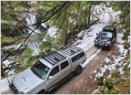 Northwest truck part swap thread
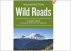 Washington State "Wild Roads" book
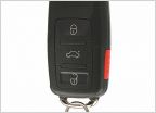 Portland Auto Locksmith Recommendations
Planning an Oregon/Washington trip, need some input!
Discussion in 'North West' started by the_dau, May 19, 2017.