1. Welcome to Tacoma World!

    You are currently viewing as a guest! To get full-access, you need to register for a FREE account.

    As a registered member, you’ll be able to:
    • Participate in all Tacoma discussion topics
    • Communicate privately with other Tacoma owners from around the world
    • Post your own photos in our Members Gallery
    • Access all special features of the site

2017 BAJA EXPEDITION #6: Southernmost Baja (14 days/ 3,000 miles)

Discussion in 'Trip Reports' started by David K, Aug 15, 2017.

  1. Aug 15, 2017 at 4:11 PM
    #1
    David K

    David K [OP] Well-Known Member

    Joined:
    Jun 27, 2009
    Member:
    #18969
    Messages:
    12,356
    Gender:
    Male
    Pala Mesa, California
    Vehicle:
    2010 4WD Off Road DC
    Differential Breather Mod Light Bar: 4 Cree LED lamps Bilstein 5100s Ride Rite Air Bags
    DAYS:

    1) San Diego North County to Shell Island (south of San Felipe), 298 miles (via Mexicali).
    2) Shell Island to El Datil south, 396 miles.
    3) El Datil south to Lopez Mateos, 229 miles (via La Purisima & Comondu).
    4) Lopez Mateos to Dolores Overview, 201 miles (via Pto. San Carlos, Mission San Luis Gonzaga, La Pasion).
    5) Dolores Overview to La Paz, 181 miles (via La Soledad, San Evaristo, tire slow leak).
    6) La Paz (Tire repair, a rest day otherwise)
    7) La Paz to Todos Santos, Los Cabos, La Ribera, and back, 272 miles.
    8) La Paz to Tecolote, La Ventana/El Sargento, Punta Arena, San Antonio, and back, 177 miles.
    9) La Paz to Punta Conejo and La Aguja, 88 miles (Days 9 & 10).
    10) La Aguja to Punta Marquez, Conquista, and back.
    11) La Aguja to Constitucion (dead battery), Agua Verde Overview, Bahia Concepcion, 285 miles.
    12) Bahia Concepcion to Mission Guadalupe to Punta Chivato, 135 miles.
    13) Punta Chivato to Shell Island, 392 miles.
    14) Shell Island (south of San Felipe) to North San Diego County, via Tecate, 292 miles.


    DAY 1 (Tue Aug 1, 2017)

    On the road at 8:05 am, heading east for Calexico/Mexicali via I-8.

    Exchanged dollars for pesos at 17.35 pesos: 1 dollar. Making 100 pesos = US$5.76

    The border crossing was simple, I got the green light [red light means you get inspected, it's either random or someone decides?]. As I already had a validated FMM (Tourist Card), no need to stop at the INM (immigration) office, once inside Mexico.

    At 12:20, I stopped to have lunch just south of Mexicali, at the restaurant 'Yocojihua' (Km. 12) having been reading good reviews for it on Baja Nomad. I had 4 tacos dorados (2 beef & 2 chicken) with rice & beans and a Jamaica drink for 115 pesos + tip (25 pesos). It was a very good lunch and start for Baja food!

    Gasoline at Km. 184 'ejido' Pemex, near San Felipe, was 15.86 pesos per liter (=US$3.46/ gallon) for Magna (87 octane). The Oxxo market had a deal for Tecate Light beer, 9 cans for 101 pesos (65 cents each). That deal improved the further south I got (10 cans for 95 pesos or 55 cents each). The time was 2:17 pm.

    Cans to avoid broken glass in the ice chest. However, later on... all the rough dirt roads did a number on 2 cans, causing them to leak! If I am not on the road for a day, then an ice cold bottle or two of Pacifico is perhaps my favorite drink in Baja?

    I arrive on Shell Island (access is 22 miles south of San Felipe) and go about a mile up the beach to camp. The truck not being as heavily loaded as other times was able to do the drive on the deep sand without deflating (thus saving me the work of putting air back in, in the morning).

    It is 4:30 pm and my simple camp is set up... a folding chair, a cot, and the stars above. Only a sheet is needed as the summer nights are warm.

    DAY 1 PHOTOS:

    IMG_6340_97001951c9c1d49b6ccea585c72524b09d8dd4ce.jpg
    Km. 12, south of Mexicali

    IMG_6342_e3a76a40bbeeddec6dd53b7e3c5fc2c7e06743fb.jpg
    On Shell Island, Km. 26, south of San Felipe, looking north...

    IMG_6343_4a8ac7ad4d10c3892493935fd1271828548352aa.jpg
    Looking south...

    IMG_6344_dfd9557b1d03b586219678dbfdd3bbeea82e48ea.jpg
    Shell Island as seen from the Sea of Cortez!

    I enjoy a couple swims before the sun sets behind the Sierra San Pedro Mártir, just south of Diablo Mountain.
    Total miles today: 298
     
    Last edited: Aug 16, 2017
    mjp2, tcBob and grdgz97 like this.
  2. Aug 15, 2017 at 4:55 PM
    #2
    David K

    David K [OP] Well-Known Member

    Joined:
    Jun 27, 2009
    Member:
    #18969
    Messages:
    12,356
    Gender:
    Male
    Pala Mesa, California
    Vehicle:
    2010 4WD Off Road DC
    Differential Breather Mod Light Bar: 4 Cree LED lamps Bilstein 5100s Ride Rite Air Bags
    DAY 2 (WED AUG 2)

    Being in a place where the sun rises over the sea instead of a mountain range means it gets light sooner. I was actually packed and left camp at 6:12 am!

    I arrived at Bahía San Luis Gonzaga Pemex Station (Km. 147+) at 8:00 am. I topped the tank (108 miles from the last topping) so I could drive worry free to San Ignacio. Magna here was 16.36/liter ($3.57/gallon) and pumped in 25 liters (6.6 gallons). For those who are wondering, dollars are accepted everywhere in Baja. It is often easier to have pesos for trip expenses and takes away any confusion on money. Mostly that you will get pesos in change if you don't have the exact amount in U.S. money. This remote Pemex was offering a good rate of 17.00 pesos per dollar. Further south, that rate dropped to as low as 16.00 per dollar.

    The end of pavement was unchanged from 2014, 12.5 miles south of the Gonzaga Pemex, just beyond the Km. 167 post.

    A side note: There was a Km. 170 sign here for a couple years, even though it was 1 km. south of the Km. 166 post. THAT has been fixed!

    I pass Coco's Corner, Mile 22.6 from Gonzaga/ 10.1 from the end of pavement, at 8:50 am. I reach Highway 1 (Laguna Chapala) at 9:28 am. Mile 35.7 from Gonzaga, (23.2 unpaved miles).

    At the Eagle Monument, near Guerrero Negro, is the state border between Baja California and Baja California Sur. The only 'big' deal here is being charged 20 pesos to drive over an insect spray strip and losing an hour on the clock going into Mountain Time Zone. 11:30 am becomes 12:30 pm!

    I arrive in San Ignacio at 2:09 pm Mountain Time. Pemex station to fill the gas tank for the long drive ahead...
    16.27 pesos/liter here. My highway mileage is about 17 mpg... providing the gasoline pump amounts are correct... and sadly, many stations are known to not be. That is just the nature of things... Baja is still so worth it.

    Across from the Pemex station are some small eating places. The burrito/taco one is really good. I tried the sea food one today, Mariscos San Ignacio. I had some great shrimp tacos and ceviche of mixed seafood. Totally great.

    It is 1.6 paved miles from the highway into the town plaza at the giant, stone mission (founded in 1728). This mission of San Ignacio appears on the cover of my book...

    I will continue this day's report soon...

    DAY 2 PHOTOS Part 1:

    IMG_6347_fff38dc2e3d2021915eb17a31d85aabf94d38ee3.jpg
    Sunrise from Shell Island

    IMG_6348_d381ce639feb3577d328cb451e0c87e59610537a.jpg
    Rancho Grande Market (across from the Gonzaga Pemex) has a new sign.

    IMG_6351_85fc3e8b715a7a4792a95af085ad63476546fe48.jpg
    New highway construction south of Gonzaga Bay.

    IMG_6357_63cbb473240c99b538b2944a74d923b5d25313e2.jpg
    Hotel sign at Eagle Monument.

    IMG_6358_888a8638bb0e7effe090583a416b1181fdfe989a.jpg
    Eagle Monument on the state border, erected in 1973, 140 feet high, harder to see with trees military base buildings, and giant flag distraction.

    IMG_6359_9a4dcfd0526a8012b19dbff19e71e9409d0d2d69.jpg
    Oasis of San Ignacio, in the center of Baja.

    IMG_6360_1f78e0bcc4699f35ffe9c818e4d103d3ad4c4ac8.jpg

    5b8154d0-ed81-4f09-93bf-8c8315d8d59f_ba7012b5601274baacdebd790a13004bf8c7cf5c.jpg
    San Ignacio stone mission on my book's cover.

    Much more of Day 2 to come!
     
  3. Aug 15, 2017 at 5:09 PM
    #3
    TireFire

    TireFire Superunknown Member

    Joined:
    Feb 6, 2016
    Member:
    #177349
    Messages:
    7,435
    Olympic Peninsula
    Subbed. I live in SD also. Why don't you just bomb down the 1 from Tijuana?
     
  4. Aug 15, 2017 at 5:13 PM
    #4
    TACOVRD

    TACOVRD I Identify As A Prius

    Joined:
    Jul 11, 2015
    Member:
    #159264
    Messages:
    6,438
    Gender:
    Male
    First Name:
    TW Addict
    AZ/WA
    Vehicle:
    2019 T4R ORP - Formerly 2013 DCSB OR Spruce Mica
    Workin' on it....
    Subd!
     
  5. Aug 15, 2017 at 5:17 PM
    #5
    David K

    David K [OP] Well-Known Member

    Joined:
    Jun 27, 2009
    Member:
    #18969
    Messages:
    12,356
    Gender:
    Male
    Pala Mesa, California
    Vehicle:
    2010 4WD Off Road DC
    Differential Breather Mod Light Bar: 4 Cree LED lamps Bilstein 5100s Ride Rite Air Bags
    Several reasons!
    1) It is faster (time-wise) to go down Hwy. 5 via Mexicali & San Felipe for central and Southern Baja.
    2) Far less stress because you have no city of Ensenada to cross over, no mountain winding roads, no San Quintin Valley (farm towns) traffic and the many other towns south of Ensenada.
    3) Far less highway traffic, which may change once the final miles are paved... being that using Hwy. 5 is a shorter route to the rest of Mexico from Central Baja.
    4) I like camping on Shell Island as a first and last place to stay on a long trip to Baja Sur.
     
    Last edited: Mar 5, 2019
    grdgz97 and TireFire[QUOTED] like this.
  6. Aug 15, 2017 at 5:19 PM
    #6
    TireFire

    TireFire Superunknown Member

    Joined:
    Feb 6, 2016
    Member:
    #177349
    Messages:
    7,435
    Olympic Peninsula
    Thanks, guess is gotta try that next time. Plus driving on some dirt is always fun. Usually no dirt until after San Ignacio
     
    Sloth likes this.
  7. Aug 15, 2017 at 11:05 PM
    #7
    David K

    David K [OP] Well-Known Member

    Joined:
    Jun 27, 2009
    Member:
    #18969
    Messages:
    12,356
    Gender:
    Male
    Pala Mesa, California
    Vehicle:
    2010 4WD Off Road DC
    Differential Breather Mod Light Bar: 4 Cree LED lamps Bilstein 5100s Ride Rite Air Bags
    Gas tank full, my stomach full, on south I go!
    Setting the odometer to zero in front of the mission, I head for Laguna San Ignacio, a popular whale watching location, in season. Closed-up to tourism off season.

    The road has been paved to about 5 miles from the lagoon shoreline.

    REVISED ROAD LOG

    The mission and town plaza is 1.6 miles from Highway 1. Continue straight, passing in front of the mission church, passing the market and hotel La Huerta, the paved street curves left, passing the Hotel Posada. Pavement ends briefly.

    Km. 0 This marker sign is 0.6 mi (1 km.) from the mission/plaza. Pavement begins in 500 feet.
    Km. 9 Rancho El Batequi
    Km. 12.5+ Rancho San Juaquín Km. 16.5 Road left, signed to San Vicente. Km. 19.5 San Zacarias
    Km. 29.5 Road left to El Patrocinio (35 kms.)
    Km. 47.5+ End of Pavement (30.1 miles from the mission/plaza). The road ahead is an elevated roadbed, over the salt pan.

    The following are mileages from the mission/plaza in San Ignacio:

    34.7 Bypass road south, avoids whale camps and village. Signed San José de Garcia. Log goes on right branch, to the lagoon.
    36.1 Pachico’s whale camp entrance, on right. (Pancho's on the map, in error)
    36.2 Lagoon shore.
    38.8 Fork, keep right. Left goes into village.
    40.2 Crossroad. Antonio’s Camp is to the right, Kuyima Camp is 0.4 mi ahead. Turn left (east) to continue south. Operations open during whale watching season. Typically, that is December-April.

    40.9 La Laguna village, pass through to far side. Several optional roads come back together.
    42.8 Join graded bypass road from Mile 34.7, above.
    46.7/ 0.0 Major Fork. Small sign “Salina” here. The left branch is the high road via Rancho Cuarenta and the access to San José de Garcia. The low road returns to the high road after 39 miles. This road log uses the more popular low road, longer but smoother driving, if dry. Reset odometer to zero.

    The washboard surface begins very bad, but soon improves. Deflating tires by ~30% improves the ride and traction off the pavement.

    14.7 Abandoned building and many high poles now serving as osprey nests mark a former desalinization project. The road soon reaches the salt flats. It is advised to avoid any shortcuts across the flats and stay on the route that follows the desert’s edge.

    22.2 El Dátil fishing village. Limited supplies.
    32.0 Sand dunes near the south end of salt flats. The road begins to turn inland.
    35.1 Rancho El Datilón. The road soon turns south and crosses an arroyo.
    41.7 Junction with high road coming approx. 39 miles from the fork at Mile 0.0, above. Turn south for San Juanico and on to La Paz.
    46.7 Rancho La Ballena at Arroyo San Raymundo. The mountain road from Mulegé came in here, but recent storms may have altered the route.
    52.8 Cadeje an oasis village with an airstrip.
    61.0 San Juanico town entrance. Motels, restaurants, supplies. Popularly known as Scorpion Bay by surfers. Paved road south to Las Barrancas and on to Ciudad Insurgentes and Highway 1 to La Paz or Loreto.


    10 miles south of El Datil, are sand dunes to the west and the end of the salt flat driving. I make camp in the sand dunes at 6:48 pm.

    REVISED MAPS:

    bb6a28e6-d5c8-41ef-ac4f-4381a216c89f_835c815a69895799ada3b3d87707f78f08294f94.jpg

    9b602dc5-17b8-4577-ade7-6eaf277c74fb_d252dc38db0485a0a34c0cd867e031b2cb35935c.jpg

    2cee18a2-cdfa-4891-a0c8-0ef0803ed151_1f2aa6261b1ce62560ce2392ffb1897e9280ed7d.jpg

    2cb60c4a-6926-4bfa-bad3-79c92995e671_e596e6092250034b5a78fe6b4c3c43c68eb794e5.jpg
    The more direct, original dirt road between San Juanico and La Purísima is between the red pointers, along the paved roads. The north end has the blue truck symbol. The dirt road is approx. 20 miles long between the arrows. Another access is when the new highway reaches the edge of Estero San Gregorio, reducing the dirt drive to La Purísima to about 12 miles.


    PHOTOS:

    IMG_6361_fb88579c3117f21de061e030989a6a49dd7d7b2a.jpg
    El Patrocino road jcn. Km. 29.5

    IMG_6362_24708eefabbdc32a18b707e2af14632b8a0c82b0.jpg
    Km. 31

    IMG_6363_a946d945a79351e29679b43aa4bb696e89165a58.jpg
    Unpaved road, easy.

    IMG_6364_646d50e1be137e94211b3769e0eb151771aa8b16.jpg
    Lagoon shore

    IMG_6369_0fba064e115cf550a7ff8227739e3f1b0f1c6272.jpg
    Salina Road Fork

    IMG_6370_2919bbaad576063a8dcfec9c26a693a3c452ad16.jpg

    IMG_6371_7c721ffefbb4db71e838856c45ba06e89e2aa1a1.jpg
    Tall power poles converted to osprey nests at ex-daslinization plant.

    IMG_6372_1e86cb533d22d456623974144a9bef4da2416de2.jpg
    El Datil boats

    IMG_6373_132e020425605fbde5f652cc3ed8c025a2133182.jpg
    Sand Dunes

    IMG_6375_a5ed5e3e48d06c1c41a37264a75e52712658c8a2.jpg
    My ride, 2010 Tacoma Off Road 4x4

    IMG_6376_1673066e943063d608556ae653cfd611de6724c9.jpg

    IMG_6377_62c5f264922fcd8ff90f33b9b1e564fd36b9cf86.jpg
    Camp Night 2.
     
    Last edited: Jul 7, 2021
    grdgz97 and TireFire like this.
  8. Aug 16, 2017 at 7:48 AM
    #8
    David K

    David K [OP] Well-Known Member

    Joined:
    Jun 27, 2009
    Member:
    #18969
    Messages:
    12,356
    Gender:
    Male
    Pala Mesa, California
    Vehicle:
    2010 4WD Off Road DC
    Differential Breather Mod Light Bar: 4 Cree LED lamps Bilstein 5100s Ride Rite Air Bags
    Perhaps just a moment to familiarize with the 800 mile-long peninsula of Baja California and where I ended each day? Day 14 was the drive home...

    24d9b2aa-4819-4ac0-91d0-d33efc437fb2_45a3e2f780e9d3fd9ee9395fe3a4b5365f445d45.jpg

    2,946 Miles (Home to Home)

    DAYS:

    1) San Diego North County to Shell Island (south of San Felipe), 298 miles (via Mexicali).
    2) Shell Island to El Datil south, 396 miles.
    3) El Datil south to Lopez Mateos, 229 miles (via La Purisima & Comondu).
    4) Lopez Mateos to Dolores Overview, 201 miles (via Pto. San Carlos, Mission San Luis Gonzaga, La Pasion).
    5) Dolores Overview to La Paz, 181 miles (via La Soledad, San Evaristo, tire slow leak).
    6) La Paz (Tire repair, a rest day otherwise)
    7) La Paz to Todos Santos, Los Cabos, La Ribera, and back, 272 miles.
    8) La Paz to Tecolote, La Ventana/El Sargento, Punta Arena, San Antonio, and back, 177 miles.
    9) La Paz to Punta Conejo and La Aguja, 88 miles (Days 9 & 10).
    10) La Aguja to Punta Marquez, Conquista, and back.
    11) La Aguja to Constitucion (dead battery), Agua Verde Overview, Bahia Concepcion, 285 miles.
    12) Bahia Concepcion to Mission Guadalupe to Punta Chivato, 135 miles.
    13) Punta Chivato to Shell Island, 392 miles.
    14) Shell Island (south of San Felipe) to North San Diego County, via Tecate, 292 miles.
     
  9. Aug 16, 2017 at 9:05 AM
    #9
    David K

    David K [OP] Well-Known Member

    Joined:
    Jun 27, 2009
    Member:
    #18969
    Messages:
    12,356
    Gender:
    Male
    Pala Mesa, California
    Vehicle:
    2010 4WD Off Road DC
    Differential Breather Mod Light Bar: 4 Cree LED lamps Bilstein 5100s Ride Rite Air Bags
    DAY 3:

    The evening on the sand dunes was great. I could hear the sounds of the Pacific far in the distance. I saw only one vehicle heading north to El Datil on the Salina (salt flat) road before it got dark. I was about a half mile from the road and partially hidden by the dunes.

    Thursday morning, I was packed up and on the road at 8:30. My body was telling me it was still on Pacific time, as it seemed like 7:30!

    I passed a ranch, there was no sign with a name, but the map has El Datilón where it was. The road curves from east to south and crosses an arroyo just past the ranch. The map shows a road fork before the arroyo crossing, but it was not very noticeable. The road was graded and maybe obscured the fork.

    The map shows another ranch called El Batequi de San Juan on the south side of the arroyo, but there was none. This map (Baja California Almanac) is the best there is of Baja dirt roads, but it does have a few errors, as most maps do.

    Eventually, the road from El Datil joins the high road used to reach San José de Garcia from San Juanico and was the road that forked at Mile 46.7.

    The ranch of La Ballena is passed and the village of Cadeje is driven through. It has an abandoned army camp and an airstrip (with tires across the runway to prevent it from being used, just any old time).

    I came to a paved highway at the entrance to the town of San Juanico, also known as "Scorpion Bay" by surfers.

    Let me add some road log details to continue from yesterday:

    0.0 El Datil
    10.0 (approx.) Leave salt flats and head inland, eastward.
    13.3 Pass by a ranch (on left) and soon head across arroyo to the south.
    20.1 T Junction with the high road. Turn right (south) for San Juanico.
    25.6 Rancho La Ballena. The cross-mountain road from Mulegé had come in here, but a different route to Cadeje may be the best way after recent hurricane damage?
    31.9 Cadeje, a small village.
    40.4 San Juanico, "Scorpion Bay". Large town.
    Paved road goes south to Las Barrancas, 30.2 miles.

    I drive around San Juanico once and noted a couple restaurants. While I did see signs for a motel, I was not seeing much of anyplace that looked like one on my quick drive by. Maybe rooms in people's homes are rented? Like other surfer locations, maybe secrecy is strictly enforced to keep away newbies? LOL The surfers on the Internet have a strict code of silence! So as to not create "waves" I don't spend a lot of time at surfer locations and move on.

    The new-ish paved road to San Juanico from the south was in good condition to Las Barrancas. The 4.5-mile paved road from Las Barrancas to the Insurgentes-La Purísima road had some pot holes to dodge.

    Las Barrancas was the location of a German/Mexican solar energy facility many years ago, long abandoned.

    PHOTOS:

    IMG_6380_255e717762ecd335b2c86a20b8dbff2f0aa8b714.jpg
    T Junction (El Datil road meets the High road)

    IMG_6381_e0ecfef327f6b92c9c9e5ea18849c451a75a1efe.jpg
    Arroyo San Raymundo at Rancho La Ballena (just ahead on right).

    IMG_6383_457f79f4fe3d8cb601dc6aa3afb52ce39ec1048c.jpg
    Nearing Cadeje

    IMG_6384_c463ba4f067fb15b1f060a2f7cdadcca3b0af3d9.jpg
    Oasis at Cadeje

    IMG_6385_9b1ceaa58c2bb3d7d42434a8eb84a06a44cf6626.jpg
    Three miles to San Juanico

    IMG_6386_e209d890e9714abeb455aa3572cad1d20b880ca8.jpg
    Looking north from pavement at San Juanico.

    IMG_6387_2519007939dfc2e4a75bde4b8ea4a0226454f1c5.jpg
    Beach at San Juanico

    IMG_6388_7fa42dc4844a24666cbb5a69b2b64175772c1a30.jpg

    IMG_6389_26bc1f674e516036e12208a8d0b2d2324776b3a3.jpg

    IMG_6390_436e5dff1190a4ce62f616ce8b039dc84211987f.jpg
    30.2 miles south of San Juanico, at the entrance to Las Barrancas.

    IMG_6391_bffe2e1ef65db6416e541c6a87f3e2a293d3ff13.jpg

    IMG_6392_b7f4ab2c4aecb632e27729e906796f1c3a47f54d.jpg

    IMG_6393_70dc664cfb4d846397f9186f63b9840d88d3eb76.jpg
    Looking west at road junction.

    Coming up next: La Purísima, San Miguel Comondú, and López Mateos.
     
    bski22 likes this.
  10. Aug 16, 2017 at 5:40 PM
    #10
    David K

    David K [OP] Well-Known Member

    Joined:
    Jun 27, 2009
    Member:
    #18969
    Messages:
    12,356
    Gender:
    Male
    Pala Mesa, California
    Vehicle:
    2010 4WD Off Road DC
    Differential Breather Mod Light Bar: 4 Cree LED lamps Bilstein 5100s Ride Rite Air Bags
    DAY 3 Continued...

    It is 4.5 miles from Las Barrancas (the San Juanico highway junction) to the La Purísima/Insurgentes highway.

    I drive north to La Purísima to cover that highway. I drove into La Purísima from Comondú and La Purísima out to Hwy. 1 near Bahía Concepción already this year (TRIP #2, Feb.). I wanted to cover the paved road into town, for the guide.

    From the Las Barrancas road to the old, dirt San Juanico road, on the La Purísima highway, it is 12.5 miles. It is 4.2 miles more into La Purísima and to the restaurant Otho and motel Posada del Angel. The mission site is just a block beyond Otho and a block north.

    I have lunch at Otho from 12:10-12:50 and head south on the highway. lunch was fish dinner plate and a Jamaica drink for 150 pesos, with tip.

    16.7 miles back down the highway is the Las Barrancas road and 14.4 additional miles is Francisco Villa and the paved highway north to San Miguel Comondú. Like La Purísima, I previously went into Comondú from the north and east and wanted to cover the south, paved road, also.

    It is 22.6 miles to the entrance of San Miguel Comondú, where the blacktop becomes cobblestone. 0.2 mi further is the street to the right, passing the boutique motel Don Mario and continues on to San José Comondú, where the mission was from 1736 to 1827. The mission was founded in 1708, but 22 miles to the north and now called Comondú Viejo (see my TRIP #2 report).

    Just past the street corner, ahead if you don't turn right, on the left, was where gasoline from 20-liter containers can be purchased. The Baja Sur state government cracked down on independent gasoline sales, so no longer are signs posted where you can buy gas in towns without a Pemex station. You just need to ask! 20 liters was 380 pesos. Very fair if you consider how far it must be brought in from.

    Back south I go to Francisco Villa and continue southward on the highway to Ciudad Insurgentes. There are no pot holes or not many on the La Purísima or Comondú highways, but from Francisco Villa south, there are some! In 3 miles, however, a brand new, very wide paved highway begins, and lasts for 19.5 miles! There are 4 miles of older highway, then again a wider highway starts.

    Nearing Ciudad Insurgentes, I take the paved road west to López Mateos, a fishing town and whale watching center on Magdalena Bay. It is 20 miles to town. I drive around and go to the Hotel Refugio, recommended by 'Mula' on Baja Nomad forums, who has a home there. The hotel owner (Róman) was very nice and the room was air conditioned, very small, but comfortable at 350 pesos (=US$20.17). The WiFi only works in the dining room area, which was not serving food in the summer... because whales are not there then! I made a couple posts and checked email. I slept well... but the mosquitos got me when I was in the dining room area and outside.

    End of Day 3.
    229 miles traveled.

    PHOTOS:

    IMG_6394_72f9a4724813bbde137d3182973f13cffc4ba9e3.jpg
    Highway nearing La Purísima

    IMG_6395_98658eba756c9cc871610e46821c740254b25ef2.jpg
    El Pilon, the famous landmark near La Purísima

    IMG_6396_887b4a84095adb609b8ad1c62e9225a1bf662eee.jpg

    IMG_6399_46e6cc178d99ca53a27bfa9cd90cf7ed3e8de9eb.jpg
    Only a pair of tombs and a wall mark the once prosperous Spanish mission.

    IMG_6397_c9da0d5817c404290c9021a2ef1d0aaf08888d82.jpg

    IMG_6398_70cc0ff08355cbb1b27da24bf7e7513b3ba9e5d0.jpg

    [​IMG]
    The mission in 1906 (photo by Arthur North)

    [​IMG]
    The mission ruins in 1956 (photo from Howard Gulick)

    [​IMG]
    The tombs in 1956.

    IMG_6401_d003679ed230ea98e979c1bf75aa5782781e30c0.jpg
    I drive up to the cemetery and took this desert foreground photo of El Pilon.

    IMG_6402_3377d751b5a3810d7e2dc440d04745e6a92fcc3c.jpg
    The "El Camino Real" mission road as it comes to La Purísima from the south and east (Comondú, San Javier, and Loreto).

    IMG_6403_3a8048854c40bdce2dbdbb2603e3a07e96856c70.jpg
    This is the paved road north into San Miguel Comondú from Francisco Villa.

    IMG_6404_74f9c12623638b5a9e7b0578b9b389547b0be98a.jpg

    IMG_6406_b546cab8488b61283855db181a2ecb4a4eabbe57.jpg

    IMG_6405_1648c79aac9124a3b5aa1f3940eec2406accbb96.jpg

    IMG_6407_fa82175fcd7aff1604fdb35561b557109d33a4a4.jpg
    New, wide highway north of Insurgentes.

    IMG_6408_42d7a5e2c474c47b0bec32ac2f07eb9aee82a0ca.jpg
    López Mateos

    IMG_6409_82c6e7c76747f2e307d6c21d77805e73c5ede261.jpg

    IMG_6411_3f543466460eaab12b8a433f15cad6249c4e8b29.jpg

    Day 4, is a big one... stay tuned!
     
    hammertime4005 likes this.
  11. Aug 17, 2017 at 4:37 PM
    #11
    David K

    David K [OP] Well-Known Member

    Joined:
    Jun 27, 2009
    Member:
    #18969
    Messages:
    12,356
    Gender:
    Male
    Pala Mesa, California
    Vehicle:
    2010 4WD Off Road DC
    Differential Breather Mod Light Bar: 4 Cree LED lamps Bilstein 5100s Ride Rite Air Bags
    DAY 4-a (FRI Aug. 4, 2017)

    I am on the road at 7:43 am and heading away from López Mateos.

    I don't want to say too much about López Mateos because I was not there very long and didn't have any Nomads to show me the highlights. My son lived there for a couple months in 2012 working for Mag Bay Outfitters (their son and my son were best friends from 4th grade on and we used to take him camping with us to Baja and the desert). It is off season, humid, mosquitos, and most restaurants were closed... again no whales or tourists in the summer. There is a huge building that looked like a museum for whale watchers out at the dock where they must get on boats to see the beasties up close. Closed now, naturally.

    Back east to the Insurgentes-La Purísima highway where I turn south.
    1.1 miles south is a Pemex station and I fill up. 15.71 pesos/liter. Someone asked about the cost of diesel, and there, it was 16.48/liter.

    The junction with Mexico Highway 1 is 0.3 mi south of the Pemex (1.4 mi south of the López Mateos highway). I continue south on the now, 4-lane highway. Kilometer markers are not as consistent on some Baja Sur sections of highway and a lot of that is because of new highway widening and not getting around to replacing the markers. The corner of Hwy. 1 where the way to Loreto and to La Paz meet is Km. 0 going to Loreto and should be Km. 237 from La Paz (but I didn't see a marker until Km. 235 just over 1.2 miles south).

    The Puerto San Carlos highway (Mexico #22) was 15.9 miles south of Insurgentes, or about Km. 211.5. In fact, the Km. 212 marker was 0.4 mi north... so the estimating of missing kilometer marker locations works.

    I drive out the 35 miles (57 kilometers) to San Carlos and was quite pleased with the nice town appearance, the beach palapas just before town, and just a better feel for what was available there to serve visitors. I saw three hotels (motels): Mar Y Arena (at the entrance to town), Alcatraz, and the Brennon (with an Irish theme).

    At a market in the middle of town, I bought three bags of ice for my chest (60 pesos) as my ice from home was finally in need of supplementing. I also knew it would be awhile before I was able to get more. I only needed the ice for milk (cereal), Costco chicken/mozzarella/artichoke brats, and to cool the beer and drinking water.

    Back out to Ciudad Constitución I go and turn south on Mex 1. I top my gas tank as I am going off grid for a couple days. 19 liters (5 gallons) for the 94 miles since I filled at Insurgentes means I got 18.8 m.p.g. for the easy, paved driving.. and the station's pump was accurate! The station was at Km. 210.5, 1/2 mile south of the San Carlos junction, west side of the highway.

    For many years, many have reported the local police being extra alert for tourists who do not stop fully at the many stop signs... even pulling some over who did stop fully. I have never had that experience in this town and usually don't even see any cops. Maybe because I travel in the hot summer? However, this day there were trucks with machine gun mounts and labeled as Municipal Police (not military) cruising up and down the main street. Didn't affect me at all, but it was pretty extreme to see.

    The south end of town is at Km. 208, the 4 lane highway returns to two lanes, and an R.V. park and motel is at Km. 206.

    At Km. 195 is the road east to Mission San Luis Gonzaga, and beyond. Finally, back into the dirt! I drop my tires to 25 psi to soften the ride on this washboard, graded road. The road is quite good and I am cruising at 50 mph until some cement vados (dips) pop up after many miles and have me hitting the brakes! The dips are at mile 8.0, 9.4, 9.6 and 10.2.

    The only fork or turn in the road is at mile 12.3, and you go right. Ahead leads to a dam project (El Ihuagil).

    Arrive at the 1737 founded mission (stone church built 1753-1758) at mile 22.3 from Hwy. 1. There is much interest in this mission that is based on the writings of one of the long-term resident Jesuits who was stationed here, Johann Jakob Baegert, S.J. from 1751 to 1768. His 1772 book, 'Observations in Lower California', (translated and re-published in 1952) are full of details of the life of the Native Californians and the geography of California (what is called Baja California today). The church is one of the few intact Jesuit California missions to survive to modern times.

    Resting in the shade of the building next to the church were a man and woman on fat tire mountain bikes. It is Mike and Rebecca from Canada and they are riding the length of Baja, following the advice of this web page: https://bajadivide.com/ .

    After I got home, three days ago, I got an email from Mike with a link to his blog page with photos, posted from La Paz. He mentions how we met... and how I bumped into them again, two days later... Here is their story: http://www.zerotocruising.com/kenny-chesney-visit and what Mike wrote about our meeting:

    Our plan, whenever possible, is to find shade between noon and 3:30 (or later) and simply hide from the sun, and we took advantage of the walls of the building adjacent to the mision to do exactly that. As we sat enjoying our lunch, a lone gringo drove up in a pickup and began taking pics. We struck up a conversation with him and learned that David was not only a life-long fan of Baja California, but that he had written and published a book on the old missions of the region. And unlike us, he was actually working that day, researching material for his upcoming book, a new travel guide for Baja. After sharing contact details, we said farewell, and he continued on his way while we resumed hiding from the sun.

    I walk over to the mission dam and small lake it creates, take photos all around and after spending about an hour there, leave at 1:24 pm.

    My next goal is to see the mission site, typically called La Pasión. It was the final location (1741-1768) for the mission of Los Dolores, founded along the gulf coast in 1721. San Luis Gonzaga was a visita (satellite mission station) of Dolores before becoming a separate mission, with its own priest.

    The missions are a link to our past, our culture, and some of the oldest structures in California (Upper or Lower). I strongly urge anyone with interest into seeing the past of California, Mexico, or Spain to see the missions or just go to their locations, even if the original mission building is gone or in ruins. While I would appreciate if you purchased my book www.oldmissions.com, at least enjoy the data and photos on my web page at Vivabaja.com devoted to the 27 missions of Baja: http://www.vivabaja.com/bajamissions/

    PHOTOS:

    IMG_6417_d75c673eed79a48f6dd3f1f1f610d93e7c6f6e53.jpg

    IMG_6419_c5b25a9e29a0c3e5c2d59e2651d35df365647dfe.jpg
    Boat launch and palapas at bridge near San Carlos

    IMG_6418_1333665052db928116f9155dca86fb93490b8e4f.jpg

    IMG_6413_8dd3fee69ecd98cc91d085095ee581e300cc6185.jpg
    Entrance to Puerto San Carlos

    IMG_6414_4e18184e230744cdea67bd5da0734b5f134b7bce.jpg

    IMG_6421_7a248bd02bc246070c0103f040f7e724bcf57659.jpg

    IMG_6425_0273b976681bcc946c2d94a5c9c7d8f3eaf0360e.jpg

    IMG_6427_a54b7b4355433efca83633b6b85e7983bfe5305c.jpg

    IMG_6429_85179a02a215a48dc7707b6258b008d27698c9f7.jpg

    IMG_6435_cb738185ea8e08c1b776428ead685f9a8f94180a.jpg

    IMG_6436_0906545f7a989387727c89e074d217f7273165e6.jpg

    IMG_6446_ddfed8f9eda6b218337c015c9a11394e7bc83c31.jpg
    Mission church as seen from the dam.

    IMG_6445_89c28874582314bba78507678cdaa81371fc091f.jpg

    To be continued...
     
    bski22 and Drainbung like this.
  12. Aug 17, 2017 at 4:46 PM
    #12
    David K

    David K [OP] Well-Known Member

    Joined:
    Jun 27, 2009
    Member:
    #18969
    Messages:
    12,356
    Gender:
    Male
    Pala Mesa, California
    Vehicle:
    2010 4WD Off Road DC
    Differential Breather Mod Light Bar: 4 Cree LED lamps Bilstein 5100s Ride Rite Air Bags
  13. Aug 18, 2017 at 5:52 PM
    #13
    David K

    David K [OP] Well-Known Member

    Joined:
    Jun 27, 2009
    Member:
    #18969
    Messages:
    12,356
    Gender:
    Male
    Pala Mesa, California
    Vehicle:
    2010 4WD Off Road DC
    Differential Breather Mod Light Bar: 4 Cree LED lamps Bilstein 5100s Ride Rite Air Bags
    DAY 4-b (FRI, Aug. 4, afternoon)

    From Mission San Luis Gonzaga, my next goal was La Pasión, the final location of Mission Los Dolores. It would be less obvious to find being that any walls have long ago fallen, and a goat ranch, La Capilla, was operating on the site.

    The road headed south from San Luis Gonzaga and there are many forks and no signs to give a hint. I did have live tracking both on my inReach device and on my smartphone with the Earthmate app (pretty good Baja maps, considering).

    There was a junction I had pre-marked, but instead of right (which was in the wrong direction but the better road to use, I think), I took a left going towards my goal. I did get there okay, but it went a little more north before returning to the watershed I was intending to follow to La Presa and La Pasión.

    I will do a little road log and compare to satellite and maps, then try to show my route on maps... This is fun for me and if you don't go to unexpected places then you might not see unexpected and cool things!

    Total (Partial) Miles
    0.0 (0.0) Mission San Luis Gonzaga (1:24 pm)
    5.3 (5.3) Curve right, ranch on left.
    7.4 (2.1) Ranch house (El Plátano?), concrete creek crossing, oasis.
    8.1 (0.7) Fork, main travel goes left.
    8.9 (0.6) San José de la Palmita (?)
    10.2 (1.3) Ranch, process building, road junction.
    12.2 (2.0) Ranch
    15.5 (3.3) T intersection. Rancho Merecuaco is 0.4 mi right (south). Go left.
    19.4 (3.9) Weather Station, ranch houses.
    20.0 (0.6) Big arroyo crossing (Arroyo San Pedro on AAA map, Arroyo La Presa on Baja Almanac).
    21.6 (1.6) Major Graded Road (3:22 pm)
    22.5 (0.9) Road right signed to El Chicural & Aguajito.
    24.9 (2.4) Rancho Cantarana
    26.8 (1.9) Rancho La Presa (closed to visitors)
    27.3 (0.5) Junction. Ahead to El Solano & San Evaristo. Left to La Pasión, Santa María de la Toris, Los Burros. Turn left.
    29.1 (1.8) Ranch on left and a road to the right crosses arroyo to the mission site. Turn right, cross arroyo. If ranch gate is closed, turn left just past and drive along the fence to get to the other side of the ranch house.
    29.3 (0.2) Rancho La Capilla and Mission Los Dolores Chillá (La Pasión) ruins. The ranch owner, 'Modesto' tells me visitors are welcome!

    PHOTOS:

    IMG_6447_3477dba2736206eec8484d16d6e920c32c8e315d.jpg

    IMG_6448_e3e65de506724655479382786b4d21cc0d851825.jpg

    IMG_6449_78ec1ca732c0ca08e3071a4611829f4912f6927b.jpg
    I call this double hill, La Tortuga!

    IMG_6450_1f0d3270390ab853034fe5b40ac88955f1143c7e.jpg

    IMG_6451_f67f57834a83002e1d8e407f17569da85c83e2a3.jpg
    (note to my BajaNomad.com forum amigos: I am also sharing on TacomaWorld.com forums and they like to see Tacomas)

    IMG_6452_bd1685c1a51f2a12ae10dc2056c59fec8e80874f.jpg
    Rancho La Presa, a historic ranch and had advertised as a guest facility under the name "Mission Dolores". It was closed to outsiders today. Their Facebook page has been inactive for 2 years and their website is no longer on line.

    IMG_6454_7f59c38c56f70f8bc8b86be02ccbbbcd5db363f1.jpg
    Crossing the arroyo to the mission site, a large white bird in the creek.

    IMG_6455_86aa94622e36e945950294253a7d79255d51f17d.jpg
    The Dolores mission was moved here in 1741. However, the location had been the visita of La Pasión before then.

    IMG_6456_47a611171e8260776332227def3eeb196f3e4303.jpg
    There was much more at the site than I had expected or seen in Jack Swords' or Baja Okie's photos (or remember seeing)!

    IMG_6457_0f66f89f87ae0cdf8a06d742b8d410269deff7ee.jpg

    IMG_6458_d0015e6823fa2cf5dedeb355699831dce2f50273.jpg
    Primary site, the round-topped hill in the background can be seen in a 1950 photo when a wall was still standing here.

    [​IMG]
    Photo from Marquis McDonald in 1950

    [​IMG]
    Photo from Jack Swords in 2000.

    IMG_6459_52b40465cee51995eedf70251900a4120e475e7b.jpg

    IMG_6460_316964927821459098d09e6d2278e842e311649b.jpg

    IMG_6461_6e7e2e8d095d585730ec780ff55ccec045a52c7e.jpg

    IMG_6462_e77f2567d69f46233fbd305ebb37b090c704a7ed.jpg

    IMG_6463_90be2097e0e2e2f2a1d2e6c67da786746aa84d65.jpg

    IMG_6464_e3d73c9bb01b53c2d275281994cabb21f59080cd.jpg
    There were foundation lines everywhere... I didn't even realize I parked on a site until I walked back to my truck!

    IMG_6465_02d87da4f6ebbc0d0b0a88d2557a57cf9fe9b2ba.jpg
    Here is that hill, just east of La Capilla/ La Pasión, as seen in the 1950 and other photos.

    IMG_6467_9084155d0c055e7bd8a79137db86cc55ff45618d.jpg
    The view to the site (on the right), across the arroyo, from the graded road going east.

    IMG_6466_c9502a521fde1782bc8e8e6dcb9718b1dc090f69.jpg
    Between the pila on the low hill and the goat ranch, La Capilla.

    From here I go on to see if I can get a clear view of the first Dolores mission buildings, near the gulf coast, but way down in a canyon!

    STAY TUNED! I will create some maps to go with my drive this afternoon.
     
    Last edited: Aug 18, 2017
    tcBob likes this.
  14. Aug 19, 2017 at 12:49 AM
    #14
    David K

    David K [OP] Well-Known Member

    Joined:
    Jun 27, 2009
    Member:
    #18969
    Messages:
    12,356
    Gender:
    Male
    Pala Mesa, California
    Vehicle:
    2010 4WD Off Road DC
    Differential Breather Mod Light Bar: 4 Cree LED lamps Bilstein 5100s Ride Rite Air Bags
    Scan0218_8069c7dc59bbc279fa9ac056b1a9983f4c09809d.jpg

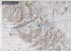
    My route is highlighted... a few dashed lines and pointers added to help me follow the route as I was matching with my GPS track onto the Almanac map.
    La Pasión is incorrectly shown by Merecuaco. It is at La Capilla, 2 miles east of La Presa (where the two yellow highlights meet). La Capilla is on the south side of the road, not north, as shown. Past La Capilla, 'Toris de la Presa' was called Santa María de la Toris on the road sign.

    The 2003 Baja Almanac
    d6e1bf5c-da5b-47e1-8f8b-44339dd741c3_9769fc3dfa90d67cb4cbb52f7e6c7715a5203cb8.jpg
    It had a trail shown as a major graded road, south of La Presa. Blurred it away.

    Here is the mission region from space:

    La20Pasion-2_498cc6a5c0670ed446dd961a5c2cdedb391090f3.jpg

    Zoom in:
    La20Pasion-1_ba9695c57828b618a31c61f0276ef9dff2190456.jpg


    La Pasión was the visita location name. When Mission Los Dolores relocated to La Pasión, the missionaries generally referred to it by the location name, not the official mission name (Nuestra Señora de los Dolores Chillá, and sometimes as Dolores del Sur as there was a visita named Dolores, near Loreto).

    The same thing occurred at Todos Santos, which was the visita name. When it was elevated to a mission, the official name was Santa Rosa de las Palmas, but the location name 'Todos Santos was used. When the La Paz mission moved to there, it replaced Santa Rosa, but it was more often called Todos Santos, still!

    Clearing up these mission names was one of my book's goals.

    Hey, this is just Day 4, afternoon... I am still going to look for the Dolores Overlook, drive down to the gulf coast (Los Burros) and camp.
    That part changed... Part 4c coming up next... and 10 more days to go! Hey, relax... I didn't work this hard every day, I had two easy days of the 14! I did go to a doctor today about some neck pain the crept up during the drive...
     
  15. Aug 19, 2017 at 11:30 AM
    #15
    David K

    David K [OP] Well-Known Member

    Joined:
    Jun 27, 2009
    Member:
    #18969
    Messages:
    12,356
    Gender:
    Male
    Pala Mesa, California
    Vehicle:
    2010 4WD Off Road DC
    Differential Breather Mod Light Bar: 4 Cree LED lamps Bilstein 5100s Ride Rite Air Bags
    Having my fill of the old stones and foundation outlines from this long ago Spanish California mission, I moved on east (well northeast) to see how close I could get to the Dolores overlook.

    Mission Nuestra Señora de los Dolores Apaté was the 9th California mission, founded in 1721. It was the result of the failure at the Ligüí
    /Malibat mission location (1705-1721). The benefactor for that mission (the third in California) suffered bankruptcy and his funds dried up. The Jesuits kept the mission going but it was in a bad location and was raided often by hostile Pericú Indians.

    When new funding was found, the mission also began anew, far to the south of Ligüí and with a new name. First established close to the beach, where shallow wells provided fresh water (probably where Rancho Dolores is today), within two years, the mission was moved into the canyon just east of the beach about 2 miles away.

    Ruins with standing walls have survived at Dolores Apaté along with other walls, a man-made storage cave, irrigation canals, etc. No road goes to Dolores, so one must get there from the sea or hike down a very steep Camino Real trail from above. This isolated location did not serve the Guaycura Natives who lived beyond the canyon, so Padre Clemente Guillén had long desired to move the mission, and he did in 1741, to La Pasión. That site was known to the Indians as Chillá or Tañuetía (The Place of Ducks).

    My time limits and energy availability prohibited me from making the 1,000 foot drop and return from the location down there. I would have to try and find a point on the ridge that the road to Los Burros comes close to and see if I could get a photo from above, as others had done.

    The hike was short to the first place I could see the site, but it wasn't ideal. I tried to find another vantage point and came across a dead coyote. Reaching for my camera, in my pocket, it wasn't there!!! PANIC!!!

    It was late, the sun was nearing the horizon and I was bush whacking near the cliff edge for a photo op. How did it get out of my pocket!!??

    Well circling back between the thorny plants I finally found it. A young ocotillo-like plant grabbed the camera leash, that was dangling out of my pocket. I saw my camera hanging on the small plant, above the ground. Wow, relief!

    I took more photos of what I thought were the ruins, my eyes are not so good anymore, but when I looked at the zoom image on my camera, it seemed I got it.

    I got my truck turned around on the very rocky road. I originally had hoped to go down to Los Burros (Ensenada Cortez) but the one steep grade to this point was really bad and I was no longer feeling like another steep drop to go down, then back up the next morning. I drove back westward and found a bit of a sandy arroyo to put up my tent. The tent was to protect me from bugs if there were any. Mosquitos love me and all the B vitamins in the world don't deter them. The sun was going down, I made my dinner of brats from Costco, and all was good.

    The next morning, after seeing on the GPS/map I am very near another possible view point of the mission, I drive just 1/4 mile back east, see the path to the north and it is drivable for about 500 feet. I hike the remaining distance to the cliff egde and take more photos. I have not (until now) examined those photo... So we are all seeing what I got today, for the first time! Cross your fingers...

    PHOTOS:

    IMG_6468_6c10b5ed69d64152f1bc5c0de6bcd400c2c53c41.jpg
    View of Rancho Dolores trees, Gulf of California (Sea of Cortez) and islands.

    IMG_6469_603caaa63d2ddf41c81c579cdd422f1f6c41434c.jpg
    View up the canyon to where I think the mission ruins are about.

    IMG_6470_0dac3b2436a18f573cf59b3331bac4cbf61099db.jpg
    View closer to the coast, looking north.

    IMG_6471_e7e8e1b3ff4080958e405a5376bc0a47461c0b13.jpg
    First zoom attempt. That square corral I knew was near the ruins.

    I need to find a better spot along the cliff... I lose my camera... find it... and take a photo of the coyote, which probably saved me from losing my camera forever!

    IMG_6472_f54f1eed3f5e01c71d3daa70fb3b700de1737dbc.jpg

    The new spot was not better, so I return to my truck and go find a camp spot. Here is the photos from Saturday morning after hiking to the edge of the gint cliff...

    IMG_6473_aed4087468ac1cf993f2f561624c1785064691d0.jpg

    IMG_6474_5e275aad11a8b97c6c62283815fa2dfcf8ea47ef.jpg

    IMG_6475_8f34beeab13946c6bdcb27f24f661b896bf6ee06.jpg
    Cliff face and Sea of Cortez... morning sun washing photo a bit.

    Now, for the mission:

    840fa353-4b35-48b2-b8dc-19d8a209bca1_cdef609f29d083ea3d32d36063bd5e1bfb39ae0f.jpg

    IMG_6476_042ac5fc43a6b4f65b98ad9be63430e8aa1dae79.jpg
    EUREKA! That's it, left of the square corral walls.

    14dc55a3-9573-46b6-8234-4e997a98b247_828d4220472a0ebb6c366c2dd1c969406bab93fa.jpg

    IMG_6478_7009f342403f58f6400de1fc262e419a78480be3.jpg
    That pointy hill helps spot it. Here is a regular view from another spot.

    Dolores20Zoom_bbaf84be49cc5acb644eb447301b7685a2f42fcf.jpg
    Okay, check...
    Here's a better photographer's (Jack Swords) view, with a better camera, a few years ago, March 2001, a different angle too:
    Jack%20Swords%20Photos%20135_3e7b8ed84a63410f733b83f6f9b8d79f19234c3e.jpg

    Coming up next, the long crossing of the mountains, seeing Mike and Rebecca again (the Canadians on bikes), a low tire pressure light comes on, and the steep drop to San Evaristo... and on to La Paz!
     
  16. Aug 19, 2017 at 12:35 PM
    #16
    David K

    David K [OP] Well-Known Member

    Joined:
    Jun 27, 2009
    Member:
    #18969
    Messages:
    12,356
    Gender:
    Male
    Pala Mesa, California
    Vehicle:
    2010 4WD Off Road DC
    Differential Breather Mod Light Bar: 4 Cree LED lamps Bilstein 5100s Ride Rite Air Bags
    Here is the 2010 AAA map with my route highlighted and some road edits, explained below the map:

    Scan0220_85fb4b3d38234fac7f8267e2da93a34653491ad5.jpg
    Edited to show road I was on (6.1 mile section) that continued beyond the 1.5 mile section of poor road on the AAA map. That spot = T junction for Rancho Merecuaco. The 'new section' goes 6.1 miles looping around La Tortuga hill, crossing Arroyo San Pedro/La Presa, and meeting the graded road. It was 5.7 miles east to the La Pasión junction. I subtracted 5.7 from the AAA's 11.5 giving 5.8 miles on the balance of the graded road going west.
     
  17. Aug 20, 2017 at 1:15 AM
    #17
    David K

    David K [OP] Well-Known Member

    Joined:
    Jun 27, 2009
    Member:
    #18969
    Messages:
    12,356
    Gender:
    Male
    Pala Mesa, California
    Vehicle:
    2010 4WD Off Road DC
    Differential Breather Mod Light Bar: 4 Cree LED lamps Bilstein 5100s Ride Rite Air Bags
    DAY 5 Saturday, continued...

    Well, I was satisfied after all those bumpy miles and hiking to see the 1721-1741 Dolores mission. Back to my truck and return to the road past La Pasión. On the north bank of the arroyo, before Rancho La Presa, is an aqueduct used to bring water to the old ranch from the water source at La Pasión. The ranch was the property of one of Baja's first Mexican governors during the transition period in the 1820s, Fernando de la Toba. He is buried there. Jack Swords managed to see the grave as well as the impressive aqueduct. Two pages of photos beginning here: http://www.vivabaja.com/swords/page4.html

    From Jack Sword's:
    The governor's grave:
    [​IMG]

    The aqueduct:
    [​IMG]

    I could see that aqueduct on Google Earth and where I could park my truck and hike to it...

    IMG_6490_53258bd9dc8358cee48dc9d4a739268ba842489b.jpg
    See it?

    IMG_6491_68bfa7fcccc4405b5c36a3d5536a482918e5a34c.jpg

    IMG_6492_876148ec61fca0a9115fb0b7fc61f4f9245ffc26.jpg
    So, 1936 was a leap year?

    IMG_6493_77847adc5569d592b29ca7c90ae0fe855e12d7a5.jpg
    Very cool even if this isn't over 100-years old.

    IMG_6494_16c136a5f2a098710c05baabaf9fff39fcbeae31.jpg
    ~Km. 56
    Back at the major graded road, near La Presa. I am turning left here. Set odometer to 0.0

    4.8 miles: I come to San Pedro de la Presa. AAA map says 4.7, so we are close!

    IMG_6495_b366fc5b08348fc3c6647ea887022e077b3a8240.jpg
    Km. 63.5

    IMG_6496_5dd13c995829dd89f44176262b38f5712d732211.jpg

    7.4 miles: Rancho Las Animas was 2.6 miles from San Pedro de la Presa, at Km. 68.

    Some pretty wild mountain country and a few big grades were concrete surfaced. This big one was 2 miles from Las Animas, at Km. 71+:

    IMG_6497_426cc1fa3effd9822fa1bd1cd59219f67315324a.jpg
    9.4 miles

    IMG_6498_21233edb95c176bf31ac2a7d4e69f671532f99d4.jpg
    17.8 miles: Major Intersection near Km. 85. Las Pocitas is out on Hwy. 1.

    IMG_6499_22f13226bda709e2372e28163e8ad941b1723160.jpg
    Lots of signs!

    IMG_6500_2b57ab9f70bd03b7b2335e17927e5cfc00f47b2a.jpg
    18.0 miles: Here is the Km. 85 post, and a fork. La Soledad is a dead end road, 0.8 miles (1.3 kms.) to the right. A ranch and an impressive church are there. But at just over a kilometer away, the Km. 88 post at La Soledad is not correct. A large school is here at the junction of roads, serving area ranches. The same was true at Santa María de la Toris, near La Pasión.

    IMG_6501_907a30db8a242bc1e4f1d31c6d16f8f6ca5e0bc1.jpg
    18.8 miles: Church at La Soledad

    I turn around and go back to the school area and take the road signed El Bosque (for the way to San Evaristo and La Paz). Set odometer to 0.0 here.
    0.0 Km.85, schools, near La Soledad on map
    1.8 Rancho Las Paredes, gasoline for sale per signs.
    2.3 La Vibora Blanca & La Purificación signs.
    4.3 El Primer Bosque road north.
    4.8 El Bosque road south.
    7.5 Top of big grade. View of gulf. elev. 1,680'.
    11.5 Bottom of grade, coast road (but not in sight of coast). San Evaristo is 1.6 miles to the left and the road ends in 2.4 miles at a ranch facing some salt mine works. One business for visitors on the beach, otherwise a fishing camp.

    IMG_6502_37b5b6e5aab0cc87629a2f43f9b90ae3529188eb.jpg
    I think this was Segunda Bosque?

    IMG_6503_86eca292a64e7da584b755b1c5d965f923f23160.jpg
    Top of grade to gulf coast. Isla San José off shore.

    IMG_6505_727ae306043c76163b84c644a2a834f72bc7a194.jpg

    IMG_6507_4d70969b820f45200e3ee03385b0f6329f8e60f9.jpg

    IMG_6508_250b4cadbaec65e1d0585ab48ab9805de629040c.jpg

    IMG_6509_6a63f8828959a01fbd2d94ea88e9ce57ede9272b.jpg
    San Evaristo is an attractive fishing camp.

    Reset odometer to 0.0 for the run to La Paz.

    IMG_6510_8e1b7048ac676fc89ca0d59df77eb2c40505dfa0.jpg

    IMG_6511_479f65791bd80cd972f6f9046150f9f4347db25d.jpg

    IMG_6512_3175c71ba55cc128f6b8bcf3426e770f6787626d.jpg

    IMG_6513_42b5bdcb12d9885eabb38861256e23a741ff4662.jpg
    18.8 miles Punta Coyote. This beach was just south, where the road left the coast.

    29.0 An extensive shrimp farm with many canals, using old slat flats, out of sight of the ocean.

    IMG_6515_7323e61cea9cb587c0954bfd114e33c7545306ac.jpg
    Bad luck boat, near San Juan de la Costa.

    42.1 miles: Pier for San Juan de la Costa. A paved road, used for mine vehicles is separated from the non-workers dirt road, next to the beach. However, without signs, you must figure how to get to that road, as it is the only way south. The beach road was washed out ahead and is a lagoon now.
    43.5 Beach Cabins on the left, here you must fork to the right, leaving the beach road. Beach route dead ends in 0.9 mi.
    44.3 T Junction, turn left.
    44.5 Meet paved road, turn left (south). Just ahead (south) is a sign directing northbound traffic to turn off the highway, this leads them to the other side of the lagoon/ washed-out-road. Km. 38.5

    Reset odometer to 0.0: San Juan de la Costa
    8.3 miles El Califin beach.
    9.5 miles Km. 23 Beach.
    21.3 miles Km. 4 El Mogote road.
    23.6 Pemex/ market at the junction with Mexico Highway 1. Km. 17 west of La Paz.

    IMG_6516_9c36eb8a8afad3a5927d78143e40f3d7f1dd0902.jpg
    Nearing La Paz, this is the view looking east, across the bay to La Paz. which is a 'west coast' city, on the east side of the Baja peninsula!

    I get to Harald's home very shortly, Karl ('Fernweh') is there as well. Harald ('4x4abc') has been living in La Paz for many years and Karl is a more recent arrival. Both are from Germany but have lived many years in the United States before moving to Mexico. Harald is an author of books on using and driving 4x4s. He maintains many great information pages at www.4x4abc

    I am offered his guest room and it was great, AC, WiFi, and a swimming pool! As many on Baja Nomad know, Harald had a terrible accident and broke his right leg, below the knee, about 6 weeks ago. It was so bad, the local doctors said it would need amputating! With help from friends and Nomad donations, a specialist was brought in from Mexico City, and hopefully, the leg will be fully functional. When I was there, he was very mobile but wheelchair bound only. Not much more I could do but help with the pool and other small things. Harald had everything well under control.

    That evening, Karl took us to dinner in La Paz and a very nice fresh seafood place. The name is a secret, I am told, so you will need to force it from him! LOL This time of year, restaurants are not busy!

    Great sleep, had Wifi so I could talk with my wife and post onto Nomad or Tacoma World and Facebook, a little.

    Tomorrow, the tire will get fixed. It got a sharp puncture before dropping off the mountain above San Evaristo. It was a slow leak, so I waited to La Paz, just in case what I did makes it worse. I simply added air every 20 miles or so.

    Coming up next, Sunday Day 6... LA PAZ and a needed rest!
     
    tcBob likes this.
  18. Aug 20, 2017 at 8:57 AM
    #18
    David K

    David K [OP] Well-Known Member

    Joined:
    Jun 27, 2009
    Member:
    #18969
    Messages:
    12,356
    Gender:
    Male
    Pala Mesa, California
    Vehicle:
    2010 4WD Off Road DC
    Differential Breather Mod Light Bar: 4 Cree LED lamps Bilstein 5100s Ride Rite Air Bags
    DAY 5 MILES: 181, left camp at 8:38 am. I think I got to Harald's about 7:00 ?
     
  19. Aug 20, 2017 at 11:06 PM
    #19
    David K

    David K [OP] Well-Known Member

    Joined:
    Jun 27, 2009
    Member:
    #18969
    Messages:
    12,356
    Gender:
    Male
    Pala Mesa, California
    Vehicle:
    2010 4WD Off Road DC
    Differential Breather Mod Light Bar: 4 Cree LED lamps Bilstein 5100s Ride Rite Air Bags
    DAY 6 (SUN. Aug. 6)

    Harald's home has the outdoors in focus as living outside is where life should be lived.

    His kitchen and living room are outside, the guest room is next door, and his mission chapel meditation room is attached. All his building ideas were gleaned from a Spanish/ Moorish villa photographs he saw in a magazine.

    The project is new, but fortunately, plants grow quickly in the tropics. Plants chosen were gathered out on Harald's 4X4 trips and he has a lot of room for expansion.

    Monday's only project was plugging my tire's newly acquired needle-hole. Harald could get out to examine it and make sure the plug went in at the correct angle. It worked and held air for the next 10 days, and 2,000 miles!

    Now, I could visit with Harald and do any assistance while he is wheelchair bound. The only request was for me to use the swimming pool and clean the steps, not reachable by the auto pool sweeper. Easy for me, and until the wind blows more, that pool was clean!

    You know you are in the tropics when coconuts grow on trees... by the pool at Harald's:

    5a67d1f8-c021-4e03-b3ed-6308b45b185c_e1951ba74115f9a0ae0b949a2b302ddea8c82c42.jpg

    Here was the very enjoyable pool, solar heated in the winter, but ideal when it was 102° in August, with humidity!

    18621e17-ddd7-45dd-bad0-36f94f90c69d_692280b3a81febcc2e8daf8dc4af2e4260798cdf.jpg

    As the sun dropped, I took Harald to the Malecon and we found a cool outdoor burger joint (that also doubled as a surfboard rental shop... Harker's: https://www.tripadvisor.com/Restaur...r_Board_Restaurant-La_Paz_Baja_California.htm

    I had the bacon cheese burger with fries and Harald had the sliders... and cold Pacificos. We watched the people walking, cruising, and the sun setting. The La Paz Malecon is a great experience for casual dining outdoors.

    Day 6 was a success... the work was done, and I was relaxed!

    Day 7 would be a BUSY day collection data, photos, and meeting an old friend, for the first time, Osprey ('Jorge') on Baja Nomad and other writing projects.

    Stay tuned!
     
    tcBob likes this.
  20. Aug 21, 2017 at 1:22 AM
    #20
    tcBob

    tcBob Gringo Bandito Moderator

    Joined:
    Sep 6, 2006
    Member:
    #1
    Messages:
    15,390
    Gender:
    Male
    First Name:
    Bob
    Vehicle:
    07 PreRunner SR5 V6 Black
    What a unique pic :thumbsup:
     

Products Discussed in

To Top