1. Welcome to Tacoma World!

    You are currently viewing as a guest! To get full-access, you need to register for a FREE account.

    As a registered member, you’ll be able to:
    • Participate in all Tacoma discussion topics
    • Communicate privately with other Tacoma owners from around the world
    • Post your own photos in our Members Gallery
    • Access all special features of the site

How-To: Planning a Trip/Route (with Google Earth, GPX, KML, and more)

Discussion in 'Off-Roading & Trails' started by turbodb, Jun 12, 2018.

  1. Nov 18, 2022 at 8:07 AM
    #41
    David K

    David K Well-Known Member

    Joined:
    Jun 27, 2009
    Member:
    #18969
    Messages:
    12,356
    Gender:
    Male
    Pala Mesa, California
    Vehicle:
    2010 4WD Off Road DC
    Differential Breather Mod Light Bar: 4 Cree LED lamps Bilstein 5100s Ride Rite Air Bags
    For the "and more" crowd:
    I do really apreciate the help given by turbodb here... for some of us (maybe older) members, techical instructions can make our eyes glaze over or we simply have not graduated to digital maps from paper maps.

    I do like seeing my position on a live map, thanks to satellites and cell phones, now with GPS.
    My off roading or dirt roading are usually down in Baja California. There is a digital version of a Baja California Peninsula map that I assisted producing from Benchmark Maps that can be loaded onto your smart phone and it does not require cell service while in Baja (which is limited to the cities and only some of the highways). The app is from Avenza. I tested it on my last Baja off-roading trip and it works great... Even will leave a track of your travel to refer to later, in addition to showing your exact location on the 2021 Baja California Atlas map.

    Not into digital maps at all?
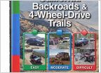
    That's okay, get the Benchmark Baja Caliofrnia Road & Recreational Atlas book.
    Want to see FREE maps of Baja California from the past to the near present? I have a pretty big collection of scanned paper maps, with zoom-in ability for research and trip planning. Links to the new Benchmark maps and Mexican topographic maps are in here, as well:
    https://vivabaja.com/maps/

    One of my map projects was to have an interactive map that shows photo locations, which I have over 1,600 photos I have taken all over Baja on. This is to show you what you might see at any spot in Baja that I was also at in the past 15 or so years (for most):
    https://vivabaja.com/explore/baja-photos-map/ (zoom in to see even more camera icons/ photos and click on a photo to enlarge it)
     

Products Discussed in

To Top