

-
Welcome to Tacoma World!
You are currently viewing as a guest! To get full-access, you need to register for a FREE account.
As a registered member, you’ll be able to:- Participate in all Tacoma discussion topics
- Communicate privately with other Tacoma owners from around the world
- Post your own photos in our Members Gallery
- Access all special features of the site
 Oil Filter Housing STUCK... need help!
 What radios are people using
 CO TW Homebrewers
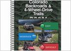 Multi Thread Idea - Trail Options
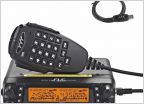 Official Colorado HAM and cheese thread
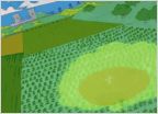 Rodents snack on my truck while I sleep
Recommend a good map to me.
Discussion in 'Colorado' started by Reddy, Apr 7, 2016.


